Pointe de l’Orsaja, starting from Pianello via the Peri huts

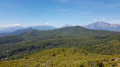
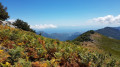
A circular route on the southern slope of the Caldane massif, the southern boundary of the Castagniccia. Breathtaking views of the Corsican mountains, from Monte Cardo to the Aiguilles de Bavella in the distance and the beaches of the Costa Verde. The Pointe de l’Orsaja is the lowest peak in the massif; climbing it opens up views of the Alesani valley and, in the distance, its dam and the beaches of Alistro.
You’ll come across plenty of birds along this route, as well as cows and sheep....

Details

n°3867504
Creation:
Last update:
Last review:
  • Walking
    Activity: Walking
  • ↔
    Distance: 7.81 mi
  • ◔
    Average duration: 5h 45 
  • ▲
    Difficulty: Moderate

  • ⚐
    Back to start: Yes
  • ↗
    Ascent: + 2,477 ft
  • ↘
    Descent: - 2,477 ft

  • ▲
    Highest point: 4,708 ft
  • ▼
    Lowest point: 2,900 ft
  • ⚐ Country: France
  • ⚐ City: Pianello (20272)
  • ⚑
    Start/End: N 42.291859° / E 9.361383°
  • ❏
    IGN map(s): Ref. 4351OT
  • Hour-by-hour weather

Photos

Description of the walk

The start is right at the top of the village of Pianello (in Poggio), at the final tarmac bend. Park here.

(S/E) Take the shaded path marked in orange, signposted “Mare a Mare Nord” towards Pirelli and Valle d’Alesani. Continue to La Bravone.

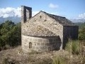
(1) Cross over a very narrow concrete path and carry on straight ahead. At this point, a track joins the path; it has been widened to accommodate the many vehicles from the surrounding villages on the feast day of Saint Vincent, which is celebrated in style at the chapel of the same name a little further on. The markings change to yellow.

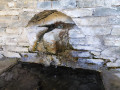
(2) Leave the path leading to the Saint-Vincent Chapel on your left and carry on straight ahead. The path climbs quite steeply but is not at all difficult, leading up to a fountain. The water from the Ruisseau de Peri is reputed to be drinkable here!

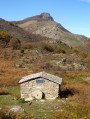
(3) Follow the path to the left for a short detour to the Peri sheepfolds, which are always worth a visit, especially as, since this year (2020), a very friendly shepherd has taken over the sheep-rearing business.

(4) Head back towards the Peri fountains.

(3) Carry on straight ahead towards the sea (east-southeast). The path is always clearly visible, even amongst the ferns. If you lose sight of it briefly near the top of thefirst hillock after the fountains, you’ll find it again quickly and without any trouble.

You then need to cross a very wide ravine with flat rocks to reach the foot of the Pointe de l’Orsaja. From a distance, on the path at the foot of the peak, you’ll recognise a boulder that looks like a cottage with a chimney.

(5) Turn left. It’s not difficult to climb to this peak; at the start, the path is marked in yellow, then the final section is a matter of following the trail through the ferns, everlasting flowers and thistles. Once at the summit, you’ll be able to see the other side, part of the Alesani valley and the reservoir, all the way to the beaches at Prunete.

(6) Head back down to the boulder.

(5) Turn left. The path continues, quite close to this rock, to the right of the fern grove and above the scrubland. It is no longer signposted but is very clear, and the descent towards the “Mare a Mare” path presents no difficulty. At the Col de Muteri, continue along the ridge to descend towards the junction with the “Mare a Mare Nord” path through a superb fern grove.

(7) At the junction, turn right, following the sign for “Pianellu”. Keep heading south-west
to rejoin the path leading up to Bravone.

(1) Turn left and follow the shaded path, which is once again marked in orange, back to the starting point (S/E).

Waypoints

  1. S/E : mi 0 - alt. 2,936 ft - Pianello
  2. 1 : mi 1 - alt. 2,923 ft - Crossing the - Bravona (fleuve)
  3. 2 : mi 1.11 - alt. 2,992 ft - Junction at the Chapelle Saint-Vincent
  4. 3 : mi 2.2 - alt. 4,337 ft - Péri Fountains
  5. 4 : mi 2.32 - alt. 4,370 ft - Péri huts
  6. 5 : mi 3.26 - alt. 4,386 ft - Rock below the Pointe de l’Orsaja
  7. 6 : mi 3.47 - alt. 4,701 ft - Pointe de L’Orsagha - Pointe de L'Orsaja
  8. 7 : mi 4.74 - alt. 3,658 ft - Junction with the “Mare a Mare Nord”, on the right
  9. S/E : mi 7.81 - alt. 2,936 ft - Pianello

Notes

There are no technical difficulties on this walk, but walking boots are essential (and walking poles are a good idea!).

You’ll come across several water sources; the water from the Ruisseau de Péri is said to be drinkable (the others probably are too, but I haven’t been given that information). You should still bring your own supply of water, though.

It’s on the southern slope, so it gets hot.

Doing the walk in a clockwise direction seems the best option: the final section is fairly shaded and the gradient quite gentle, so it’s not too difficult and ensures a leisurely return, unlike the path along the Ruisseau de Péri, which has a fairly steep gradient!

Reviews and comments

4.2 / 5
Based on 2 reviews

Reliability of the description
4 / 5
Ease of following the route
4 / 5
Route interest
4.5 / 5
gilles.percheron
gilles.percheron

Overall rating : 4.3 / 5

Date of your route : Sep 10, 2024
Reliability of the description : ★★★★☆ Good
Ease of following the route : ★★★★☆ Good
Route interest : ★★★★★ Very good
Very busy route : No

Stunning scenery all along the route
For your information, the path described between point 5 and point 7 is now marked in yellow

Machine-translated

Thauber
Thauber

Overall rating : 4 / 5

Date of your route : Oct 18, 2020
Reliability of the description : ★★★★☆ Good
Ease of following the route : ★★★★☆ Good
Route interest : ★★★★☆ Good
Very busy route : No

beautiful views from Pointe de l’Orsajz of the east coast and the Diana and Urbîno ponds
A moderate-difficulty hike

Machine-translated

Other walks in the area

For more walks, use our search engine .

The GPS track and description are the property of this route's author. Please do not copy them without permission.