Bucatoghju Waterfall in Santa-Maria-Poggio

This trail, starting from a pay-and-display car park (€5), takes you to the Bucatoghju Waterfall and also allows you to see a Genoese bridge. It is an easy, family-friendly walk, though it does involve several (structured) stream crossings.

Details

101400479
Creation:
Last update:
Last review:
  • Walking
    Activity: Walking
  • ↔
    Distance: 1.23 mi
  • ◔
    Average duration: 0h 40 
  • ▲
    Difficulty: Easy

  • ⚐
    Back to start: Yes
  • ↗
    Ascent: + 79 ft
  • ↘
    Descent: - 262 ft

  • ▲
    Highest point: 348 ft
  • ▼
    Lowest point: 115 ft

Photos

Description of the walk

The starting point is at the Parking des Noisetiers car park (paid parking, flat rate of €5).

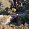
(S/E) With your back to the car park, take the well-marked path heading due north; it’s an easy walk. The path alternates between shade and sunshine. You’ll arrive not far from a magnificent Genoese bridge.

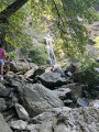
(1) Continue to the left, following the River Buccatoggio. You’ll cross several small streams, but the crossings are well-marked (with pebbles or logs). The final few metres are a bit trickier as you’ll need to climb over the rocks.

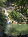
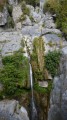
(2) On arrival, enjoy the waterfall and its large natural pool. The return to the car park is via the same path, in the opposite direction (S/E).

Waypoints

  1. S/E : mi 0 - alt. 312 ft - Les Noisetiers car park
  2. 1 : mi 0.23 - alt. 295 ft - Genoise Bridge
  3. 2 : mi 0.58 - alt. 194 ft - Waterfall - Buccatoggio (fleuve) - Mer Tyrrhénienne
  4. S/E : mi 1.23 - alt. 154 ft - Les Noisetiers car park

Notes

Bring a picnic and your swimming costume.

Worth a visit

The Genoese bridge and the waterfall.

Reviews and comments

5 / 5
Based on 1 review

Reliability of the description
5 / 5
Ease of following the route
5 / 5
Route interest
5 / 5
User 5894478

Overall rating : 5 / 5

Date of your route : Aug 10, 2026
Reliability of the description : ★★★★★ Very good
Ease of following the route : ★★★★★ Very good
Route interest : ★★★★★ Very good
Very busy route : Yes

The route ends with a lovely surprise and isn’t particularly difficult, although you do need to be careful towards the end to avoid slipping.
I’d recommend it despite the large number of visitors to the site.

Machine-translated

Other walks in the area

For more walks, use our search engine .

The GPS track and description are the property of this route's author. Please do not copy them without permission.