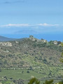
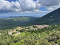
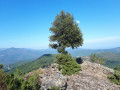
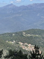
The Erbajolo ridges circular loop

The second circular ridge loop is of intermediate difficulty and takes three and a half hours to complete.
It is marked in blue and will guide you along the ridges before reaching the abandoned village of Casella in the central part of the valley. From Casella, the markings change to orange, leading to Petra a u Moru and finally on to Erbajolo via a very gentle 1-hour climb.
In the abandoned village of Casella, you can shorten the circular route by taking the alternative route via the San Martinu chapel, a 30-minute climb also marked in orange.

Details

n°44524044
Creation:
Last update:
Last review:
  • Walking
    Activity: Walking
  • ↔
    Distance: 5.51 mi
  • ◔
    Average duration: 3h 45 
  • ▲
    Difficulty: Moderate

  • ⚐
    Back to start: Yes
  • ↗
    Ascent: + 1,381 ft
  • ↘
    Descent: - 1,388 ft

  • ▲
    Highest point: 3,051 ft
  • ▼
    Lowest point: 1,699 ft
  • ⚐ Country: France
  • ⚐ City: Erbajolo (20212)
  • ⚑
    Start/End: N 42.261976° / E 9.283221°
  • ❏
    IGN map(s): Ref. 4351OT
  • Hour-by-hour weather

Description of the walk

Set off from the San Cristofalu Chapel, at the top of the village of Erbajolo, along the D14.

(D:A) Head east along the D16, which climbs towards Sant’Andria di Boziu, and follow the blue signposts. After about 100 metres, take a path on the left. Climb up to a junction.

(1) Continue straight on. Climb whilst staying on the ridge, heading north-north-east. This will take you to the Spinerazzie summit at an elevation of 931 (unnamed on the map).

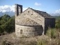
(2) Turn left and descend gently along the ridge, heading west-north-west then west (blue markings). Pass the ruined chapel of San Chirgu (a small section of the apse remains; there’s a lovely view) and reach a fork at the foot of a telecoms mast.

(3) Then turn sharply left. You’ll soon reach the D14; follow it to the left. Ignore a track on the right.

(4) At a left-hand bend, leave the road and start descending to the right through the old wheat-threshing areas (aghje in Corsican).

(5) Further down, at the last aghja, turn left. Walk along a gently sloping track, cross a few ravines and reach the abandoned village of Casella.

(6) Turn right, cross the abandoned village and follow the orange markings. At the far end of the village (old bread oven), turn left along the old terraces (do not follow the green markings towards Poggio). Cross a stream and come out onto a track.

(7) Follow the track to the left, through a large oak forest, and reach the abandoned hamlet of Cherchiglioni.

(8) Carry on along the track.

(9) At the next junction, turn left, heading south then south-south-west towards A Petra a u Moru. Reach this memorial site. Continue south and, shortly afterwards, follow a path on the left to join a track (still following the orange markings).

(10) Follow the track to the left as far as the place known as Foce at an elevation of 688 (Teppa la Costa on the map; lovely view, former wheat-threshing area).

(11) Leave the track and take a ridge path for a final climb heading north-east. Descend, pass the cemetery and reach the San Cristofalu Chapel (S/E)

Waypoints

  1. S/E : mi 0 - alt. 2,457 ft - Chapelle San Cristofalu (Erbajolo)
  2. 1 : mi 0.32 - alt. 2,671 ft - Crossroads
  3. 2 : mi 0.94 - alt. 3,048 ft - Spinerazzie summit
  4. 3 : mi 2.08 - alt. 2,356 ft - Junction
  5. 4 : mi 2.51 - alt. 2,339 ft - Start of the trail
  6. 5 : mi 2.84 - alt. 1,975 ft - Aghja – Wheat threshing floor
  7. 6 : mi 3.29 - alt. 1,860 ft - The abandoned village of Casella
  8. 7 : mi 3.57 - alt. 1,736 ft - Trail
  9. 8 : mi 3.9 - alt. 1,831 ft - Cherchiglioni – abandoned hamlet
  10. 9 : mi 4.11 - alt. 1,909 ft - Crossroads
  11. 10 : mi 4.65 - alt. 2,116 ft - Trail
  12. 11 : mi 5.18 - alt. 2,251 ft - Foce – Wheat threshing area
  13. S/E : mi 5.51 - alt. 2,457 ft - Chapelle San Cristofalu (Erbajolo)

Notes

Bring at least 1 litre of water, a cap and good walking shoes.

Worth a visit

The village of Erbaghjolu has a bar in the centre of the village and a snack bar at the top of the village next to the Chapel of Sant’Antone/San Cristofalu.

(2) Spinerazzie is the highest point in the Erbaghjolu valley, at an altitude of 931 metres. There you’ll find the ruins of old huts where straw used to be stored, known as ‘pagliaghji’. It marks the boundary with the neighbouring Boziu Valley. You can reach this valley by taking the red-marked path which branches off to the right and leads to the Col de San Cerbone in 30 minutes, from where the Via Romana begins. This Via Romana was once a major route between the eastern plain and Central Corsica, and you can reach several villages in the Rogna – the valley of the River Tavignanu – and the Boziu valley, including the village of Sant’Andria di Boziu, just a few kilometres away.

In the abandoned village of Casella there are numerous ruins and a small chapel that has been preserved. Until the 1850s, there were around thirty ‘households’ in Casella, each officially comprising at least two adults and two children. The village therefore had at least 120 inhabitants, yet within the space of a hundred years it was completely deserted.
In the upper part of the village stands the chapel of San Ghjiseppu (St Joseph), which was built inthe 15th century and can be visited using the key found in a hole to the left of the entrance door. A few houses further down on your left, you will find a lintel bearing a striking cross, which some attribute to the Ghjuvannali, a religious movement of Franciscan origin fromthe 14th and15th centuries that broke away from the official church in search of a return to the roots of spirituality.

(8) Cherchiglioni: this abandoned hamlet was once surrounded by old gardens. Its last owner would come down from Erbaghjolu two or three times a week to tend to his crops right up until the 1970s. There is a fairly large pond that was used to water the vegetables. Thanks to its southerly aspect and protection from the wind, the residents were able to harvest tomatoes, courgettes, potatoes, onions, leeks and all sorts of other vegetables before anyone else…
The only remaining ruined house is overgrown with ivy – or perhaps it is the house that holds the ivy… It now lies abandoned, and it is not uncommon to come face to face with a pig, a cow or a goat when trying to visit it…

At Petra a u Moru: the inscription on this stone depicts a cross surrounded by several dots; it is said that during a battle from which the Corsicans emerged victorious, a Moorish chieftain was beheaded. Given the distance from the sea, it is thought that this battle may be linked to the great war between the Ottomans and the Genoese in the16th century. A few minutes’ walk from this historic site, follow the track on the left – still marked in orange – to a place known as Foce, a plateau offering a beautiful view.

Back at (S/E): “Back in the village, you’ll find the orientation table and a magnificent view stretching from the Aiguilles de Bavella mountain range to the Aiguilles de Popolasca… taking in the Renosu, Monte d’Oru, Paglia Orba and Cintu!”

Reviews and comments

3.7 / 5
Based on 3 reviews

Reliability of the description
3.7 / 5
Ease of following the route
3 / 5
Route interest
4.3 / 5
SandrineG
SandrineG

Overall rating : 4 / 5

Date of your route : Sep 11, 2025
Reliability of the description : ★★★★☆ Good
Ease of following the route : ★★★☆☆ Average
Route interest : ★★★★★ Very good
Very busy route : No

Fairly easy trail, superb views, some sections can be very windy.
We didn't meet a single person, despite it being a beautiful September day.
It's a shame there's a bit of road!

Machine-translated

luisipatrick
luisipatrick

Overall rating : 3 / 5

Date of your route : Sep 14, 2025
Reliability of the description : ★★★☆☆ Average
Ease of following the route : ★★☆☆☆ Disappointing
Route interest : ★★★★☆ Good
Very busy route : No

The route from points 1 to 3 adds nothing of interest to the hike, except for the fact that you have to retrace your steps along a section of road to reach the abandoned village of Casella.
Visiting the abandoned village of Casella provides an insight into village life.
Please note at point 9: the GPX route no longer exists. It is essential to follow the orange markings that lead to point 10.
Don't miss the legend of the stone at Petra a u Moru.

Machine-translated

marco 85
marco 85

Overall rating : 4 / 5

Date of your route : Jun 18, 2025
Reliability of the description : ★★★★☆ Good
Ease of following the route : ★★★★☆ Good
Route interest : ★★★★☆ Good
Very busy route : No

I’d give this hike a rating of 8.5 out of 10. Definitely worth doing

Machine-translated

Other walks in the area

For more walks, use our search engine .

The GPS track and description are the property of this route's author. Please do not copy them without permission.