


Refine your search for walks in Pamplona
Pamplona walks
 Esteribar - Puente la Reina
 Visorando Member
 20.98 mi
 +1,657 ft
 -1,932 ft
 8 hrs
8 hrs
 Very difficult
 Departure from Esteribar (Navarre)
Forty-eighth stage of the Camino de Santiago. A stage like today’s is described in Spanish as: todo derecho – straight ahead all the way. You walk alongside the River Arga with little change in elevation until you reach Pamplona, at the foot of a group of hills covered in beech, oak and wild pine trees. As you approach Pamplona, the landscape becomes more clearly influenced by civilisation, with its conifers, reforestation and farmland.
The rest of the stage is dominated by the Alto del Perdón, which offers a magnificent view. From there, you can see Pamplona and the Pyrenees behind, and opposite, the vast Navarrese plain. You will spend part of the day climbing up and down this mountain range, passing through quiet little towns that resemble islands floating amongst the fields of grain.
Puente la Reina - Estella Lizarra
 13.23 mi
+1,280 ft
-1,030 ft
7h 10
13.23 mi
+1,280 ft
-1,030 ft
7h 10
 Difficult
Departure from Puente la Reina/Gares (Navarre)
Difficult
Departure from Puente la Reina/Gares (Navarre)
Forty-ninth stage of the Camino de Santiago. This short stage remains very interesting thanks to the towns you pass through, such as Mañerú, Cirauqui and Villatuerta, until you reach your destination for the day, Estella, on the River Ega, a marvel from centuries past, which welcomes you with a very photogenic bridge.
Adi ascent
4.92 mi
+1,752 ft
-1,732 ft
3h 45
 Moderate
Departure from Erro (Navarre)
Moderate
Departure from Erro (Navarre)
The Adi overlooks the Urepel valley and the Quinto Real, which belonged to the kings of Navarre. The inhabitants paid a grazing fee corresponding to one-fifth of the herds, the quint.Currently reduced to 2,000 ha on the French side, but belonging to Spain, only the families of Saint-Étienne de Baïgorry have use of it. Herd owners pay a grazing fee (vacade) for each animal. This is why a fence marks the boundary of the Quinto Real.
Leurtza peaks and lakes from Urrotz
 7.34 mi
+1,529 ft
-1,552 ft
4h 40
Moderate
Departure from Urroz (Navarre)
7.34 mi
+1,529 ft
-1,552 ft
4h 40
Moderate
Departure from Urroz (Navarre)
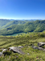
A superb hike with four peaks over 1000 m, two superb lakes and also a dolmen, a menhir, an ancient Roman road, all in a protected natural setting.
Ichterbegui, Adi and Iturrumburu from the Korrota Pass
 8.22 mi
+3,419 ft
-3,422 ft
6h 45
Difficult
Departure from Urepel (Pyrénées-Atlantiques)
8.22 mi
+3,419 ft
-3,422 ft
6h 45
Difficult
Departure from Urepel (Pyrénées-Atlantiques)
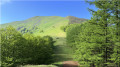
This walk starts at the head of the Baigorri valley on the edge of the Pays Quint (Kintoa). The route forms a semicircle around the Inbelertegiko Erreka valley and takes you up the three peaks (Ichterbegui, Adi – the highest – and Iturrumburu) that frame this watershed.
Great loop via the Trinidad ridges from Lumbier
 7.24 mi
+1,978 ft
-1,972 ft
5h 05
Difficult
Departure from Lumbier (Navarre)
7.24 mi
+1,978 ft
-1,972 ft
5h 05
Difficult
Departure from Lumbier (Navarre)
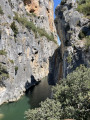
This loop from Lumbier takes you to a hermitage, a ridge trail with fine views, two mineral arches and the Foz de Lumbier. An alternative to the small loop starting from the paying car park at Foz de Lumbier, the first part of which is not very interesting.
This hike is for experienced hikers only.
Eznaazu Circuit
 Tourist office1.11 mi
+194 ft
-177 ft
0h 40
Tourist office1.11 mi
+194 ft
-177 ft
0h 40
 Easy
Departure from Aldudes (Pyrénées-Atlantiques)
Easy
Departure from Aldudes (Pyrénées-Atlantiques)
A picturesque walk along this headland, where the cool mountain breeze blows, making for a pleasant post-meal stroll.
The Harriondoko ridges, Lindus and Xaxperro in a loop from Urepel
14.13 mi
+3,294 ft
-3,264 ft
9h 20
Very difficult
Departure from Urepel (Pyrénées-Atlantiques)
This loop is a superb hike in Lower Navarre, taking you in turn to the peaks of Lindus, Xaxperro and Sorotepo. This ridge route between France and Spain offers total immersion in the open, wild landscapes of the Basque Country. Throughout the route, panoramic views of the Baigorri valley, the surrounding Basque peaks and, on a clear day, the High Pyrenees follow one after another. A complete itinerary, between high-altitude pastures, airy ridges and a pastoral atmosphere, ideal for hikers in search of tranquillity and wide open spaces.
The Foz de Lumbier
 3.86 mi
+981 ft
-965 ft
2h 40
Moderate
Departure from Lumbier (Navarre)
3.86 mi
+981 ft
-965 ft
2h 40
Moderate
Departure from Lumbier (Navarre)
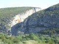
The Foz de Lumbier is a gorge carved out by the River Irati within the mountain. Both ends are narrow, making it an exceptional nature reserve. A path following the route of an old railway line allows you to walk through the Foz with ease.
Roncesvalles - Esteribar
 20.74 mi
+1,480 ft
-3,114 ft
10h 50
Difficult
Departure from Orreaga/Roncesvalles (Navarre)
20.74 mi
+1,480 ft
-3,114 ft
10h 50
Difficult
Departure from Orreaga/Roncesvalles (Navarre)
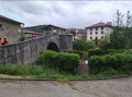
The forty-seventh stage of the Camino de Santiago. A long stage but less gruelling than the previous day’s, despite a somewhat arduous descent towards Zubiri. Along this route, you’ll alternate between landscapes of beech and pine forests and charming little villages with typical Navarran architecture. From this stage onwards, the signposting on the Camino de Santiago in Spain consists of yellow arrows—either painted on the ground, on building facades, on rocks or on trees—or specific European signage featuring a stylised yellow scallop shell on a blue background. This logo may also take the form of bronze scallop shells nailed to walls or set into the ground in the major towns along the route, indicating the direction towards Santiago de Compostela.
Mendixuri and Lindus near Roncesvalles
9.42 mi
+1,627 ft
-1,644 ft
5h 45
Difficult
Departure from Orreaga/Roncesvalles (Navarre)
A very beautiful circular route offering a fairly easy climb up the magnificent Mendixuri. The ascent is mainly along marked tracks or a few clearly visible paths to the foot of the Mendixuri rock. The final 100 metres are along a fairly obvious path leading to the summit. You’ll then be treated to stunning views as you follow a level track to the foot of Lindus. From there, you’ll need to climb a path on the Spanish side to a barbed-wire fence, which you follow to the summit. Alternatively, carry on along the track for a short while until you come across a gap to cross the fence and climb up on the French side via a more visible mountain-bike track that also follows the barbed wire to the summit. The Lindus is of interest mainly for its historical significance. It was the site of a fortification during a Napoleonic battle. Descend on the French side to the road (or on the Spanish side, but you’ll need to cross the barrier at the bottom). Then follow the track to the Ibañeta Pass. From there, follow the Way of St James.
Roncesvalles loop via Burguete
 Association / Club / Walk leader
 7.06 mi
+778 ft
-784 ft
3h 55
Moderate
Departure from Orreaga/Roncesvalles (Navarre)
7.06 mi
+778 ft
-784 ft
3h 55
Moderate
Departure from Orreaga/Roncesvalles (Navarre)
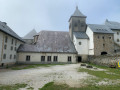
A beautiful loop around the hospitable center of Roncesvalles, an important stage in the pilgrimage to Santiago de Compostela.Roncesvalles is called Roncesvalles in Castilian, or Orreaga in Basque.
The route passes through the village of Auritz (in Basque) or Burguete (in Castilian).
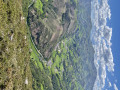
The Abraku from the village of Les Aldudes
 7.56 mi
+2,165 ft
-2,139 ft
5h 20
Moderate
Departure from Aldudes (Pyrénées-Atlantiques)
7.56 mi
+2,165 ft
-2,139 ft
5h 20
Moderate
Departure from Aldudes (Pyrénées-Atlantiques)
A steep climb right from the start, along a small road, then we take the HRP and the GRT5.
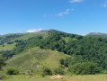
The Zarkindegi loop from Les Aldudes
 6.39 mi
+1,870 ft
-1,857 ft
4h 35
Moderate
Departure from Aldudes (Pyrénées-Atlantiques)
6.39 mi
+1,870 ft
-1,857 ft
4h 35
Moderate
Departure from Aldudes (Pyrénées-Atlantiques)
A lovely hike, taking in part of the western ridges of the Aldudes valley, which guarantees magnificent views.
Otsaxar, Otsamuho et Errola en boucle depuis les Aldudes
7.34 mi
+1,900 ft
-1,877 ft
5h 00
Moderate
Departure from Aldudes (Pyrénées-Atlantiques)
Cette boucle, à l'Est du village des Aldudes, permet de faire une belle trilogie de sommets Otsaxar (825 m), Otsamuhno (901 m) et Errola (907 m), ornés de promontoire rocheux, dans le cadre enchanteur des collines de Basse Navarre. Le retour face aux crêtes Ouest des Aldudes nous donne une vue superbe sur la Peña de Alba, l'Hargibel et le Zarkindegi. On revient au village par le Sud et on découvre (ou redécouvre) les spécialités du village !
Passages interdits ? Voir l'avis di 04/09/2023 et laisser le votre, merci
The Aldudes tour
2.64 mi
+659 ft
-643 ft
1h 45
Easy
Departure from Aldudes (Pyrénées-Atlantiques)
An easy family walk offering the chance to explore the hills around Aldudes. You may spot a few Pottok ponies roaming freely on the tops of some of the hills.The walk offers some very pretty views of the neighbouring valleys and can be rounded off with a visit to a farm rearing pink and black Basque pigs.