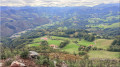
Otsaxar, Otsamuho et Errola en boucle depuis les Aldudes

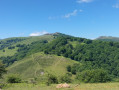
Cette boucle, à l'Est du village des Aldudes, permet de faire une belle trilogie de sommets Otsaxar (825 m), Otsamuhno (901 m) et Errola (907 m), ornés de promontoire rocheux, dans le cadre enchanteur des collines de Basse Navarre. Le retour face aux crêtes Ouest des Aldudes nous donne une vue superbe sur la Peña de Alba, l'Hargibel et le Zarkindegi. On revient au village par le Sud et on découvre (ou redécouvre) les spécialités du village !
Passages interdits ? Voir l'avis di 04/09/2023 et laisser le votre, merci

Details

n°26507106
Creation:
Last update:
Last review:
  • Walking
    Activity: Walking
  • ↔
    Distance: 7.34 mi
  • ◔
    Average duration: 5h 00 
  • ▲
    Difficulty: Moderate

  • ⚐
    Back to start: Yes
  • ↗
    Ascent: + 1,900 ft
  • ↘
    Descent: - 1,877 ft

  • ▲
    Highest point: 2,949 ft
  • ▼
    Lowest point: 1,211 ft

Description of the walk

On arriving in the village of Les Aldudes, the car park is on the right after the bridge leading to the church.

(S/E) From the church car park, cross back over the bridge and the road (D948) and take a flight of steps that winds up the hillside, heading south-east. After the steps, continue along the path to the Col de Lepeder.

(1) Head up the grassy slope to the right and follow the HRP until you reach a road. Follow it to the left, heading north, to the Col Harizkiloa, a crossroads of tracks at an elevation of 633.

(2) Take the wide path that branches off to the left along the hillside, heading north-east, until you reach a fork.

(3) Leave the wide path and follow a small path to the left, heading south-east then east, until you meet the path coming from Les Aldudes.

(4) Follow the path uphill to the right to reach the Col d’Otsaxar, then head due north to the summit of Otsaxar.

(5) Head back due south to the Col d’Otsaxar and climb up the opposite slope to the summit of Otsamunho.

(6) From the summit, head southwards and join a track below, facing south-east; follow it to the wide Col de Mizpira.

(7) Continue straight on, south-east, to the large rocky promontory of Errola (elevation 909).

(8) Turn round and head back to the Col de Mizpira.

(7) Turn left onto the path that winds westwards and head for the Col d’Amez.

(9) Continue westwards up the grassy slope to join a wide track heading due west then south; follow it to a fork at elevation 499.

(10) Leave the track and head right. The path descends due west and joins the D948 village road.

(11) Before heading back along the road, pop in to see Pierre Oteiza’s piglet nursery (S/E).

Waypoints

  1. S/E : mi 0 - alt. 1,211 ft - Car park at the - Église Notre-Dame (Les Aldudes)
  2. 1 : mi 0.44 - alt. 1,614 ft - Col de Lepeder (500 m)
  3. 2 : mi 1.39 - alt. 2,070 ft - Crossroads of tracks
  4. 3 : mi 2.01 - alt. 2,454 ft - Junction
  5. 4 : mi 2.54 - alt. 2,575 ft - Junction
  6. 5 : mi 2.88 - alt. 2,694 ft - Otsaxar ou Otsaizahar (825 m)
  7. 6 : mi 3.51 - alt. 2,949 ft - Otsamunho (901 m)
  8. 7 : mi 3.84 - alt. 2,707 ft - Col de Mizpira (832m)
  9. 8 : mi 4.48 - alt. 2,251 ft - Col d'Amez ou Amezlepho (682 m)
  10. 9 : mi 5.14 - alt. 2,008 ft - Junction
  11. 10 : mi 6.24 - alt. 1,316 ft - D948 road
  12. 11 : mi 6.52 - alt. 1,260 ft - ‘Kintoa’ piglet nursery
  13. S/E : mi 7.34 - alt. 1,211 ft - Church car park - Nive des Aldudes (rivière)

Notes

Pas de point d'eau sur ce parcours, sauf au village.

IBP= 66

Worth a visit

Les élevages de porc Kintoa et la charcuterie "Oteiza".

Reviews and comments

3.3 / 5
Based on 5 reviews

Reliability of the description
2.8 / 5
Ease of following the route
2.8 / 5
Route interest
4.4 / 5
Antoine Veillerette
Antoine Veillerette

Overall rating : 4.3 / 5

Date of your route : Sep 01, 2025
Reliability of the description : ★★★★☆ Good
Ease of following the route : ★★★★☆ Good
Route interest : ★★★★★ Very good
Very busy route : No

Rainy weather but a lovely walk to enjoy the setting of the Aldudes Valley.

Machine-translated

Patchi61
Patchi61
• Edited:

Overall rating : 3.3 / 5

Date of your route : Aug 14, 2024
Reliability of the description : ★★★☆☆ Average
Ease of following the route : ★★☆☆☆ Disappointing
Route interest : ★★★★★ Very good
Very busy route : No

Almost no signposting after point 1 except on the peaks, route very difficult to follow except at the top.
I would rate it as average to above average.
However, it is a very beautiful hike with 360-degree panoramic views. Good shoes, walking sticks and at least 2 litres of water are required, but the effort is well worth it.

Machine-translated

Linette64
Linette64

Overall rating : 3.7 / 5

Date of your route : Apr 03, 2024
Reliability of the description : ★★★☆☆ Average
Ease of following the route : ★★★★☆ Good
Route interest : ★★★★☆ Good
Very busy route : No

Nice route with beautiful views.
at point 9, there is indeed a fence that is difficult to climb over. You have to go to the edge, which is a little higher, and open the gate to get back onto the path.

The very beginning of the route is quite dangerous as it is very narrow and you have to walk over rocks that can be slippery. A section of the ground has completely collapsed due to rain. This section would benefit from a handrail.

Machine-translated

donibanegarazi
donibanegarazi

Overall rating : 3.3 / 5

Date of your route : Sep 10, 2023
Reliability of the description : ★★★☆☆ Average
Ease of following the route : ★★★☆☆ Average
Route interest : ★★★★☆ Good
Very busy route : No

A lovely discovery. Although it is not very well marked, it is fairly easy to find your way, with a difficult barrier to cross at point 9 to follow the trail...
Superb view of the Peña de Alba, the Hargibel and the Zarkindegi

Machine-translated

jelebo645
jelebo645

We must not be talking about the same route. At point (9), there are no barriers. It is a grassy pass with no obstructions. As for point (10), the fork to the right is well before the farm. It is true that the entire route is not perfectly marked, but when hiking in the mountains, you also need to know how to find your way around.

Machine-translated

makila
makila

Overall rating : 2 / 5

Date of your route : Sep 04, 2023
Reliability of the description : ★☆☆☆☆ Very disappointing
Ease of following the route : ★☆☆☆☆ Very disappointing
Route interest : ★★★★☆ Good
Very busy route : No

Beautiful hike
unmarked hike
the trails are not well marked
at point 9, it is impossible to pick up the trail again because of a fence that must be crossed.
At point 10, you are on a farm with a series of gates.

Machine-translated

Other walks in the area

For more walks, use our search engine .

The GPS track and description are the property of this route's author. Please do not copy them without permission.