


Refine your search for walks in Pagny-sur-Meuse
Pagny-sur-Meuse walks


 A circular walk starting from Pagny-sur-Meuse
 Visorando Member
 8.92 mi
 +341 ft
 -348 ft
 4h 25
 Moderate
 Departure from Pagny-sur-Meuse (Meuse)
A peaceful walk around the Meuse and Troussey, with the added bonus of crossing the Mazagran Canal Bridge.
The Bois de Grammont from the Savonnières farm
 8.07 mi
+804 ft
-810 ft
4h 25
Moderate
Departure from Foug (Meurthe-et-Moselle)
This pleasant circuit crosses the communal forest of Foug from the Savonnières farm.
 From Rigny to Rigny along the banks of the Marne–Rhine Canal
 28.54 mi
+436 ft
-417 ft
2.5 hrs
Moderate
Departure from Rigny-la-Salle (Meuse)
A mountain bike ride on easy trails, best undertaken when the ground is heavy, as the route follows only dry paths and roads.
Autour de Rigny-la-Salle
 6.16 mi
+482 ft
-469 ft
3h 15
 Easy
Departure from Rigny-la-Salle (Meuse)
Balade en Meuse, sympathique au milieu des bois, offrant une belle vue sur Rigny-la-Salle et ses alentours.
Domgermain Plateau and Val-de-Passey from Choloy-Ménillot
 5.14 mi
+479 ft
-456 ft
2h 45
Moderate
Departure from Choloy-Ménillot (Meurthe-et-Moselle)
A circular route starting with a fairly long climb through meadows, orchards and woodland towards the summit of the Domgermain Plateau. Cross its meadow, a Natura 2000 ecological site, along a hillside path where you will see the remains of fortifications dating from 1876, then descend towards the Val de Passey with a detour to the hamlet of Les Sept Sources (where you can quench your thirst with spring water from the forest) and its ponds.
Gombervaux Castle Route
 7.63 mi
+449 ft
-427 ft
3h 55
Moderate
Departure from Vaucouleurs (Meuse)
An easy walk in the land of Joan of Arc, taking in two castles in the region: Tusey Castle and the feudal castle of Gombervaux.
Around the Domfontaine woods
 5.55 mi
+617 ft
-607 ft
3h 05
Easy
Departure from Lucey (Meurthe-et-Moselle) (Meurthe-et-Moselle)
A lovely walk along good paths; the route passes through Laneuveville behind Foug with its lovely rest area, picnic tables, stream and the Prensieux fountain.
Laneuveville, behind Foug, stands out for its fountains, its colourful shutters and, more unusually, its electricity poles and a few items of street furniture legally decorated by artists.
The route leaves Laneuveville via a small tarmac road which quickly turns into the ‘Grand Chemin Blanc’. This section is completely unshaded until you return to the forest after the ‘Faux Moulin’.
NOTE: this route follows numerous signposts and, in particular, the Yellow Rings. These are specified in this description.
History and tags in the Bois de Charmes-la-Côte
 6.73 mi
+407 ft
-420 ft
3h 25
Moderate
Departure from Domgermain (Meurthe-et-Moselle)
This hike is located near the Côtes de Toul vineyards.
You will discover the old Fort de Charmes-la-Côte and many vestiges of the past.
Pretty tags created by a local graphic designer add to the charm of this hike.
The paths and trails are easy to follow and present no danger.
However, do not stray from the paths, as there are still many hazards in the undergrowth linked to the activity of the forts. Keep an eye on children and keep dogs on a leash.
‘Côtes et Délices’ Walk in Domgermain
 7.26 mi
+725 ft
-715 ft
4h 00
Moderate
Departure from Domgermain (Meurthe-et-Moselle)
This route forms the basis for the gourmet walk organised on 27 April 2025. This walk allows you to discover three typical villages in the southern Toulois region: Domgermain, Charmes-la-Côte and Mont-le-Vignoble. Signposting has been put in place along the entire route for the day of the gourmet walk. The route described on Visorando complements this signposting and will subsequently allow you to complete this circular route at your leisure. You will simply need to omit the stages listed in the description.
The villages of the Toul coast and the surrounding area
 12.69 mi
+1,053 ft
-1,083 ft
6h 45
 Difficult
Departure from Lagney (Meurthe-et-Moselle)
Tourist route through forests, vineyards and orchards. Discover typical Lorraine villages in the Côtes de Toul region, such as Lagney, Bruley and Laneuveville derrière Foug.
Route without any particular difficulties.
Mirabelle plums and grapes in the Toul region
 5.67 mi
+541 ft
-541 ft
3h 05
Easy
Departure from Lucey (Meurthe-et-Moselle) (Meurthe-et-Moselle)
A lovely walk through vineyards and orchards, with beautiful views of the Lorraine vineyards and the chance to discover typical Lorraine villages and their unique characteristics.
No particular difficulty, walking on good paths
There are many trails and signposts in this region, but this route does not follow any particular signposting. It is therefore advisable to follow the description and map or GPS route carefully.
The old Moselle valley
 16.70 mi
+1,391 ft
-1,286 ft
8h 55
Difficult
Departure from Toul (Meurthe-et-Moselle)
This route follows the ancient valley of the Moselle, which used to flow into the Meuse at Pagny-sur-Meuse before it was diverted, some 200,000 years ago, towards the Meurthe due to the accumulation of alluvial deposits at the Foug weir.
Starting from Toul, you follow the Ingressin valley, which runs along the former course of the Moselle; you then cross the Foug weir to emerge into the Val de l’Asne and arrive at Pagny-sur-Meuse at the former confluence of the two rivers.
Old forts, springs, crosses and a chapel on the route from Gironville
 10.93 mi
+1,237 ft
-1,227 ft
6h 05
Moderate
Departure from Geville (Meuse)
A landscape of woodland and farmland, springs and fountains, old forts, as well as a view of the Euville quarry.
A short sensory trail has been added along the path at point 10
A rest area, as idyllic as you could wish for, near the Gévaux chapel, or in the tranquillity of the Noblanvau valley: lovely picnic areas at both these points.
Please note: We will not be following any permanent signposting. Please follow this description carefully.
Circuit around Mont St Michel on the hills above Toul
2.91 mi
+367 ft
-377 ft
1h 40
Moderate
Departure from Toul (Meurthe-et-Moselle)
Follow the contours of Mont St-Michel; no particular difficulty. It’s just a slight climb… a family hike.
Moderator’s note added on 20/07/2021: The car park at the start of this walk seems difficult to find (has it disappeared since 2012?). Suggestion: park near (5), close to the sports ground?
Forêt de la Reine - Lorraine region
 10.16 mi
+52 ft
-52 ft
1.5 hrs
Easy
Departure from Broussey-Raulecourt (Meuse)
A beautiful bike ride in the Lorraine Regional Nature Park and, more specifically, the superb Forêt Domaniale de la Reine, which straddles the departments of Meurthe-et-Moselle and Meuse.It is a so-called "wet" forest, containing more than a dozen natural ponds.
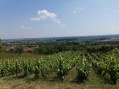
Between vineyards and forests around Bulligny
 6.06 mi
+610 ft
-597 ft
3h 20
Easy
Departure from Bulligny (Meurthe-et-Moselle)
A route to discover the heritage of the wine-growing village of Bulligny, its vineyards, woods and mysterious "blue pond". With a beautiful view of the Côtes de Toul vineyards.
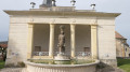
From the canal to the wind turbines via fountains and wash houses from Mauvages
 4.56 mi
+338 ft
-341 ft
2h 25
Easy
Departure from Mauvages (Meuse)
A lovely walk that will allow you to discover Mauvages, its fountains and its extraordinary wash houses. It also includes a short stroll through the forest to listen to the murmur of the wind turbines
Please note: do not walk this route in the opposite direction, as it is forbidden to go down the steps by the canal, between (3) and (4)