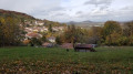
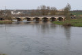
Domgermain Plateau and Val-de-Passey from Choloy-Ménillot

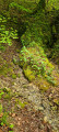
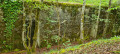
A circular route starting with a fairly long climb through meadows, orchards and woodland towards the summit of the Domgermain Plateau. Cross its meadow, a Natura 2000 ecological site, along a hillside path where you will see the remains of fortifications dating from 1876, then descend towards the Val de Passey with a detour to the hamlet of Les Sept Sources (where you can quench your thirst with spring water from the forest) and its ponds.

Details

93208265
Creation:
Last update:
Last review:
  • Walking
    Activity: Walking
  • ↔
    Distance: 5.14 mi
  • ◔
    Average duration: 2h 45 
  • ▲
    Difficulty: Moderate

  • ⚐
    Back to start: Yes
  • ↗
    Ascent: + 479 ft
  • ↘
    Descent: - 456 ft

  • ▲
    Highest point: 1,263 ft
  • ▼
    Lowest point: 794 ft

Photos

Description of the walk

Park on Rue de Toul near the castle.

(S/E) With your back to the castle, follow Rue de Toul towards Foug on the left and turn into the first street on the left, at the corner of No. 63. Follow the path running alongside the horse paddocks, then just after the bridge over a stream, cross the Marne-Rhine Canal feed channel.

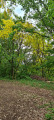
(1) Turn left onto the path leading up to the plateau, with orchards on either side. At the end of the path, cross a large sloping meadow at the edge of the forest. At the far end of the meadow, on the right, a small passage leads to a forest track.

(2) After a few metres along the forest track, take the path on the left which climbs towards the plateau. At the top, turn right for 30 m.

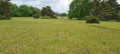
(3) After the climb, you’ll emerge onto the meadow of the Domgermain plateau. Turn left, cross the meadow and you’ll reach a track. Cross it, take the path opposite and you’ll immediately come to a fork.

(4) Turn right and walk straight on for about 1.5 km.

(5) Cross the track again (Chemin du Plateau) then begin your descent towards the Val de Passey via the path that branches off to the right, heading south-west, then turns right again heading due north until you reach a fork at Val de Passey.

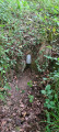
(6) Head down to the left towards a pond and, just after the Val de Passey lodge, take the path climbing up to your left to the hamlet of Les Sept Sources to quench your thirst.

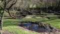
(7) Then return to the little Route du Val de Passey which runs alongside the ponds and follow it to the left.

(8) Take a detour to admire the pond and the Saint-Pierre mill, then return to the village via the road followed by Rue Chapelle Sainte-Croix.

(9) At the church, turn right, cross the Marne-Rhine Canal supply channel again and continue along Chemin de Pont Maizières. You will emerge onto Rue Toul and arrive at the car park (S/E).

Waypoints

  1. S/E : mi 0 - alt. 804 ft - Car park on Rue de Toul near the castle
  2. 1 : mi 0.3 - alt. 804 ft - Stream
  3. 2 : mi 1.06 - alt. 1,014 ft - Climb up to the plateau
  4. 3 : mi 1.45 - alt. 1,243 ft - Prairie du Plateau
  5. 4 : mi 1.63 - alt. 1,230 ft - Hillside path
  6. 5 : mi 2.22 - alt. 1,240 ft - Chemin du Plateau
  7. 6 : mi 2.74 - alt. 1,004 ft - Junction at Val de Passey
  8. 7 : mi 3.15 - alt. 1,001 ft - The Seven Springs
  9. 8 : mi 4.24 - alt. 843 ft - Étang and Moulin Saint-Pierre
  10. 9 : mi 4.8 - alt. 840 ft - Junction at the church
  11. S/E : mi 5.14 - alt. 807 ft - Car park on Rue de Toul near the castle

Reviews and comments

4.5 / 5
Based on 1 review

Reliability of the description
Not used
Ease of following the route
5 / 5
Route interest
4 / 5
Christecol
Christecol

Overall rating : 4.5 / 5

Date of your route : May 07, 2026
Reliability of the description : Not used / Not applicable
Ease of following the route : ★★★★★ Very good
Route interest : ★★★★☆ Good
Very busy route : No

A very pleasant afternoon walk with no particular difficulties. After point no. 7, I think it’s best to continue along this path to avoid the tarmac road, unless you want to see the pond and St Pierre Mill.

Machine-translated

Other walks in the area

For more walks, use our search engine .

The GPS track and description are the property of this route's author. Please do not copy them without permission.