


 Country:
 City:
City:


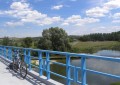
(S/E) From the car park at Rigny-la-Salle Town Hall, take Rue de l’École to reach the football ground. Turn right and continue along this road to join the D144 via the footbridge crossing the Beaumelle stream (Aroffe). Turn left and carry on to the next junction.
(1) Turn left, towards Ugny-sur-Meuse (signposted). Cross the Meuse to reach a ‘Stop’ sign.
(2) Turn right, then right again at the first street, which quickly becomes unpaved, leading onto a grassy track. Continue straight on for about 1 km until you pass under the bridge of an old railway line.
(3) Stay on this track until you reach the junction with a dirt track. Turn right onto it to join the D144a. Pass the bridge over the Meuse on your right and continue along the road on your left towards Ourches-sur-Meuse.
(4) At the junction, turn right onto the D144. In Ourches-sur-Meuse, pass the church on your left. You are now on Rue de Naives.
(5) At the bottom of the street, at the four-way junction with a sign pointing to Pagny-sur-Meuse 5 km to the right, turn left, then immediately right onto Rue Saunière. The steep climb turns left then right.
When you reach the three-way junction, bordered by an orchard on the left, continue along the road to the left. After a few dozen metres, the tarmac ends and gives way to a stony track. At the next crossroads, take the track on the right. After just under a hundred metres, you’ll come to another three-way junction formed by two tracks; stay on the one on the left. Continue straight ahead.
(6) Please note: as you come out of the right-hand bend, a path branches off to the left at a 90° angle; take this one. Shortly afterwards, after about 300 metres, opposite the copse of trees, take the path on the right (north-east). Carry on to the next junction with the ‘white’ track coming from the left. Turn onto this white track towards the N4, which you can see in the distance. On the way, ignore the two tracks branching off to the left, pass under two high-voltage power lines and arrive at the N4 bridge.
(7) After the bridge, carry on to join the D36. Turn right towards Pagny-sur-Meuse, quickly cross a bridge over the Meuse and then enter the village via the Grande Rue. When you reach the first four-way junction, near the bakery, patisserie and grocery shop, go past the Rue de l’Église on the left, which is a one-way street.
(8) Take the next left; this is Rue du Sac, signposted as a dead end but accessible by bike. After 50 metres, turn left to find yourself facing the church and the nursery school on your left. Take the road leading uphill to the right to reach the banks of the Marne–Rhine Canal.
Take the tarmac path on the left to follow the canal. When you reach the last houses, leave the tarmac section and follow a grassy path that is easily passable by cycle. From there, continue for just over 1 km along this path beside the canal; there are no junctions. Please note that during this section, you will pass under a high-voltage power line.
(9) At the junction of two canals (the Marne–Rhine Canal and the northern branch of the Canal de l’Est), turn left towards the Troussey canal bridge, which spans the Meuse.
(10) As you come off the canal bridge, continue along the path until you cross the canal and reach the D36. Cross the road to take the road opposite, which you’ll soon leave at the bottom, after about 60 metres, to turn left onto the path leading to the canal bank. Follow the canal along this path until you reach the junction with the white track near the bridge that passes under the N4, known as the Pont Biais.
(11) Take the path under the N4 towards Void-Vacon and follow it for about 3 km. Once in Void-Vacon, go under the bridge on the D964 (Route de Vaucouleurs) and continue along the path, staying by the canal.
(12) On the other side of the canal is the harbour, where there are two rows of five silos. Continue to lock number 12 at Void. Pass through this lock, continue along the same path and arrive at lock number 11 at Vacon.
(13) When you reach the tarmac section, at the bend, turn left onto the bridge spanning the canal. As soon as you come off the bridge, turn right onto the path that passes in front of the lock-keeper’s house and rejoin the path along the canal bank to reach Haut Bois Lock No. 10. Walk alongside the lock and continue along the same path to Lock No. 9 at Les Biguiottes. Walk past the lock, staying on the same path, to reach Lock No. 8 at Varonnes.
(14) Do not go down towards the lock but cross the bridge on the right. At the end of the bridge, leave the white track, turn left to join the path on the other bank of the canal. Follow this path towards Lock No. 7 at Sauvoy, walk alongside it and continue along the path until you come to the bridge spanning the canal. Take the path on the right and join the D134. Take the hairpin bend to the left, cross the canal to reach the junction with the D10 (cross opposite).
(15) Turn right onto the D10, towards Vaucouleurs, Mauvages and Rosières-en-Blois (signposted). After 400m on the road, and after passing Lock No. 6 at La Corvée, turn left onto the D134 towards Vaucouleurs, 7km away. Follow this road through the woods without hesitation until you reach the junction with the D964 at the entrance to Vaucouleurs. Take the D964 to the right for 180m, then leave it and turn left onto the road leading to the lay-by.
(16) When you reach the junction with the two dirt tracks, turn onto the track on the right heading east. Follow this track, skirting the grounds of the Château de Tusey, until you reach a junction with a tarmac road, opposite which is a row of houses.
Turn left onto the tarmac road called “Chemin de Vaucouleurs à Saint Germain”. At the next junction, ignore the road branching off to the right and carry on straight ahead. After the last house, leave the tarmac and continue along the track. When you reach the sewage treatment plant on your right, take the track just past the plant which branches off to the right; you’ll soon come back onto a tarmac road. Cross the Tusey industrial estate to join the D36.
(17) At the Stop sign, turn left onto the D36. Follow the road into Ugny-sur-Meuse and pass through the village.
(2) On leaving the village, turn right to cross the bridge over the Meuse and continue to the next junction. Turn right.
(1) Turn right onto the D144c towards Rigny-la-Salle and Rigny-Saint-Martin. Follow this road until you enter Rigny-la-Salle via Rue des Preyens. When you reach the bridge over the Beaumelle stream, turn right towards Chalaines and Vaucouleurs. Continue along the road for 230 metres. You will find yourself in front of the Town Hall (S/E).

 Visorando Member
 Easy
Easy 
 Tourism professional
