‘Côtes et Délices’ Walk in Domgermain

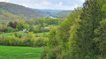
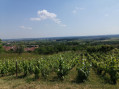
This route forms the basis for the gourmet walk organised on 27 April 2025. This walk allows you to discover three typical villages in the southern Toulois region: Domgermain, Charmes-la-Côte and Mont-le-Vignoble. Signposting has been put in place along the entire route for the day of the gourmet walk. The route described on Visorando complements this signposting and will subsequently allow you to complete this circular route at your leisure. You will simply need to omit the stages listed in the description. 

Details

69790478
Creation:
Last update:
Last review:
  • Walking
    Activity: Walking
  • ↔
    Distance: 7.26 mi
  • ◔
    Average duration: 4h 00 
  • ▲
    Difficulty: Moderate

  • ⚐
    Back to start: Yes
  • ↗
    Ascent: + 725 ft
  • ↘
    Descent: - 715 ft

  • ▲
    Highest point: 1,312 ft
  • ▼
    Lowest point: 784 ft
  • ⚐ Country: France
  • ⚐ City: Domgermain (54119)
  • ⚑
    Start/End: N 48.644901° / E 5.835566°
  • Accessible from the train station Gare de Domgermain.
  • ❏
    IGN map(s): Ref. 3215SB, 3315ET
  • Hour-by-hour weather

Description of the walk

The starting point is in the car park near the Domgermain community hall. Cars can be parked in this car park.

(S/E) Leave the car park and take Rue de la Gare (D11) towards the centre of Domgermain.

(1) When you reach the junction of Rue de la Gare and Rue de la Rosière, enter the car park and walk past the school on your left. Leave the car park via the tarmac path that starts at the far end. 

(2) Go straight on through the hairpin bend, reach the junction with another cross-path and take it to the right to follow the path up the hill. At the junction on the edge of the woods, take the path on the left towards Charmes-la-Côte and continue for about 400 m. 

(3) Leave the track and turn right up the fairly steep slope. Follow the track to the junction and take the path on the left towards Charmes-la-Côte. You’ll rejoin the tarmac road at a hairpin bend. 

(4) Take the road leading uphill to the right and follow it to the sports ground near the cemetery (where the first stage of the organised walk is located: 1).

(5) Leave the sports ground and rejoin the route via Rue Bellevue. Walk past the church and the town hall, turn left into Rue des Jardinets, then right into Rue du Han.

(6) Turn left onto Rue des Mulsons, keep to the right at the three-way junction and continue to the entrance to the private property. 

(7) Take the path on the left before the private property and follow it in the same direction until you reach the entrance to Mont-le-Vignoble. 

(8) Head towards the centre of Mont-le-Vignoble by turning left onto Chemin du Saint-Esprit, then right onto Rue Léopold Cabret. Then follow Rue de Toul to the right and you’ll reach the school in Mont-le-Vignoble after about 100 metres (second stage of the organised walk: 2).

(9) Continue along Rue de Toul and turn right into Rue des Marcottes. Leave Mont-le-Vignoble and follow the road until the end of the tarmac section.

(10) Take the path on the right which climbs up the hill and head for the building known as the Guingette du Sans Souci (where the third stage of the organised walk is located: 3). At the top of the hill, at the junction, turn right onto the main path and follow it to the road linking Charmes-la-Côte to the hamlet of Saint-Fiacre.

(11) Cross the road and continue along the path to the star-shaped junction by the old oak tree at Charmes-la-Côte (where the fourth stage is located: 4).

(12) Continue the route by taking the second path on the right. Follow this path to the road that descends from the Domgermain plateau towards Domgermain.

(13) Head down the road to the right. At the entrance to Domgermain, at the three-way junction, turn left onto the Chemin de la Côte-le-Loup and continue for about 200 m (to the left of the track, in a field, is the fifth stage:5)

(14) Take the cross-country path on the right that runs alongside the shed. Join Rue Saint-Fiacre and first turn left then right to enter Grande Rue. Walk down this street, which bends sharply to the left further on and leads to the junction with Rue de la Gare. 

(15) Continue to the right and return to the school car park, then to the junction between Rue de la Gare and Rue de la Rosière. 

(1) Carry on straight ahead along Rue de la Gare and, following the route in reverse to the one taken on the way out, return to the Salle des Fêtes car park (final stage of this walk:6) (S/E). 

Waypoints

  1. S/E : mi 0 - alt. 784 ft - Salle Polyvalente car park - Gare de Domgermain
  2. 1 : mi 0.37 - alt. 837 ft - Junction of the circular loop
  3. 2 : mi 0.8 - alt. 902 ft - Hairpin bend, straight ahead
  4. 3 : mi 1.35 - alt. 922 ft - Turn right
  5. 4 : mi 1.72 - alt. 1,024 ft - Turn right
  6. 5 : mi 1.9 - alt. 1,096 ft - Charmes-la-Côte sports ground
  7. 6 : mi 2.2 - alt. 1,037 ft - Rue des Mulsons
  8. 7 : mi 2.52 - alt. 1,027 ft - Private property – no entry
  9. 8 : mi 3.16 - alt. 909 ft - Chemin du Saint-Esprit
  10. 9 : mi 3.32 - alt. 886 ft - Mont-le-Vignoble School
  11. 10 : mi 3.79 - alt. 1,079 ft - La Guinguette de Mont-le-Vignoble
  12. 11 : mi 4.55 - alt. 1,260 ft - Junction with the road, straight ahead
  13. 12 : mi 4.85 - alt. 1,309 ft - Old oak tree at Charme-la-Côte
  14. 13 : mi 5.8 - alt. 1,237 ft - Road junction, turn right
  15. 14 : mi 6.45 - alt. 1,073 ft - Shortcut
  16. 15 : mi 6.74 - alt. 879 ft - Rue de la Gare
  17. S/E : mi 7.26 - alt. 784 ft - Salle Polyvalente car park

Notes

The route follows paths that may be slippery, especially after rain. Sturdy walking shoes are recommended.

Reviews and comments

4.7 / 5
Based on 3 reviews

Reliability of the description
4.7 / 5
Ease of following the route
4.7 / 5
Route interest
4.7 / 5
windgilles
windgilles

Overall rating : 4.7 / 5

Date of your route : Aug 16, 2026
Reliability of the description : ★★★★★ Very good
Ease of following the route : ★★★★★ Very good
Route interest : ★★★★☆ Good
Very busy route : No

A lovely route along the coast of Toul, combining nature, villages and a few remains of fortifications… A very pleasant, shaded route, especially as we did it during a heatwave… Thanks to the person who mapped the route…

Machine-translated

BAJOLET
BAJOLET

Overall rating : 5 / 5

Date of your route : Feb 03, 2026
Reliability of the description : ★★★★★ Very good
Ease of following the route : ★★★★★ Very good
Route interest : ★★★★★ Very good
Very busy route : No

A beautiful route along the coast of Toul, easy for an afternoon with beautiful views, passing through three villages with vineyards. Can be done in summer as it is shaded.

Machine-translated

bebert48
bebert48

Overall rating : 4.3 / 5

Date of your route : Apr 12, 2025
Reliability of the description : ★★★★☆ Good
Ease of following the route : ★★★★☆ Good
Route interest : ★★★★★ Very good
Very busy route : No

A varied route with some lovely views. Perhaps best avoided in wet weather.

Machine-translated

Other walks in the area

For more walks, use our search engine .

The GPS track and description are the property of this route's author. Please do not copy them without permission.