Country:
 City:


Car park near the Lucey stadium: walk through the village towards the church, go round it on the right, turn left towards the sheltered picnic table; the car park is on the left behind the football stadium and next to the tennis court.
(S/E) From this car park, with your back to the stadium, take Rue des Lésières on the right and follow it to the junction with a pretty fountain.
(1) Turn sharply right and head up Chemin de Foug. After a short stretch through the woods, ignore the paths to the right and left and follow the track that climbs towards the woods. (Markings: White Rectangle No. 7, Yellow Ring and Blue Ring).
(2) Follow this path until you reach a forest track.
(3) Cross the road, then head straight ahead and follow the wide path on the right (signposted with a white/yellow Rectangle, a Yellow Ring and a Blue Ring).
(4) About 700 m further on, turn right onto another forest track and, a few metres further on, leave it via a wide grassy path to the right of plot 12 (marked only with a Yellow Ring).
(5) At the three-way junction, take the path on the left (marked with a Yellow Ring) and head down towards Laneuveville. You’ll pass the rest area; be sure to stop there for a short break.
(6) Take the wide white path on the right. On the left, you’ll find a shelter and a playground, and a little further on, the pretty wash house.
(7) As you come to the end of the path at the Fontaine des Sœurs, take Rue Basse on the left and head towards the church. Go round it on the right, then follow the signs for Trondes.
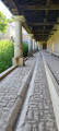
A short alternative route: you can reach the town hall via the covered passageway. On emerging, turn right, then head towards Trondes.
(8) At the three-way junction, turn right, then left at the wayside cross. Continue along this tarmac road, which soon becomes a passable dirt track, until you reach the Faux Moulin crossroads
(9) Turn right, passing in front of the Faux Moulin ( Yellow Ring signposting)
(10) At the crossroads, turn right and enter the forest (Green Disc and Yellow Ring markings). Head straight up, passing the Domfontaine Spring catchment (Blue Ring and Yellow Ring markings), and continue to the top. The track turns right; keep going straight on across the Wailly plateau.
Stay on the same wide white path and head downhill along a path that becomes rutted and rocky until you reach the village.
(11) Before reaching the road junction, turn right between two houses and carefully cross the D192 to explore the Roises site. A short circular route is available on site, which is not included in this route. Weather conditions may make the path muddy and slippery. Return to the car park (S/E).
 Visorando Member


 Difficult
 Moderate