


 Country:
 City:


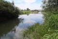
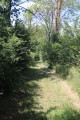
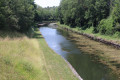
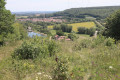
(S) On leaving Toul station, take the street to the left of the station, head back towards the tracks and take the underpass beneath them. On the other side of the railway line, carry on straight ahead, cross Avenue Clemenceau and continue uphill opposite until you reach a Fork in the road.
Turn right onto Rue Saint-Michel and continue uphill to the Notre-Dame Chapel.
(1) Turn left onto Chemin de Saint-Jean and continue to a junction.
Ignore the path winding uphill to the right and carry on straight ahead until you reach the next junction.
(2) Take the path leading down to the left and join Rue du Vieux Chemin de Bruley.
Turn right onto the D 908 (Rue Gabriel Mouilleron)
(3) Turn left. You’ll come to a group of industrial buildings enclosed by a wall, one of which has been converted into a sports hall.
(4) Just before the sports hall, take the path on the right. Leave the path running alongside the wall on your left and head up through the fields to the next junction.
(5) Turn left and continue uphill through the woods to the next junction.
(6) Turn and head up the winding path to the right. At the next left-hand bend, ignore the first path on the left and continue leftwards along the winding path on the ridge to the top of the Barine hill.
From the top of Côte Barine, head back the way you came and return to the junction.
(6) Turn right opposite and continue downhill. The path winds to the left. At the junction by the water tower, carry on straight ahead and join the D 119 (Rue des Oiseleurs).
(7) Turn right and carry on for about a hundred metres, until you reach a junction with a street on the left.
Turn left; a few metres further on, pass a street on your left and keep to the right. The path turns left, then right, and passes in front of the inter-municipal technical services’ depots. Immediately afterwards, you’ll reach a junction in a left-hand bend.
(8) Take the path on the right, keeping the fences on your right-hand side. When it rejoins the D119, carry on in the same direction. The road bends to the left and passes under high-voltage power lines. Carry on until you reach the second street on the left.
(9) Turn left and follow Rue de la Croix de Mission. Continue along the track which extends from the street after a sharp right-hand bend and leave the built-up area. Further on, the track makes a sharp hairpin bend to the left and then joins a track. Continue in the same direction for a few metres, until you reach the start of a path on the right.
(10) Take the path on the right, at a 90° angle. It eventually joins a track.
(11) Turn left and follow the track. When it joins another track about fifty metres further on, continue in the same direction. Follow the straight track to the end. It leads to a large crossroads with a tarmac track, a viewpoint over the valley and an orientation table.
(12) Turn left and follow the tarmac track for about ten metres. Turn right onto the path that descends, starting with a few wooden steps, and joins a small road.
(13) Turn right and follow the road. It passes in front of Écrouves Church and then the cemetery. It continues along a path. Carry on straight ahead along the path, which eventually leads onto a street. Continue along this street. When it joins a side street, turn right and carry on to the end of the street.
(14) Turn left. At the three-way junction with a cross, keep to the right and join Rue de Paris.
Turn right, then immediately turn left. Follow the tarmac track. It crosses some railway lines and leads to the Marne–Rhine Canal. You will then reach a junction with a track coming from the right.
(15) Turn left, cross the canal and turn immediately right. Follow the tarmac road alongside the canal until you reach a junction with a path on the left, near a ruined building on your left-hand side.
(16) Turn left onto this track, which crosses the Ingressin. A few metres further on, turn right. Continue upstream along the river. Ignore a track on the left. At Neuf Moulin, carry on straight ahead. You’ll reach the springs. Join the D11 and continue in the same direction. You’ll come to a junction in a right-hand bend.
(17) Turn left and follow Rue de Roubie for a few metres. Turn right off this road to join a fitness trail. Pass the start of the trail, under a gantry, on the right-hand side and turn immediately left to walk along it in the opposite direction. Walk through a copse until you reach a piece of fitness equipment near a track. Leave the fitness trail, join the track and turn right. The track eventually turns left uphill, then winds to the right and joins a road.
(18) Take the road on the right. Follow it until you reach a junction with two paths on the left after crossing a canal.
(19) Turn left, then take the path immediately on the right which climbs up the Foug threshold. At the top of this, after passing under two high-voltage power lines, join another path. Continue in the same direction for about 50 m until you reach a junction.
(20) Turn left and you’ll reach a junction with a track.
Turn left again. After passing under the high-voltage power lines once more, you’ll reach a three-way junction at a right-hand bend. Leave the track that runs alongside the four-lane road and keep to the right. Further on, the track takes a wide right-hand bend and passes under the high-voltage power lines again. At the end of the bend, you’ll come to the start of a path on the left.
(21) Take the grassy path on the left. It runs alongside the canal and joins a road.
Turn left, then immediately turn right onto the grassy path which climbs the embankment and runs alongside the canal. You’ll reach a junction with the D 400.
(22) Cross the D 400 and continue along the canal on the path opposite. Follow it for a long way. It bends twice to the left, then to the right, and eventually joins Rue du Faubourg in Pagny-sur-Meuse, at the river landing stage.
(23) Turn left and follow Rue du Faubourg. Follow it to the end.
(24) Turn right, then immediately left, and follow Rue “Bas des Rues”, then the path that continues from it, until you reach the confluence of the Ruisseau des Marais and the Meuse, about 15 metres past the last house.
(25) Take the narrow path on the right between the wall on your right and the fence on your left, and join the Grande Rue.
Cross the street and take the narrow passage opposite between two houses. Behind the houses, it turns right. Follow it to the church and go round the back of it.
(26) Turn left, head towards the canal bank and turn right. You’ll reach Rue de Trondes.
(27) Follow this street to the left and cross the canal. Continue straight on for 1 km until you reach Pagny-sur-Meuse station. (E)

 Visorando Member
 Moderate
 Easy

