


Refine your search for walks in Omblèze
Omblèze walks


 La Tête de la Dame and Pas du Gouillat
 Visorando Member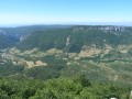
 8.38 mi
 +2,959 ft
 -2,943 ft
 6h 25
6h 25
 Moderate
 Departure from Omblèze (Drôme)
Set off from Omblèze for a breathtaking view of the Quint region and the Ambel Plateau.
The Rochers de la Sausse and the Col de la Bataille as seen from Omblèze
 6.03 mi
+2,638 ft
-2,615 ft
5h 05
6.03 mi
+2,638 ft
-2,615 ft
5h 05
 Difficult
Departure from Omblèze (Drôme)
Difficult
Departure from Omblèze (Drôme)
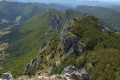
From Omblèze, a steep climb will take you to the beautiful cliffs of the Rochers de la Sausse, which you’ll follow as far as the Col de la Bataille before descending just before the Ambel plateau. The more adventurous can push on to the Tête de la Dame or set out to tackle the Roc de Toulau.
See the ‘Practical Information’ section for details on the difficulty of this route.
The Ambel Plateau as seen from the Gervanne Valley
12.04 mi
+3,507 ft
-3,504 ft
8h 35
Difficult
Departure from Omblèze (Drôme)
Situated at the southernmost tip of the Vercors, the Ambel Plateau overlooks the Drôme and the small valleys leading up to it. The Gervanne Valley, once past the Gorges d’Omblèze, is a lovely starting point from which to explore the vast expanse of this high plateau, perched at nearly 1,500 metres. Steppe lovers, don’t miss out.
Crossing the Ambel d’Omblèze plateau to Font d’Urle
18.98 mi
+5,430 ft
-5,430 ft
10 hrs
 Very difficult
Departure from Omblèze (Drôme)
Very difficult
Departure from Omblèze (Drôme)
This traverse of the Ambel plateau is magnificent. The beauty of the scenery is simply sublime.You can see all the surrounding mountain ranges (Vercors, Dévoluy, Écrins) and even Mont Blanc on a clear day.On the other side, there are views of the Massif Central and the Rhône Valley.It is possible to complete the hike over two days thanks to the two unstaffed mountain huts.
Bec Pointu - Courcousson - Pré des Chaux
 6.36 mi
+2,448 ft
-2,451 ft
5h 05
Difficult
Departure from Omblèze (Drôme)
6.36 mi
+2,448 ft
-2,451 ft
5h 05
Difficult
Departure from Omblèze (Drôme)
A wild hike, allowing you to reach the summit of Bec Pointu and then return via Courcousson and the Pré des Chaux meadow.
The circuit follows several panoramic ridges, offering 360° views of the Gorges d'Omblèze, the Roc de Toulau, the Tête de la Dame, the Vercors ridges, the Glandasse, and the Quint and Gervanne valleys.
Tête de la Dame - Bec Pointu - Courcousson from Les Arbods
 9.34 mi
+3,593 ft
-3,593 ft
7h 25
Difficult
Departure from Omblèze (Drôme)
9.34 mi
+3,593 ft
-3,593 ft
7h 25
Difficult
Departure from Omblèze (Drôme)
A magnificent ridge hike offering a wide variety of landscapes and sublime panoramas in a mountainous environment.
This route is closed to hikers from 1 November to 1 May, by order 0601.
La Tête de la Dame
 6.45 mi
+2,877 ft
-2,877 ft
5h 30
Moderate
Departure from Omblèze (Drôme)
6.45 mi
+2,877 ft
-2,877 ft
5h 30
Moderate
Departure from Omblèze (Drôme)
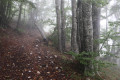
The summit of the Tête de la Dame offers superb views of the Diois, the Drôme valley and the Vercors massif.
Canyon des Gueulards via the seven hairpin bends
 4.84 mi
+1,060 ft
-1,063 ft
3h 10
Moderate
Departure from Omblèze (Drôme)
4.84 mi
+1,060 ft
-1,063 ft
3h 10
Moderate
Departure from Omblèze (Drôme)
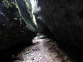
This unusual spot offers a complete change of scenery, with a crevice that plunges into nowhere and a calm, dark atmosphere among rocky outcrops, lichens and ferns. Access to the canyon is via a track with seven hairpin bends that demonstrate the art of building passages carved into the rock on the mountain side and masonry on the side facing the void.
Canyon des Gueulards via the Chaffal
 4.72 mi
+1,555 ft
-1,529 ft
3h 30
Moderate
Departure from Omblèze (Drôme)
4.72 mi
+1,555 ft
-1,529 ft
3h 30
Moderate
Departure from Omblèze (Drôme)
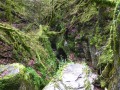
Enjoy a complete change of scenery in this superb canyon between two narrow cliffs. An unusual spot with a crevasse that descends into nowhere, offering a calm and sombre atmosphere among rocky outcrops, lichens and ferns.
Please note! The route has been changed to avoid the Ferme du Pêcher du Bas. At (1), go straight ahead, then take a path on the right and head straight for (3).
Canyon des Gueulards, via the Sept Lacets
 4.81 mi
+1,270 ft
-1,299 ft
3h 20
Moderate
Departure from Omblèze (Drôme)
4.81 mi
+1,270 ft
-1,299 ft
3h 20
Moderate
Departure from Omblèze (Drôme)
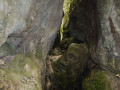
This unusual spot offers a complete change of scenery, with a crevasse that plunges into nowhere and a calm, sombre atmosphere among rocky outcrops, lichens and ferns. The return route takes you along a track with seven hairpin bends that illustrate the art of building passages carved into the rock on the mountain side and masonry on the side facing the void.
From the Ambel Farm to Bouvante le Haut
 8.42 mi
+860 ft
-2,966 ft
6 hrs
Very difficult
Departure from Omblèze (Drôme)
8.42 mi
+860 ft
-2,966 ft
6 hrs
Very difficult
Departure from Omblèze (Drôme)
Pastoral plateau, undergrowth, flower-filled meadow. A varied and very pleasant route offering the chance to encounter a rich and unspoilt flora. This route features a very steep descent for the return to Bouvante le Haut via the Col de Rioupeysson.
The Vellan Cross
 8.45 mi
+1,040 ft
-1,037 ft
4h 50
8.45 mi
+1,040 ft
-1,037 ft
4h 50
 Easy
Departure from Le Chaffal (Drôme)
Easy
Departure from Le Chaffal (Drôme)
A peaceful hike with the panorama of the Croix du Vellan as our destination. View of the entire Diois valley and some of the peaks of the Vercors. A panoramic table invites you to learn about all these peaks.
Circular walk starting from La Vacherie
 7.98 mi
+1,637 ft
-1,654 ft
5h 05
Moderate
Departure from Le Chaffal (Drôme)
7.98 mi
+1,637 ft
-1,654 ft
5h 05
Moderate
Departure from Le Chaffal (Drôme)
This walk can be done in either direction.
No real difficulties, but a steep climb depending on the direction chosen:
- around 200 metres between Les Moreaux and Le Chaffal, a very shaded climb,
- approximately 400 metres between Le Pêcher du Bas and Le Chaffal, a climb with little shade.
Circular walk from La Vacherie via the Canyon des Gueulards
 7.08 mi
+1,112 ft
-1,132 ft
4h 15
Moderate
Departure from Le Chaffal (Drôme)
7.08 mi
+1,112 ft
-1,132 ft
4h 15
Moderate
Departure from Le Chaffal (Drôme)
An unusual hike through the Canyon des Gueulards, a circular route starting from La Vacherie. Particularly pleasant in hot weather.
Short walk from La Vacherie
 1.67 mi
+112 ft
-131 ft
0h 50
Easy
Departure from Le Chaffal (Drôme)
1.67 mi
+112 ft
-131 ft
0h 50
Easy
Departure from Le Chaffal (Drôme)
This is an easy walk that can be done with young children. Picnics are possible in a shaded area.
Circular route around Omblèze in the southern Vercors
 21.85 mi
+5,614 ft
-5,584 ft
2 days
Difficult
Departure from Omblèze (Drôme)
21.85 mi
+5,614 ft
-5,584 ft
2 days
Difficult
Departure from Omblèze (Drôme)
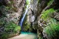
This two-stage circular loop takes place in a sparsely populated region with luminous landscapes, alternating between Provençal and mountainous scenery. From the Druise car park, the path heads to the Druise Waterfall, then follows the La Gervanne Gorge route and visits the La Pissoire Waterfall before venturing into the eerie Gueulards Canyon. It reaches the Abbaye de Léoncel lodge for a peaceful, monastic night’s rest. The next stage begins with a good warm-up leading to the Pas du Grand Échaillon, then on to the Col de la Bataille and its viewpoint, before continuing to that of the Croix d’Ambel. The path descends to the Pierre Plate viewpoint and then to the village of Omblèze, from where it climbs to the Col des Ayes and on to the Col d’Anse. It descends to the hamlet of Ansage and returns to the car park.
From the Druise Waterfall to Léoncel via the Gueulards Canyon
 8.99 mi
+2,300 ft
-1,220 ft
6h 10
Moderate
Departure from Omblèze (Drôme)
8.99 mi
+2,300 ft
-1,220 ft
6h 10
Moderate
Departure from Omblèze (Drôme)
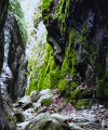
First stage of the circular route around Omblèze in the Southern Vercors. This route begins with a visit to the Chute de la Druise, one of the most beautiful waterfalls in the Vercors, which plunges 70 metres from the bottom of a narrow gorge. After passing through the Gervanne Gorge, you come to the charming little Pissoire Waterfall, followed by a crossing of the Gueulards Canyon, a unique geological feature that inspires both unease and delight, before reaching the small, isolated village of Léoncel and its 12th-century abbey, with its old-world charm, which offers hospitality in a discreet manner.
Gorge d'Omblèze - Canyon des Gueulards
 14.33 mi
+4,291 ft
-4,262 ft
10h 20
Difficult
Departure from Omblèze (Drôme)
14.33 mi
+4,291 ft
-4,262 ft
10h 20
Difficult
Departure from Omblèze (Drôme)
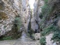
Randonnée permettant de parcourir sur la journée l'ensemble des cascades et des particularités des gorges.
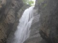
Druise waterfall
 1.12 mi
+476 ft
-499 ft
0h 55
Easy
Departure from Omblèze (Drôme)
1.12 mi
+476 ft
-499 ft
0h 55
Easy
Departure from Omblèze (Drôme)
The Druise waterfall, an impressive 72-metre drop, is undoubtedly one of the most beautiful in the Vercors. The view from below is breathtaking: the high waterfall looks like a bridal veil, accompanied by a thunderous roar and a huge blast of air.
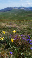
Tête de la Dame from the Col de la Bataille
 7.23 mi
+1,460 ft
-1,460 ft
4h 35
Moderate
Departure from Omblèze (Drôme)
7.23 mi
+1,460 ft
-1,460 ft
4h 35
Moderate
Departure from Omblèze (Drôme)
The Tête de la Dame offers a magnificent 360-degree panorama.
Although it is accessible to experienced hikers from the village of Omblèze, it is also easier to get there from the Col de la Bataille. Ideal for a picnic!
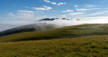
The Roc de Toulau and the Plateau d'Ambel with its karstic cave
 9.79 mi
+2,546 ft
-2,546 ft
6h 45
Moderate
Departure from Omblèze (Drôme)
9.79 mi
+2,546 ft
-2,546 ft
6h 45
Moderate
Departure from Omblèze (Drôme)
After a slightly steep but easy climb to Roc de Toulau, where the view is magnificent, we will reach the Plateau d'Ambel and its curious karstic cave des Quatre Gorges before climbing to the Tête de la Dame. Return via a good trail and then a wide path.
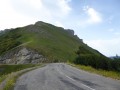
Roc de Toulau
 2.27 mi
+1,056 ft
-1,040 ft
2h 00
Difficult
Departure from Omblèze (Drôme)
2.27 mi
+1,056 ft
-1,040 ft
2h 00
Difficult
Departure from Omblèze (Drôme)
An outpost of the Vercors on the western side, Roc de Toulau is a 1,581-metre peak offering views of the Ambel Plateau and the peaks of the Vercors, Diois, Drôme Provençale and, on a clear day, Mont Ventoux.
Ambel plateau
 12.16 mi
+2,146 ft
-2,116 ft
7h 30
Difficult
Departure from Omblèze (Drôme)
12.16 mi
+2,146 ft
-2,116 ft
7h 30
Difficult
Departure from Omblèze (Drôme)
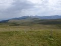
The Ambel Plateau, a mix of pastures and forests, covers an area of 1,231 hectares. The view of the surrounding peaks and mountain ranges is superb: to the east, the Vercors High Plateaus and the Grand Veymont; to the west, the Tête de la Dame (1,506 m), from where you can see the Diois, the Baronnies and the Omblèze valley with its cliffs below; and to the south, the Saint-Julien-en-Quint valley.
⚠️ Between 1 July and 15 September, Prefectural Order DDT-SEF-2026-0176 of 4 June 2026 concerning temporary restrictions on access to the Saoû Forest and the Ambel Plateau in the event of a fire risk, assessed on a daily basis. A map is published every evening (around 5.30 pm) for the following day.
Roc de Toulau and Rochers de la Sausse
 Tourism professional
 6.93 mi
+2,329 ft
-2,336 ft
5h 15
Moderate
Departure from Léoncel (Drôme)
6.93 mi
+2,329 ft
-2,336 ft
5h 15
Moderate
Departure from Léoncel (Drôme)
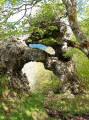
A lovely spring walk, partly off the beaten track, with the added bonus of discovering two beautiful arches.
The Ambel Plateau
9.23 mi
+1,591 ft
-1,562 ft
5h 40
Moderate
Departure from Omblèze (Drôme)
A panoramic hike with spectacular landscapes and countless 360° views, in a preserved area.
Scialet des Quatre Gorges circular loop
 8.90 mi
+1,594 ft
-1,568 ft
5h 30
Moderate
Departure from Omblèze (Drôme)
8.90 mi
+1,594 ft
-1,568 ft
5h 30
Moderate
Departure from Omblèze (Drôme)
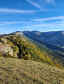
A hike around the Plateau d'Ambel to explore its hidden depths and vertiginous cliffs. Interesting in all seasons, and equally so when done in the opposite direction.
 On horseback across the Ambel Plateau from the Refuge de la Gardiole
 9.22 mi
+1,631 ft
-1,608 ft
4 hrs
Moderate
Departure from Omblèze (Drôme)
9.22 mi
+1,631 ft
-1,608 ft
4 hrs
Moderate
Departure from Omblèze (Drôme)
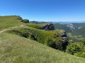
A lovely horse ride to explore the Ambel Plateau.No particular difficulty; theGR®® signposting is very easy to follow.There are vast expanses of pasture to explore at the summit, as well as fantastic views all along the ridges.Take care, however, in poor visibility (fog, rain), as there is a risk of not seeing the drop-off at the ridges and cliffs.
Pierre Chauve at the start of Les Vigouroux
 7.89 mi
+1,224 ft
-1,207 ft
4h 40
Moderate
Departure from Le Chaffal (Drôme)
7.89 mi
+1,224 ft
-1,207 ft
4h 40
Moderate
Departure from Le Chaffal (Drôme)
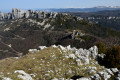
A magnificent view of the Monts du Matin: the Rocher du Roi Gros Nez, the Montagne de l'Epenet, the Rochers des Deux Soeurs and the Barbières valley as far as Valence and Romans-sur-Isère.
 Tubanet Hut – Hollowed-Out Tree Trunk Serving as Drinking Trough
16.91 mi
+4,396 ft
-4,511 ft
10 hrs
Very difficult
Departure from Omblèze (Drôme)
Stage4 sets off from the Cabane de Tubanet and returns to the high plateaus of the Vercors at the Cabane des Bachassons above Saint-Agnan-en-Vercors.A very long day. It is the longest of the tour.
Circular route via the Roc de Toulau and the Plateau d’Ambel from Bouvante
 16.31 mi
+4,275 ft
-4,275 ft
10 hrs
Very difficult
Departure from Bouvante (Drôme)
16.31 mi
+4,275 ft
-4,275 ft
10 hrs
Very difficult
Departure from Bouvante (Drôme)
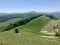
This long circular route allows you to discover several aspects of this part of the Southern Vercors: the Bouvante valley and its access routes to the plateau, the Roc de Toulau, a grassy area dotted with steep slopes, and finally the wide Ambel plateau, which you walk all the way round, not forgetting to visit the karstic cave of the Four Gorges, a sight that’s accessible to everyone.
Bec Pointu from the Quint Valley
 8.33 mi
+3,087 ft
-3,061 ft
6h 30
Difficult
Departure from Saint-Julien-en-Quint (Drôme)
8.33 mi
+3,087 ft
-3,061 ft
6h 30
Difficult
Departure from Saint-Julien-en-Quint (Drôme)
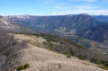
This circular hike takes you up the south-eastern slope of Bec Pointu from the Quint Valley. Although the ascent and descent are challenging, your efforts will be rewarded by the incomparable 360° view from the summit, taking in the Vercors, Glandasse, the Massif des Trois-Becs, Omblèze and, of course, the Tête de la Dame.
In the footsteps of monks, in the Léoncel forest
 10.93 mi
+2,382 ft
-2,369 ft
7h 05
Moderate
Departure from Léoncel (Drôme)
10.93 mi
+2,382 ft
-2,369 ft
7h 05
Moderate
Departure from Léoncel (Drôme)
From Léoncel via the Pas du Grand Échaillon to the Col de la Bataille, then Gampaloux and the Grand Échaillon, a walk through the forest in the footsteps of the Cistercian monks of Léoncel Abbey.
The deer rut trail in Ambel Forest
 2.13 mi
+200 ft
-203 ft
1h 10
Easy
Departure from Omblèze (Drôme)
2.13 mi
+200 ft
-203 ft
1h 10
Easy
Departure from Omblèze (Drôme)
The aim of this walk is to get closer to wildlife using the hides provided for walkers.
Be sure to stay on the path, especially between 15 September and 15 October, or you may be fined if you do not follow the instructions posted along the path.
Circular Vacherie from Léoncel
5.63 mi
+741 ft
-728 ft
3h 15
Easy
Departure from Léoncel (Drôme)
An easy circular walk from Léoncel to La Vacherie. No particular difficulties. The outward leg to La Vacherie, which follows the GR®9, is very pleasant, starting through the woodland. The return leg to Léoncel includes a few sections on the road where you need to be careful.
Short walk around Léoncel
 2.41 mi
+282 ft
-285 ft
1h 20
Easy
Departure from Léoncel (Drôme)
2.41 mi
+282 ft
-285 ft
1h 20
Easy
Departure from Léoncel (Drôme)
A short, easy walk offering various views of Léoncel. Generally very easy, except for the final stretch with the descent from Franchelongue, which may be tricky for children or those with mobility issues.
From Léoncel to the Druise car park via the Croix d'Ambel
 12.86 mi
+3,314 ft
-4,364 ft
8h 50
Difficult
Departure from Léoncel (Drôme)
12.86 mi
+3,314 ft
-4,364 ft
8h 50
Difficult
Departure from Léoncel (Drôme)
Second stage of the Omblèze circular route in the Southern Vercors. This mountainous stage begins with a long climb to the Pas du Grand Échaillon, which continues up the Ravin de Pissenible to reach the Col de la Bataille and its viewpoint. The path, which is almost level on the flank of the Roc de Toulau, then climbs to the panoramic viewpoint at the Croix d'Ambel, before descending after the Pas de Garde to the viewpoint at Pierre Plate and crossing through Omblèze. It climbs to the Col des Ayes and then continues to the Col d'Anse, from where it descends to the hamlet of Ansage before reaching the car park
Circular Pas du Grand Échaillon starting from Léoncel
 3.18 mi
+994 ft
-981 ft
2h 20
Moderate
Departure from Léoncel (Drôme)
3.18 mi
+994 ft
-981 ft
2h 20
Moderate
Departure from Léoncel (Drôme)
A short, very well-signposted and fairly easy walk, but with a section featuring a narrow, steep slope with a significant elevation gain or loss, depending on the direction chosen. This requires a good level of fitness and suitable footwear. Stunning views over Léoncel.
More walks in Omblèze
Select a point of interest below: