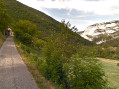
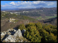
Circular walk starting from La Vacherie

This walk can be done in either direction.
No real difficulties, but a steep climb depending on the direction chosen:
- around 200 metres between Les Moreaux and Le Chaffal, a very shaded climb,
- approximately 400 metres between Le Pêcher du Bas and Le Chaffal, a climb with little shade.

Details

13136677
Creation:
Last update:
Last review:
  • Walking
    Activity: Walking
  • ↔
    Distance: 7.98 mi
  • ◔
    Average duration: 5h 05 
  • ▲
    Difficulty: Moderate

  • ⚐
    Back to start: Yes
  • ↗
    Ascent: + 1,637 ft
  • ↘
    Descent: - 1,654 ft

  • ▲
    Highest point: 3,294 ft
  • ▼
    Lowest point: 2,087 ft

Photos

Description of the walk

Park in the car park at La Vacherie cemetery, or alternatively at the car park by La Vacherie church.

(S/E) Turn left, then left again onto Rue de Chasseloup. Continue until you reach the Tête Noire crossroads.

(1) Leave the street and turn right onto theGR®9, marked in red and white. Continue along theGR® until you reach Morelle Farm.
Cross the small streams at Comberoufle and Les Moreaux.

(2) Walk past the Morelle farm, respecting the fact that it is private property. Continue along the path, passing the houses of Fionat. Stay on theGR® to reach the junction marking the end of the circular route.

(3) Stay on theGR® to the right to reach the Moreaux Lodge. Please respect the property for the tenants’ sake.

(4) Carry on and then cross the little Ruisseau des Moreaux, which can be a bit tricky after heavy rain. Continue uphill to reach the crossroads by the ruins of Chaffal.

(5) Leave theGR® here and turn left onto the path leading down into the Bois de Fobesse. You’ll reach the Ravin du Grand Crot stream.

(6) Turn left, cross the Ruisseau de Corbière and then head towards Pêcher du Bas. Please note that this is private property.

(7) Keep to the right to head into the woods, where you’ll soon rejoin theGRP® du Grand Tour de la Gervanne. Leave thisGRP® and continue left along the track to reach Pêcher du Haut.

(8) Stay on the track and, further on, you’ll reach the junction marking the end of the circular route.

(3) Follow the route back in the opposite direction to return to the car park at La Vacherie cemetery (S/E).

Waypoints

  1. S/E : mi 0 - alt. 3,074 ft - Car park at La Vacherie Cemetery
  2. 1 : mi 0.36 - alt. 3,054 ft - Tête Noire
  3. 2 : mi 0.86 - alt. 2,894 ft - La Morelle
  4. 3 : mi 1.35 - alt. 2,717 ft - Crossroads at the end of the circular loop
  5. 4 : mi 1.63 - alt. 2,671 ft - Les Moreaux
  6. 5 : mi 2.65 - alt. 3,274 ft - Le Chaffal
  7. 6 : mi 3.83 - alt. 2,152 ft - Grand Crot Ravine
  8. 7 : mi 4.12 - alt. 2,182 ft - Le Pêcher du Bas - Gervanne (rivière)
  9. 8 : mi 4.92 - alt. 2,520 ft - Le Pêcher du Haut
  10. S/E : mi 7.98 - alt. 3,074 ft - Car park at La Vacherie Cemetery

Notes

(2) For those wishing to shorten the route, do not park at La Morelle, as this is private property.
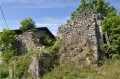
Chaffal: this hamlet was inhabited until 1920 and then briefly during the Second World War.
(8) Pêcher du Haut: take the opportunity here to admire the façades of the old buildings. Do not attempt to enter the buildings, as they are private property and at risk of collapse.
Please note: there is no water along the route, so please plan accordingly.
Please ensure you close the electric gates properly after passing through.
Hiking boots are strongly recommended.

Worth a visit

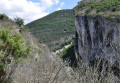
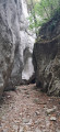
Canyon des Gueulards

Always be cautious and plan ahead when you're outdoors. Visorando and the author of this route cannot be held responsible for any accidents occurring on this route.

The GR® and PR® markings are the intellectual property of the Fédération Française de Randonnée Pédestre.

Reviews and comments

3.8 / 5
Based on 4 reviews

Reliability of the description
4.3 / 5
Ease of following the route
3.3 / 5
Route interest
4 / 5
Michel/Mireille
Michel/Mireille

Overall rating : 3 / 5

Date of your route : May 17, 2024
Reliability of the description : ★★★★☆ Good
Ease of following the route : ★☆☆☆☆ Very disappointing
Route interest : ★★★★☆ Good
Very busy route : No

A lovely walk to start with. When we got to Le Chaffal (point No. 5), we couldn’t find the path leading to point 6 – what a shame!
No signposting to be seen.

Machine-translated

Robert G
Robert G

Overall rating : 4 / 5

Date of your route : Mar 25, 2024
Reliability of the description : ★★★★☆ Good
Ease of following the route : ★★★★☆ Good
Route interest : ★★★★☆ Good
Very busy route : No

A walk best done in fine weather; the initial climb up to Chaffal is a bit of a slog. Once you reach Chaffal, take the path slightly below the main track, marked with green and yellow signs.
The path descends into the valley towards the Gueulards Canyon; it’s very stony.
There are no difficulties – the paths are well marked – and the return route is very wide, offering a view of the ‘Gueulards’.
R G

Machine-translated

marc 26
marc 26

Overall rating : 4 / 5

Date of your route : Oct 11, 2023
Reliability of the description : ★★★★☆ Good
Ease of following the route : ★★★★☆ Good
Route interest : ★★★★☆ Good
Very busy route : Yes

A really lovely walk, with a steep climb followed by a slightly tricky descent. Well worth a go.

Machine-translated

Gizou 26
Gizou 26

Overall rating : 4.3 / 5

Date of your route : Oct 26, 2022
Reliability of the description : ★★★★★ Very good
Ease of following the route : ★★★★☆ Good
Route interest : ★★★★☆ Good
Very busy route : No

Hello
The signposting wasn’t always very clear, but the hike – which is quite a physical challenge – is well worth it

Machine-translated

Other walks in the area

For more walks, use our search engine .

The GPS track and description are the property of this route's author. Please do not copy them without permission.