Circular Vacherie from Léoncel

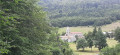
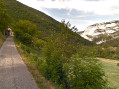
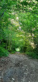
An easy circular walk from Léoncel to La Vacherie. No particular difficulties. The outward leg to La Vacherie, which follows the GR®9, is very pleasant, starting through the woodland. The return leg to Léoncel includes a few sections on the road where you need to be careful.

Details

102276908
Creation:
Last update:
Last review:
  • Walking
    Activity: Walking
  • ↔
    Distance: 5.63 mi
  • ◔
    Average duration: 3h 15 
  • ▲
    Difficulty: Easy

  • ⚐
    Back to start: Yes
  • ↗
    Ascent: + 741 ft
  • ↘
    Descent: - 728 ft

  • ▲
    Highest point: 3,304 ft
  • ▼
    Lowest point: 2,969 ft

Description of the walk

Park in the Léoncel car park, in front of the inn.

(S/E) Walk about 400 m along the road towards the Col de la Bataille. Turn right onto the D190. Cross the small bridge, then pass the Ponts et Chaussée building. Just after this building, look out for the red and white markings of the GR®93 at a place called Bérangeon.

(1) Turn right and head towards “Frachelongue”.

(2) Turn right onto the GR®9 heading towards Les Marais, due south.

(3) At the junction, carry straight on along the GR®9 until you reach a Fork in the road.

(4) Turn left to continue on the GR®9. Ignore a turn-off on the left and head for the hamlet of La Tête Noire.

(5) Leave the GR®9 on your left, turn right towards La Vacherie and join the D70.

(6) Follow this departmental road until you reach a track on the left.

(7) Take this track, which leads to the hamlet of Bourelioux.

(8) In front of the farm, turn right towards the hamlet of Lèma.

(9) At the crossroads, continue to the right towards the D70.

(10) Cross it carefully, then rejoin the GR®9 and the junction you passed on the way out.

(4) Follow it to the left, heading north-east in the opposite direction to the outward journey, until you reach the Marais junction, which you also passed on the outward journey.

(3) Turn left to rejoin the D70 and follow it to the right until you reach an entrance to the forest.

(11) Head up to the left into the forest, join a road and follow it to the right along the GRP® until you reach the D70.

(12) Follow it to the right to return to the car park (S/E).

Waypoints

  1. S/E : mi 0 - alt. 2,995 ft - Léoncel car park - Abbaye de Léoncel
  2. 1 : mi 0.31 - alt. 3,169 ft - Bérangeon - Léoncel (cours d'eau) - Affluent de la Lyonne
  3. 2 : mi 0.49 - alt. 3,255 ft - Frachelongue junction
  4. 3 : mi 1.57 - alt. 3,241 ft - Les Marais junction, A/R
  5. 4 : mi 1.67 - alt. 3,235 ft - Common A/R junction. Tête Noire circular loop
  6. 5 : mi 2.95 - alt. 3,212 ft - Tête Noire
  7. 6 : mi 3.15 - alt. 3,225 ft - Junction with the D70 - Église Saint-Robert (La Vacherie)
  8. 7 : mi 3.37 - alt. 3,232 ft - Junction on the path
  9. 8 : mi 3.56 - alt. 3,255 ft - Bourelioux
  10. 9 : mi 3.8 - alt. 3,225 ft - La Côte
  11. 10 : mi 3.93 - alt. 3,219 ft - Crossing the D70
  12. 11 : mi 4.73 - alt. 3,182 ft - Entrance to the forest
  13. 12 : mi 5.5 - alt. 3,009 ft - D70
  14. S/E : mi 5.63 - alt. 2,995 ft - Léoncel car park - Abbaye de Léoncel

Worth a visit

Always be cautious and plan ahead when you're outdoors. Visorando and the author of this route cannot be held responsible for any accidents occurring on this route.

The GR® and PR® markings are the intellectual property of the Fédération Française de Randonnée Pédestre.

Other walks in the area

For more walks, use our search engine .

The GPS track and description are the property of this route's author. Please do not copy them without permission.