


Refine your search for walks in Mizoën
Mizoën walks


 Lodge de l'Emparis - Refuge des Mouterres
 Visorando Member
 5.55 mi
 +3,717 ft
 -259 ft
 5h 45
 Difficult
 Departure from Mizoën (Isère)
Another magical stage, thanks to the breathtaking scenery all along the balcony trail above Lac du Chambon, including a stop at the ‘petrifying’ spring. Opposite lies a long mountain range and majestic glaciers, with famous names: the Girose Glacier, Pic de la Grave, Le Râteau and the majestic Meije. You will finish this stage at the start of the Emparis plateau at the Refuge des Mouterres, one of the most beautiful camping spots with an exceptional view of the Meije.
Message from the moderators: You are in a sensitive natural area (Natura 2000) which is subject to specific regulations (see practical information).
Emparis Plateau, from the Chambon Dam to La Grave
 14.22 mi
+5,581 ft
-4,124 ft
10 hrs
 Very difficult
Departure from Mont-de-Lans (Isère)
A mountain hike on the Emparis plateau with views of La Meije.This hike can be completed over several days.
Message from the moderators: You are in a Sensitive Natural Area (Natura 2000) which is subject to specific regulations (for more information on this SNA and available accommodation, see the practical information).
Route of the oratories, chapels and hamlets of Besse-en-Oisans
 5.90 mi
+1,959 ft
-1,939 ft
4h 25
 Moderate
Departure from Besse (Isère) (Isère)
A route, which can be done with the family, to discover the oratories built by the Bessats in the 19th century. The route follows a sunny slope and passes through two hamlets with typical houses and the village of Besse, which is worth a visit in its own right.
As a bonus, there are some magnificent panoramic views of the Grandes Rousses and Écrins massifs between La Meije and Le Rochail.
The Cassini Cross
 4.03 mi
+1,804 ft
-1,795 ft
3h 25
Difficult
Departure from Le Freney-d'Oisans (Isère)
Hike on a historic site chosen by César-François Cassini in the18th century to map the Écrins Massif and other surrounding mountains.
Magnificent 360° viewpoint over the Grandes Rousses, Belledonne, Taillefer, Rochail, Muzelle, Mont de Lans Glacier, La Meije, Aiguilles d'Arves and even Mont Blanc in the distance!
And the resorts of Alpe d'Huez on one side and Les Deux Alpes on the other...
An easy climb but a more... "sporting" descent!
Emparis Plateau from Besse-en-Oisans
 10.55 mi
+3,379 ft
-3,376 ft
7h 50
Difficult
Departure from Besse (Isère) (Isère)
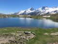
This is a beautiful hike with a wide variety of landscapes ranging from pastures to glaciers that can be admired on the northern slope of the Écrins.
Message from the moderator: You are in a Sensitive Natural Area (Natura 2000) which is subject to specific regulations (see practical information).
From the Col de Cluy to the Croix de Cassini and back via the Grandes Buffes
5.47 mi
+2,205 ft
-2,211 ft
4h 25
Difficult
Departure from Le Freney-d'Oisans (Isère)
This walk takes you to the Croix de Cassini (2,361 m), offering a magnificent 360° view of La Meije, the Aiguilles d’Arves, the Grandes Rousses, Belledonne, Le Taillefer and the Muzelle Glacier. In good weather, you may be able to see Mont Blanc, and blueberries can be picked in season.
From Les Deux Alpes Mont de Lans to Les Deux Alpes Venosc via Clos des Balmettes
 4.37 mi
+902 ft
-719 ft
2h 50
 Easy
Departure from Mont-de-Lans (Isère)
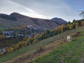
An easy hike to warm up and enjoy a superb view of the Deux Alpes resort. In this sense, the route allows you to benefit from the shade of the forest on the way up, and therefore to arrive in good conditions at Clos des Balmettes, where the descent to the resort will be in the open.
Exploring the Mailloz Hot Springs Trail
 2.77 mi
+886 ft
-863 ft
2h 05
Difficult
Departure from Auris (Isère)
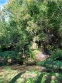
In the past, there were hot springs in the hamlet of Mailloz, which were used by the locals for a very long time. Some records indicate a temperature of 20°C, whilst others suggest as high as 28°C. These springs disappeared when the Chambon dam and the penstocks were built. This path takes you through the Mailloz forest, past various historical remains: the Italians’ hut (built by workers), a penstock, a small dam, an old mill, former bathing areas and the old tufa waterfall. Not to mention, towards the end, a stop at the little lake of Mailloz, an enchanting spot for a picnic or a dip in the water. Do also take a moment to admire the trees in the forest; some appear to be well over a hundred years old.
Circular walk around the Plateau d’Emparis
 11.58 mi
+3,222 ft
-3,222 ft
8h 10
Difficult
Departure from Besse (Isère) (Isère)
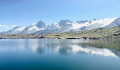
The Emparis Plateau is a famous vantage point overlooking La Meije and the surrounding mountain ranges, particularly from its Lacs Noir and Lérié. This double circular route follows the classic route around these lakes but extends the circular route to include a less-frequented return route, which prolongs the day’s views.
Waterfall loop starting from the Col de Sarenne
 6.18 mi
+1,972 ft
-1,985 ft
4h 35
Moderate
Departure from Clavans-en-Haut-Oisans (Isère)
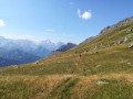
A superb loop that is fairly accessible, even if the first kilometre is on a slightly steep path. You will cross multiple waterfalls, streams and torrents, all with breathtaking views of the Emparis plateau and all the surrounding mountains.
The Auris Chapel Route
6.64 mi
+1,493 ft
-1,512 ft
4h 20
Moderate
Departure from Auris (Isère)
This route offers magnificent views of the Écrins Massif and La Meije, as well as the Bourg-d’Oisans valley. There are four chapels along the route: those in the hamlets of Les Cours and Cluy, the Saint-Géraud Chapel and the chapel in the hamlet of Les Certs.
This is an easy walk with several picnic spots along the way.
There are several alternative routes available, allowing you to extend the route. You can start from the resort.
Circular of the grand tour of Signal de l'Homme and view of five mountain ranges.
 8.34 mi
+1,509 ft
-1,509 ft
5h 10
Moderate
Departure from Auris (Isère)
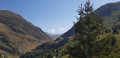
This easy circular offers superb 360° views of five mountain ranges during the journeyOisans with a view of La MeijeThe Aiguilles d'Arves, symbol of the MaurienneThe Grandes Rousses mountain rangeThe Belledonne rangeThe Taillefer massifnot forgetting the Emparis plateau.
Refuge des Mouterres - La Grave
 9.47 mi
+1,440 ft
-3,957 ft
5h 35
Difficult
Departure from Mizoën (Isère)
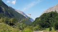
Stage7 of this route. One of the most beautiful stages of this tour of the Écrins National Park. After making the most of the welcome at the Refuge des Mouterres and a campsite with an extraordinary view, you will discover the unspoilt nature of the Emparis Plateau, a Natura 2000 site with abundant mountain flora.
You will leave theGR® 54C for a detour across the Emparis Plateau and its three lakes, Cristallin, Noir and Lérié, before descending to La Grave.
Message from the moderators: You are in a sensitive natural area (Natura 2000) which is subject to specific regulations (see practical information).
Lac des Quirlies and Râteau des Rousses via the Échine de Praouat
 13.73 mi
+4,928 ft
-4,934 ft
10 hrs
Very difficult
Departure from Clavans-en-Haut-Oisans (Isère)
A stunning circular route around one of the most beautiful valleys in the Alps, the Ferrand Valley, leading to the Râteau des Rousses and the turquoise Lac des Malatres.
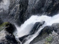
The route follows the Ferrand stream as far as the waterfalls, then bypasses the main path leading to Lac des Quirlies, before climbing to the impressive Pic du Râteau des Rousses — the only technical challenge — and returns to the valley via magnificent lakes, glaciers and meadows dotted with rounded boulders.
Solitude and wonder guaranteed!
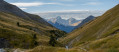
The Vallon du Ferrand and Lac des Quirlies from the Sarenne road
 9.85 mi
+3,077 ft
-3,084 ft
7h 15
Difficult
Departure from Clavans-en-Haut-Oisans (Isère)
Lac des Quirlies (2,566 m) and its eponymous glacier are situated on the eastern slope of the Grandes Rousses massif, right at the far end of the Ferrand Valley.
This is a truly beautiful hike that passes through a lush, peaceful valley before reaching a much more rugged landscape around this glacial lake, surrounded by high peaks.
Magnificent panoramic views of the Arves and Écrins massifs and, in the distance, the Vanoise. No technical difficulty apart from the length and elevation gain.
More walks in Mizoën
Select a point of interest below: