Refine your search for walks in Marignac (Haute-Garonne)
Marignac (Haute-Garonne) walks
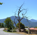
 The Val de Burat and the Marignac Beech Tree

An easy hike through beech forests, including the winner of the 2014 "Remarkable Trees" competition, and along forest roads. View of Pic de Burat on the way up and Pic du Gar on the way down. Picnic possible at the Contraire hut halfway along the route.
 Pic du Gar and Pic Saillant via the Col de Teyech and then the Col de Caube
Magnificent ascent of the Pic du Gar via the Col de Teyech. Superb views of the surrounding valleys. A challenging hike with a lot of elevation gain but no technical difficulty.
 Élodie's loop starting from Burgalays

This pretty loop was the mountain biking training ground of our local champion Élodie, French junior champion in 2001 and 2002. On foot, you will have time to enjoy this route, which will take you to viewpoints overlooking the valley, where you may be lucky enough to spot numerous deer in this area.
 Pic du Gar and Pic de Cagire via the ridges

This looping route around the Pic du Gar and Pic de Cagire from the small village of Bezins takes you right up close to the impressive limestone cliffs and gives the Pic du Gar, which is less than 2,000 m high, an air of grandeur. Crossing the beech forest provides a shady route, with beautiful views over the valley. Access to the Pic de Cagire via the north-facing slope offers views over the plain and, in fine weather, spectacular views of the Pyrenees from the summit. This view can still be enjoyed along the ridge route.This hike can be done over two days, with an overnight stay in a hut or bivouac.Gpx trail recommended.
 Summit of Oudérou from Binos

A very pretty early winter circuit to be done on foot or snowshoes depending on the snow conditions. Its good south-eastern exposure allows you to walk in the sun, which is appreciated in cold weather.
A very picturesque hike through the village, beautiful beech forests and the sumptuous panorama from the summit.
 Short circular at Mail de la Pique

This magnificent walk above Baren allows you to discover the mountain pastures, deciduous forests and a spectacular panorama of the legendary 3,000-metre peaks of the Central Pyrenees: Anéto, Maladeta, Maupas, Crabioules, Perdiguère, Posets, Quayrat, Lézat, Gougs Blancs, Spijeoles, Schrader...
The Cabane de la Plagnette and its surroundings, a "true paradise for hikers", provide a pleasant approach for climbing Burat and the border peaks.
 Tour of Mayroue via Sabachouau
Siradan, Salechan, Thèbe. A short walk in the forest, in the shade if it's sunny and sheltered if it rains.
 The Chemin des Palombières at Saint-Pé-d'Ardet

This hike, which has no major difficulties, will be great fun to do in autumn in the midst of an explosion of colour. You'll discover superb beech forests, impressive pidgeon hunting huts, a beautiful view of the Pic du Cagire, the Garonne valley and the first Pyrenean peaks dominating the Barousse.
 Pic de Cagire from the Col de Menté

This hike allows you to reach the Pic de Cagire in a morning, offering a 360° view between the plain and the highest peaks of the Pyrenees.
07/01/2024: Hiking prohibited to the public from 1 January 2025 to 31 March 2025 by municipal decree (from Pic de L'Escalette towards Pas de l'Âne via the ridges located in the commune of Boutx).
This hike is strongly discouraged in winter due to its dangerous nature, particularly between the summit of Les Parets and Col du Pas de l'Âne! See practical information.
 The Larreix hut

Starting from the Col de Menté, this easy hike takes you on a circular route at the foot of the Cagire and very close to the Col du Pas de l'Âne.
 Pic de l'Escalette and Cabane de Larreix from the Col de Menté

A very pleasant circular with autumn colours. Only to be attempted in good weather. Splendid 360° view from the Pic d'Escalette over the surrounding peaks.
Feasible in winter with good snow conditions but classified as difficult with frozen ground.
 Pic de l'Escalette from the Col de Menté

A beautiful hike that is accessible to families as it is fairly short. It offers magnificent views of the Pyrenees and ends in a rather rocky environment.
The views are quite dizzying for a hike of this length, but you do get to reach a peak!
 Le Mourtis - Tuc de Pan loop

A beautiful hike with no major difficulties, most of which takes place under the trees. At the summit of Tuc de Pan (1,724 m), you will discover an exceptional panorama of the Garonne valley as it enters France, as well as the Maladeta Massif, among other sights.
 Circuit des Deux Ourses

A short, mostly shaded hike starting from the beautiful village of Mauléon-Barousse. The path is marked from start to finish (yellow markings). You can go to the Gouffre de la Saoule and admire the waterfalls.
 Loop via the Saunères hut from Artigue

This easy hike will allow you to discover Artigue, a charming village in the Luchonnais region, beautiful forests and a superb panorama of Bagnères-de-Luchon surrounded by its 3000m peaks, all on very different paths and trails.
 Tour of the barns and huts of Artigue
Tour of the barns and huts of Artigue, making a large circular loop through the summer pastures via the PR® and GR®10 trails. Pass through Plan de Montmajou and the border markers to Col des Taons de Bacanère. The return journey takes you past two huts and the Cigalère State Forest. A very pleasant hike in the gentle autumn sunshine with beautiful views of the peaks and 3,000-metre summits of the Luchonnais, sometimes whitened by the first snows.
 Camin des Costes in Antichan
The commune of Antichan has a mountain climate and is drained by various small streams. It has a remarkable natural heritage comprising two natural areas of ecological, faunistic and floristic interest and several built heritage sites.
 Tourroc from Sacoué

A pleasant hike from the village of Sacoué, through the Bois du Mont Sacon (or Saqueton). Cool in summer and sheltered in winter, the entire route is through the forest. At the summit, a sheltered orientation table has been built on an ancient sanctuary consisting of the remains of votive altars from the Gallo-Roman period, possibly dedicated to Jupiter, and currently preserved at the Saint-Raymond Museum in Toulouse. Breathtaking view all the way to Aneto.
 Espiau Mountain via the cromlechs and the Croix de Garin

A very pleasant and easy hike, allowing you to stroll between the Oueil Valley and the Col de Peyresourde. Halfway along the route, you will discover rows of cromlechs with views of the Pyrenean peaks between Aneto and Quayrat. The Croix de Garin offers a clear view of the Agudes and the climb up to the pass.
More walks in Marignac (Haute-Garonne)
Select a point of interest below:
