


Refine your search for walks in Lierneux
Lierneux walks


 Ardennes walk around Odrimont
 Visorando Member
 9.90 mi
 +1,037 ft
 -1,040 ft
 5h 25
5h 25
 Moderate
 Departure from Lierneux (Province de Liège)
Offering stunning panoramic views in a rolling landscape alternating between open countryside and woodland, mostly on hilltops, this walk takes you to explore the Prés de la Lienne Nature Reserve, Belgium’s first forest wind farm, the village of Arbrefontaine, its chapel and 18th-century wayside cross, as well as the site of the former Odrimont mill.
Trois-Ponts, south side
 11.90 mi
+1,404 ft
-1,424 ft
6h 40
11.90 mi
+1,404 ft
-1,424 ft
6h 40
 Difficult
Departure from Trois-Ponts (Province de Liège)
Difficult
Departure from Trois-Ponts (Province de Liège)
This lovely circular route to the south of Trois-Ponts offers a pleasant way to explore the region, with just the right amount of hills for the scenery without being too taxing on the calves. It’s a curious region where a hamlet called Fosse is definitely situated high up!The section after the Hêtre du Berger is particularly attractive and interesting in spring (broom, orchids, etc.).Then, before Bergeval, the route once again offers a beautiful panoramic stretch over the region before heading towards the Croix des Hottlîs and descending towards the Sanctuaire de la Vierge des Pauvres.One last short climb and it’s the descent towards Trois-Ponts, where the route follows the pretty Bâleur stream and its pond before returning to the starting point.
Route through the woods to Rencheux
8.42 mi
+1,033 ft
-1,037 ft
4h 45
Moderate
Departure from Vielsalm (Province de Luxembourg)
A lovely walk around Rencheux, suitable for families, not accessible to people with reduced mobility. Can be done in all seasons. Wear good walking shoes. Pets are allowed but must be kept on a lead. Mainly forest paths.
Around the Fraiture hut
3.54 mi
+449 ft
-440 ft
2h 00
 Easy
Departure from Vielsalm (Province de Luxembourg)
Easy
Departure from Vielsalm (Province de Luxembourg)
This family walk is easy, wooded and pleasant, offering a guaranteed change of scenery.
Follow the yellow and white markers.
Vielsalm - Gouvy
 10.65 mi
+1,572 ft
-1,237 ft
6h 15
Moderate
Departure from Vielsalm (Province de Luxembourg)
10.65 mi
+1,572 ft
-1,237 ft
6h 15
Moderate
Departure from Vielsalm (Province de Luxembourg)
La Salm Valley, known as Le Glain
This stage ofthe GRP®571starts in Vielsalm in the Pays des Macralles, crosses the river at Salmchâteau and enters the Deux Ourthes Nature Park, heading towards the Ardennes plateau and Gouvy.
From Vielsalm station to Trois-Ponts station
11.33 mi
+1,440 ft
-1,765 ft
6h 30
Difficult
Departure from Vielsalm (Province de Luxembourg)
This Ardennes walk stretches across the heights of the left bank of the Salm. Set mainly in woodland, it offers magnificent views of the region. Relatively far from road traffic, it is a walk that rejuvenates body and mind through its tranquillity and the fresh air that is ever-present. The charming village of Goronne, the tranquillity of the Domaine de Farnières and the hamlet of Bergeval are much-loved stops along the way.
Towards Farnières Castle
 7.76 mi
+948 ft
-951 ft
4h 25
Moderate
Departure from Vielsalm (Province de Luxembourg)
7.76 mi
+948 ft
-951 ft
4h 25
Moderate
Departure from Vielsalm (Province de Luxembourg)
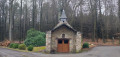
Wide forest paths and country roads take you to Farnières Castle and its chapel. Return via wide forest paths and finish along Vielsalm Lake.
Trois-Ponts - Vielsalm
 12.67 mi
+1,788 ft
-1,444 ft
7h 25
Difficult
Departure from Trois-Ponts (Province de Liège)
12.67 mi
+1,788 ft
-1,444 ft
7h 25
Difficult
Departure from Trois-Ponts (Province de Liège)
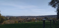
La Salm Valley, whose real name is Le Glain
This stage ofthe GRP®571leaves the Amblève Valley and heads up the slopes of the La Salm Valley, known as Le Glain. The route changes banks several times until it reaches Vielsalm in the Pays des Macralles.
Over hill and dale around Trois-Ponts
10.97 mi
+1,683 ft
-1,703 ft
6h 30
Difficult
Departure from Trois-Ponts (Province de Liège)
The surroundings of Trois-Ponts and Coo are mainly forested, with paths and trails running through coniferous and deciduous trees. The rugged terrain highlights the panoramic views of the Ardennes and promises a sometimes very challenging route. In the heart of nature, the route connects with the site of Coo and its lower lake before returning to Trois-Ponts, again mainly through the woods.
Grand-Bois to Vielsalm: the treasures of the Salm region
 Tourism professional
 5.99 mi
+604 ft
-597 ft
3h 15
Difficult
Departure from Vielsalm (Province de Luxembourg)
5.99 mi
+604 ft
-597 ft
3h 15
Difficult
Departure from Vielsalm (Province de Luxembourg)
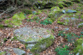
This walk takes you on a journey of discovery through the arkose and schist quarries of the Pays de Salm, the gold prospectors of La Rougerie, the Celts and their fortified settlement at the Celtic Camp, and the Quatre-Vents nature reserves.
Around Rahier
 9.59 mi
+1,096 ft
-1,096 ft
5h 20
Moderate
Departure from Stoumont (Province de Liège)
9.59 mi
+1,096 ft
-1,096 ft
5h 20
Moderate
Departure from Stoumont (Province de Liège)
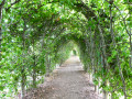
Starting from the Moulin de Rahier, the walk alternates between deciduous and coniferous forests and delightfully rolling countryside, with the scenery changing almost at every bend.Whilst the Rouge Thier or Rofthier hill is suffering increasingly from the summer drought, the view from this highest point on the route is 360°. Anyone familiar with the region will spot in the distance the dams of the upper reservoirs of the Coo hydroelectric power station, right next to the summit of Mont Saint-Victor.After passing through the Rahier arbour, the route heads towards the village of Cheneux, from where you can see Froidcourt Castle in the distance (private, not open to visitors), crosses the road and enters the forest for a good while.A collection of wooden beaver figurines adorns the route shortly before you emerge from the woods.A final short detour through the countryside around the hamlet of Froidville, and then it’s a descent back to the starting point of the circular route.
From Bêche to Bêche
6.07 mi
+915 ft
-761 ft
3h 35
Easy
Departure from Vielsalm (Province de Luxembourg)
Discover the landscapes and history of the people who shaped the Salm region. A lovely walk with very little road, mainly forest paths. Beautiful views at Bec du Corbeau, where history and nature come together on this walk.
Walk from La Vecquée to Stoumont
5.05 mi
+771 ft
-771 ft
3h 00
Moderate
Departure from Stoumont (Province de Liège)
Following the blue markings, starting from the church square, this route will take you to the highest point in the municipality of Stoumont. You will start with a climb, crossing the pretty hamlets of Roua and Monthouet. Along the way, you will discover the Croix Honnay, which is said to have been planted long ago by a traveller lost in the snow, and the Pyramide, a geodetic marker which, according to legend, was an observation post for Caesar's army. La Vecquée then opens up before you. This large, wide firebreak at the top of the slope is the ancient Roman road that the prince-bishops used in the Middle Ages to travel from Liège to Stavelot Abbey. A historic border between states, it still marks the boundary between Theux and Stoumont today. To descend, you will walk along the Pansîres nature reserve, cross woods and pastures, and come across the Cheval de pierre, a block of quartzite that looks like a lying horse.
Stoumont - Trois-Ponts
 12.22 mi
+2,034 ft
-2,290 ft
7h 25
Difficult
Departure from Stoumont (Province de Liège)
12.22 mi
+2,034 ft
-2,290 ft
7h 25
Difficult
Departure from Stoumont (Province de Liège)
Amblève Valley
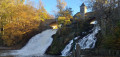
This stage ofthe GRP® 571 starts in Stoumont, passes in front of Froidcourt Castle and crosses the Amblève in Cheneux. The route then descends towards the Coo waterfall, crosses the river again and reaches Trois-Ponts via the Belvédère de Ster.
Circular loop at the source of the Aisne
 10.00 mi
+715 ft
-715 ft
5h 15
Moderate
Departure from Manhay (Province de Luxembourg)
10.00 mi
+715 ft
-715 ft
5h 15
Moderate
Departure from Manhay (Province de Luxembourg)
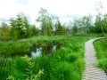
The Tailles plateau rises to an altitude of around 650 metres, where fagnes, fanges, pools and peat bogs are home to the sources of many of the Ourthe’s tributaries. Two of the best-known streams are the Henri Moulin, which flows southwards and joins the Eastern Ourthe just before the Nisramont dam, and the Aisne, which flows northwards and joins the Ourthe at Bomal.This walk explores the northern part of the Plateau des Tailles and the wetlands where the Aisne has its source. The boardwalks installed in recent years at the bottom of the Fagne de Pouhon will save you from the wet feet that were a certainty in previous years! While you’re unlikely to spot any beavers, a bit of careful observation is all it takes to discover their handiwork.