


It is worth noting that Rahier has long been known for its fine collection of schist stones ‘engraved’ with poems, maxims, aphorisms or legends; the trail allows you to discover a small selection of these, but the text is not always easy to decipher, as the paint has faded over time and due to the elements.
Around Rahier


Starting from the Moulin de Rahier, the walk alternates between deciduous and coniferous forests and delightfully rolling countryside, with the scenery changing almost at every bend.
Whilst the Rouge Thier or Rofthier hill is suffering increasingly from the summer drought, the view from this highest point on the route is 360°. Anyone familiar with the region will spot in the distance the dams of the upper reservoirs of the Coo hydroelectric power station, right next to the summit of Mont Saint-Victor.
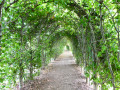
After passing through the Rahier arbour, the route heads towards the village of Cheneux, from where you can see Froidcourt Castle in the distance (private, not open to visitors), crosses the road and enters the forest for a good while.
A collection of wooden beaver figurines adorns the route shortly before you emerge from the woods.
A final short detour through the countryside around the hamlet of Froidville, and then it’s a descent back to the starting point of the circular route.
Details
Creation:
Last update:
Last review:
–
–
-
 Activity: Walking
 -
 Distance: 9.59 mi
 -
 Average duration: 5h 20
 -
 Difficulty: Moderate
 -
-
 Back to start: Yes
 -
 Ascent: + 1,096 ft
 -
 Descent: - 1,096 ft
 -
-
 Highest point: 1,312 ft
 -
 Lowest point: 745 ft
-
 Country:
Belgium
Country:
Belgium
-
 Area: Massif des Ardennes
 -
 City:
Stoumont
City:
Stoumont -
 Start/End: N 50.3882° / E 5.758863°
 -


 Hour-by-hour weather
Photos
Description of the walk
Waypoints
- S/E : mi 0 - alt. 745 ft - Rahier Mill
- 1 : mi 0.85 - alt. 1,099 ft - Meuville
- 2 : mi 1.57 - alt. 1,306 ft - Rouge Thier or Rofthier – panoramic tower
- 3 : mi 2.4 - alt. 1,175 ft - Rahier’s arbour
- 4 : mi 3.3 - alt. 961 ft - Rahier
- 5 : mi 3.81 - alt. 873 ft - Laid Ru – footbridge
- 6 : mi 4.4 - alt. 958 ft - Distant view of Froidcourt Castle
- 7 : mi 5.25 - alt. 1,070 ft - Le Fa
- 8 : mi 6.58 - alt. 1,198 ft - A line of beavers
- 9 : mi 8.25 - alt. 958 ft - Fork in the road
- 10 : mi 8.97 - alt. 1,024 ft - The hamlet of Froidville
- S/E : mi 9.59 - alt. 745 ft - Rahier Mill
Notes
Whilst the northern section (Rofthier and a little further on towards the arbour) has a few benches, there are none further on.
Worth a visit
Completely off the trail: the Coo waterfall
Other walks in the area
Route from La Vecquée to Stoumont
 Visorando Member5.69 mi
+912 ft
-928 ft
3h 25
Visorando Member5.69 mi
+912 ft
-928 ft
3h 25
 Easy
Easy
 Departure from Stoumont (Province de Liège)
Would you like to take a beautiful walk in the snow, far from the tourist trails that are overrun as soon as the first snowflakes fall? Then the Vecquée walk is the ideal hike for you. Near Stoumont, at an altitude of 500 metres, snow falls abundantly in this region of the province of Liège. A stone's throw from the Hautes Fagnes, less crowded yet just as beautiful, the Vecquée walk offers an idyllic setting for a winter stroll.
Walk from La Vecquée to Stoumont
5.05 mi
+771 ft
-771 ft
3h 00
Moderate
Departure from Stoumont (Province de Liège)
Following the blue markings, starting from the church square, this route will take you to the highest point in the municipality of Stoumont. You will start with a climb, crossing the pretty hamlets of Roua and Monthouet. Along the way, you will discover the Croix Honnay, which is said to have been planted long ago by a traveller lost in the snow, and the Pyramide, a geodetic marker which, according to legend, was an observation post for Caesar's army. La Vecquée then opens up before you. This large, wide firebreak at the top of the slope is the ancient Roman road that the prince-bishops used in the Middle Ages to travel from Liège to Stavelot Abbey. A historic border between states, it still marks the boundary between Theux and Stoumont today. To descend, you will walk along the Pansîres nature reserve, cross woods and pastures, and come across the Cheval de pierre, a block of quartzite that looks like a lying horse.
Stoumont - Trois-Ponts
 12.22 mi
+2,034 ft
-2,290 ft
7h 25
12.22 mi
+2,034 ft
-2,290 ft
7h 25
 Difficult
Departure from Stoumont (Province de Liège)
Difficult
Departure from Stoumont (Province de Liège)
Amblève Valley
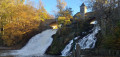
This stage ofthe GRP® 571 starts in Stoumont, passes in front of Froidcourt Castle and crosses the Amblève in Cheneux. The route then descends towards the Coo waterfall, crosses the river again and reaches Trois-Ponts via the Belvédère de Ster.
The Roannay Valley – right bank
 11.72 mi
+1,539 ft
-1,545 ft
6h 45
Difficult
Departure from Stoumont (Province de Liège)
11.72 mi
+1,539 ft
-1,545 ft
6h 45
Difficult
Departure from Stoumont (Province de Liège)
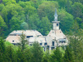
This walking route explores a large part of the area between the Roannay stream and the Vecquée ridge (Fagne de Malchamps), on the northern slope of the Roannay valleyIt quickly leaves La Gleize to skirt the former Borgoumont sanatorium, continues towards the hamlets of Cour and Andrimont, and turns back upon reaching Chevrouheid.The route rarely enters the woods at all. Very often it simply runs alongside them, offering numerous magnificent panoramic views of this wonderfully undulating region.Switching between paths and tracks, and always halfway up the hillside, it leads to a stone’s throw from the Amblève. One last climb and you arrive at the famous Tiger tank site and the ‘December 44’ museum on the small church square.A huge thank you to our friend Paolo who put together this lovely route for us.
From Ernonheid to La Rouge-Minière via Le Paradis
 10.81 mi
+1,201 ft
-1,211 ft
6h 00
Moderate
Departure from Aywaille (Province de Liège)
10.81 mi
+1,201 ft
-1,211 ft
6h 00
Moderate
Departure from Aywaille (Province de Liège)
Starting from the old school in Ernonheid (Al Vîle Sicole), the hike explores forests (mainly) and countryside between the villages of Ernonheid and La Rouge-Minière, passing not only near the hamlet of Paradis, but also Sainte-Anne Chapel, Brasserie Misery and Grimonster Castle.
The Grand Trixhe loop
7.05 mi
+367 ft
-364 ft
3h 35
Moderate
Departure from Ferrières (Belgique) (Province de Liège)
A family walk through the former commune of Werbomont.
Trois-Ponts, south side
 11.90 mi
+1,404 ft
-1,424 ft
6h 40
Difficult
Departure from Trois-Ponts (Province de Liège)
11.90 mi
+1,404 ft
-1,424 ft
6h 40
Difficult
Departure from Trois-Ponts (Province de Liège)
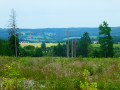
This lovely circular route to the south of Trois-Ponts offers a pleasant way to explore the region, with just the right amount of hills for the scenery without being too taxing on the calves. It’s a curious region where a hamlet called Fosse is definitely situated high up!The section after the Hêtre du Berger is particularly attractive and interesting in spring (broom, orchids, etc.).Then, before Bergeval, the route once again offers a beautiful panoramic stretch over the region before heading towards the Croix des Hottlîs and descending towards the Sanctuaire de la Vierge des Pauvres.One last short climb and it’s the descent towards Trois-Ponts, where the route follows the pretty Bâleur stream and its pond before returning to the starting point.
Burnontige and Les Arsins
 9.29 mi
+1,050 ft
-1,076 ft
5h 10
Moderate
Departure from Ferrières (Belgique) (Province de Liège)
9.29 mi
+1,050 ft
-1,076 ft
5h 10
Moderate
Departure from Ferrières (Belgique) (Province de Liège)
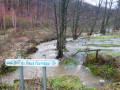
This long circular walk, centred on the theme of the old local road, winds through the woods and countryside around Burnontige. In winter,the paths are waterlogged; others are very slippery where a thin layer of ice remains, and streams swollen with rushing water overflow onto the paths and tracks in many places. The thaw can be sudden.
For more walks, use our search engine .
The GPS track and description are the property of this route's author. Please do not copy them without permission.

