Goronne – Grand Sart (Vielsalm – Lierneux)

The route takes you through the very pretty countryside, with several farms built from local stone. The view stretches quite far. There are also some lovely woods. You can enjoy almost complete tranquillity for most of the walk and, in many places, take in a magnificent rural landscape of meadows.

The region has an industrial past, dating back to the 16th century with the quarrying of schist, slate and, above all, coticule – a stone with exceptional abrasive properties.

Details

n°22176552
Creation:
Last update:
Last review:
  • Walking
    Activity: Walking
  • ↔
    Distance: 6.22 mi
  • ◔
    Average duration: 3h 25 
  • ▲
    Difficulty: Moderate

  • ⚐
    Back to start: Yes
  • ↗
    Ascent: + 600 ft
  • ↘
    Descent: - 594 ft

  • ▲
    Highest point: 1,752 ft
  • ▼
    Lowest point: 1,358 ft

Photos

Description of the walk

The route starts at number 217 in Goronne; there is a large car park in front of a hall called L’Entente Goronaise.

(S/E) Follow the road southwards, cross the N822 straight ahead, with the church on your right, and continue to a T-junction.

(1) Follow the road to the left. When it splits into a Y-junction at a small square with a sort of monument, follow the road to the left. After 200 metres, leave the road and follow the wide path to the right through the meadows. When you reach the edge of the woodland, take the path on the left for about a hundred metres.

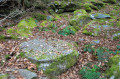
(2) Turn right onto the path leading uphill into the woods to reach a clearing where there is a stone describing the legend of Faustine (born in 1666). Immediately after this clearing, follow the narrow path on the right which leads uphill into the woods.

(3) When you reach a wider path (Vielsalm Jaune), continue climbing to the right, go straight on at the nearby junction and begin the descent, keeping to the right towards the small hamlet of La Comté.

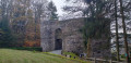
(4) Take the road on the right and continue straight on, keeping to the right, for 1.5 km until you reach the US Memorial (December 1944) at Grand-Sart, which has a picnic area.

(5) To the left of the monument, leave the road and turn right onto the track that runs alongside the woodland and descends through the meadows to the N822. Cross the road and continue towards Le Chenay.

(6) Turn right onto the road and carry on straight ahead into the woods until you reach a junction of three paths.

(7) Take the narrow middle path, heading east, which leads through the woods and then across the meadows back to Goronne (S/E).

Waypoints

  1. S/E : mi 0 - alt. 1,365 ft - L’Entente Goronaise car park
  2. 1 : mi 0.22 - alt. 1,368 ft - T-junction
  3. 2 : mi 1.16 - alt. 1,490 ft - Path leading uphill through the woods
  4. 3 : mi 1.53 - alt. 1,726 ft - Marked path
  5. 4 : mi 2.08 - alt. 1,440 ft - Comté cheese
  6. 5 : mi 3.49 - alt. 1,558 ft - US Memorial (December 1944) at Gran Sart
  7. 6 : mi 4.71 - alt. 1,440 ft - Le Chenay
  8. 7 : mi 5.36 - alt. 1,499 ft - Forest track towards Goronne
  9. S/E : mi 6.22 - alt. 1,368 ft - L’Entente Goronaise car park

Worth a visit

Farm-raised meat:
Beef, pork, chicken, lamb, cured meats, etc., sourced from local, sustainable farming on family-run farms, with a commitment to animal welfare.

Reviews and comments

5 / 5
Based on 1 review

Reliability of the description
5 / 5
Ease of following the route
5 / 5
Route interest
5 / 5
Cousbifou
Cousbifou

Thanks for the hiking suggestion. Very little tarmac, it seems? Great!

Machine-translated

michel docquier
michel docquier

Overall rating : 5 / 5

Date of your route : May 22, 2023
Reliability of the description : ★★★★★ Very good
Ease of following the route : ★★★★★ Very good
Route interest : ★★★★★ Very good
Very busy route : No

Magnificent route with unobstructed views

Machine-translated

Other walks in the area

For more walks, use our search engine .

The GPS track and description are the property of this route's author. Please do not copy them without permission.