


Picnic tables at (S/E), (1), (5) and off the route if you continue straight on at (7) under the high-voltage power line.
A few benches in the second half of the route, notably at (9), after the fork (10) and at (12)
Ardennes walk around Odrimont


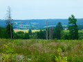
Offering stunning panoramic views in a rolling landscape alternating between open countryside and woodland, mostly on hilltops, this walk takes you to explore the Prés de la Lienne Nature Reserve, Belgium’s first forest wind farm, the village of Arbrefontaine, its chapel and 18th-century wayside cross, as well as the site of the former Odrimont mill.
Details
Creation:
Last update:
Last review:
–
–
-
 Activity: Walking
 -
 Distance: 9.90 mi
 -
 Average duration: 5h 25
 -
 Difficulty: Moderate
 -
-
 Back to start: Yes
 -
 Ascent: + 1,037 ft
 -
 Descent: - 1,040 ft
 -
-
 Highest point: 1,778 ft
 -
 Lowest point: 1,096 ft
-
 Country:
Belgium
Country:
Belgium
-
 Area: Massif des Ardennes
 -
 City:
Lierneux
City:
Lierneux -
 Start/End: N 50.307264° / E 5.775598°
 -


 Hour-by-hour weather
Photos
Waypoints
- S/E : mi 0 - alt. 1,115 ft - S/E ‘Promenade des Prés de la Lienne’ walk
- 1 : mi 0.33 - alt. 1,102 ft - Flat-stone bridge - Lienne (rivière) - Belgique) - Affluent de l'Amblève
- 2 : mi 0.48 - alt. 1,109 ft - Prés de la Lienne Nature Reserve – north
- 3 : mi 1.19 - alt. 1,158 ft - Hierlot
- 4 : mi 1.94 - alt. 1,404 ft - Batteye viewpoint
- 5 : mi 2.8 - alt. 1,509 ft - Picnic shelter
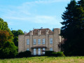
- 6 : mi 3.39 - alt. 1,414 ft - Amcômont Castle – rear view
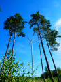
- 7 : mi 4.18 - alt. 1,663 ft - High-voltage power line + Belgium’s first forest wind farm
- 8 : mi 5.17 - alt. 1,775 ft - The Shepherd’s Beech
- 9 : mi 6.45 - alt. 1,411 ft - Arbrefontaine Chapel and Calvary (18th century)
- 10 : mi 7.59 - alt. 1,348 ft - Junction
- 11 : mi 8.37 - alt. 1,168 ft - Odrimont Mill
- 12 : mi 8.41 - alt. 1,165 ft - Flat-stone bridge - Lienne (rivière) - Belgique) - Affluent de l'Amblève
- 13 : mi 9.42 - alt. 1,122 ft - Les Prés de la Lienne Nature Reserve – south
- S/E : mi 9.9 - alt. 1,115 ft - S/E ‘Promenade des Prés de la Lienne’ walk
Notes
Other walks in the area
Around the Fraiture hut
 Visorando Member3.54 mi
+449 ft
-440 ft
2h 00
Visorando Member3.54 mi
+449 ft
-440 ft
2h 00
 Easy
Easy
 Departure from Vielsalm (Province de Luxembourg)
This family walk is easy, wooded and pleasant, offering a guaranteed change of scenery.
Follow the yellow and white markers.
Trois-Ponts, south side
 11.90 mi
+1,404 ft
-1,424 ft
6h 40
11.90 mi
+1,404 ft
-1,424 ft
6h 40
 Difficult
Departure from Trois-Ponts (Province de Liège)
Difficult
Departure from Trois-Ponts (Province de Liège)
This lovely circular route to the south of Trois-Ponts offers a pleasant way to explore the region, with just the right amount of hills for the scenery without being too taxing on the calves. It’s a curious region where a hamlet called Fosse is definitely situated high up!The section after the Hêtre du Berger is particularly attractive and interesting in spring (broom, orchids, etc.).Then, before Bergeval, the route once again offers a beautiful panoramic stretch over the region before heading towards the Croix des Hottlîs and descending towards the Sanctuaire de la Vierge des Pauvres.One last short climb and it’s the descent towards Trois-Ponts, where the route follows the pretty Bâleur stream and its pond before returning to the starting point.
Around Rahier
 9.59 mi
+1,096 ft
-1,096 ft
5h 20
Moderate
Departure from Stoumont (Province de Liège)
9.59 mi
+1,096 ft
-1,096 ft
5h 20
Moderate
Departure from Stoumont (Province de Liège)
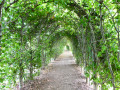
Starting from the Moulin de Rahier, the walk alternates between deciduous and coniferous forests and delightfully rolling countryside, with the scenery changing almost at every bend.Whilst the Rouge Thier or Rofthier hill is suffering increasingly from the summer drought, the view from this highest point on the route is 360°. Anyone familiar with the region will spot in the distance the dams of the upper reservoirs of the Coo hydroelectric power station, right next to the summit of Mont Saint-Victor.After passing through the Rahier arbour, the route heads towards the village of Cheneux, from where you can see Froidcourt Castle in the distance (private, not open to visitors), crosses the road and enters the forest for a good while.A collection of wooden beaver figurines adorns the route shortly before you emerge from the woods.A final short detour through the countryside around the hamlet of Froidville, and then it’s a descent back to the starting point of the circular route.
Between beavers and an old local track in Manhay
 12.02 mi
+1,404 ft
-1,404 ft
6h 45
Moderate
Departure from Manhay (Province de Luxembourg)
12.02 mi
+1,404 ft
-1,404 ft
6h 45
Moderate
Departure from Manhay (Province de Luxembourg)
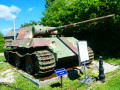
This outing in the northern part of the Plateau des Tailles stretches between the Fagnes de la Goutte and Pouhon (sources of the Aisne) and Grandménil (with its German Panzer and its 1944 museum). Mostly through woodland, the route follows fairly easy paths and tracks. Make sure you wear suitable footwear, especially after a spell of rain, as there are two fords that can sometimes be tricky to cross, one over the Aisne and the other over the stream in the Fagne de la Goutte, which is home to beavers.
Route through the woods to Rencheux
8.42 mi
+1,033 ft
-1,037 ft
4h 45
Moderate
Departure from Vielsalm (Province de Luxembourg)
A lovely walk around Rencheux, suitable for families, not accessible to people with reduced mobility. Can be done in all seasons. Wear good walking shoes. Pets are allowed but must be kept on a lead. Mainly forest paths.
Trois-Ponts - Vielsalm
 12.67 mi
+1,788 ft
-1,444 ft
7h 25
Difficult
Departure from Trois-Ponts (Province de Liège)
12.67 mi
+1,788 ft
-1,444 ft
7h 25
Difficult
Departure from Trois-Ponts (Province de Liège)
La Salm Valley, whose real name is Le Glain
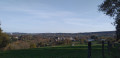
This stage ofthe GRP®571leaves the Amblève Valley and heads up the slopes of the La Salm Valley, known as Le Glain. The route changes banks several times until it reaches Vielsalm in the Pays des Macralles.
Over hill and dale around Trois-Ponts
10.97 mi
+1,683 ft
-1,703 ft
6h 30
Difficult
Departure from Trois-Ponts (Province de Liège)
The surroundings of Trois-Ponts and Coo are mainly forested, with paths and trails running through coniferous and deciduous trees. The rugged terrain highlights the panoramic views of the Ardennes and promises a sometimes very challenging route. In the heart of nature, the route connects with the site of Coo and its lower lake before returning to Trois-Ponts, again mainly through the woods.
Vielsalm - Gouvy
 10.65 mi
+1,572 ft
-1,237 ft
6h 15
Moderate
Departure from Vielsalm (Province de Luxembourg)
10.65 mi
+1,572 ft
-1,237 ft
6h 15
Moderate
Departure from Vielsalm (Province de Luxembourg)
La Salm Valley, known as Le Glain
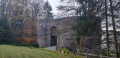
This stage ofthe GRP®571starts in Vielsalm in the Pays des Macralles, crosses the river at Salmchâteau and enters the Deux Ourthes Nature Park, heading towards the Ardennes plateau and Gouvy.
For more walks, use our search engine .
The GPS track and description are the property of this route's author. Please do not copy them without permission.

