Between Ottré and Petite Langleur, via the Tannenbaum Monument

This family walk is easy, taking you through the woods and across fields. There are no signposts to follow.
First section through the woods: stony paths, dirt tracks; there’s mud in places.
The second section runs between the fields: tarmac.
This route is not accessible to wheelchair users or pushchairs.

Details

n°3247066
Creation:
Last update:
–
Last review:
  • Walking
    Activity: Walking
  • ↔
    Distance: 2.68 mi
  • ◔
    Average duration: 1h 30 
  • ▲
    Difficulty: Easy

  • ⚐
    Back to start: Yes
  • ↗
    Ascent: + 305 ft
  • ↘
    Descent: - 302 ft

  • ▲
    Highest point: 1,850 ft
  • ▼
    Lowest point: 1,663 ft

Photos

Description of the walk

Park near the church and the cemetery in Ottré.

(S/E) Take the small road leading uphill opposite. After the old village school, you’ll find it on the right with a small square in front of it; turn left onto the gravel road leading into the woods. Further on, it turns into a dirt track. Keep going straight on. Ignore the roads coming from the left and right. You’ll reach a crossroads with four arms that are almost perpendicular to one another.

(1) Take the gravel track on the right. Begin a descent heading roughly south. Pass a farm and a holiday cottage for groups. You’ll reach the junction with the Ottré–Langlire road.

(2) On the right, begin another gentle climb leading to the Croix de Bièvre crossroads, where the Tannenbaum Monument is also situated.

(3) After the monument, continue along the road and turn right at the Au Corai crossroads. At the next crossroads, marked by a cross, turn left and then right to return to the church car park (S/E).

Waypoints

  1. S/E : mi 0 - alt. 1,663 ft - Ottré church car park
  2. 1 : mi 0.76 - alt. 1,824 ft - Four-way crossroads
  3. 2 : mi 1.44 - alt. 1,683 ft - Ottré–Langlire road
  4. 3 : mi 2.02 - alt. 1,808 ft - Tannenbaum Monument
  5. S/E : mi 2.68 - alt. 1,663 ft - Ottré church car park

Worth a visit

(S/E) There are no shops or cafés/restaurants in Ottré or Petite Langlire. So do remember to bring some food and drink with you if you can.
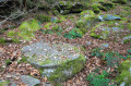
(Between 1 and 2) I’m no expert on the subject, but I think there are ‘foxholes’ (trenches) to the left and right of the road in the woods. These ‘foxholes’ were dug by American soldiers to take cover from the Germans during the Second World War.

Reviews and comments

5 / 5
Based on 1 review

Reliability of the description
5 / 5
Ease of following the route
5 / 5
Route interest
5 / 5
lth.warnier
lth.warnier

Overall rating : 5 / 5

Date of your route : Jan 15, 2021
Reliability of the description : ★★★★★ Very good
Ease of following the route : ★★★★★ Very good
Route interest : ★★★★★ Very good
Very busy route : No

January! Temperatures hovering around freezing point: the slightly sloping stony path we set off on is now a stream of melting snow. A few tricky sections follow, with our eyes fixed on the ground rather than the beautiful views already surrounding us.
But from the crossroads at point 1 to point 2, we are amazed by the woods, undergrowth and snow-covered meadows bathed in the gentle late morning sun: superb!
On the way back, we stopped at the Tannenbaum monument, " in memory of the Belgian soldiers and victims of the Second World War 1940-1945 ".
A lovely walk. Thank you to whoever recommended it.

Machine-translated

Other walks in the area

For more walks, use our search engine .

The GPS track and description are the property of this route's author. Please do not copy them without permission.