


 Country:

 City:


Park at the Château de Rosemont car park (ruins), approximately 400 m after leaving the village of Vescemont on the D24.
Marked with Yellow Discs
(S/E) Cross the road and take the path that starts behind a large beech tree by the roadside.
Follow the path uphill; it crosses a forest track and then turns left to descend towards a small lane. Join a tarmac road coming from the right and follow it for about a hundred metres until you reach a junction. Turn right onto the road leading uphill, then take the path immediately on the left (Rue des Écoles).
When you reach a house, the street slopes slightly down to the left. Opposite, a driveway leads into a property; take the path slightly to the right which climbs alongside the fence of this property.
The path turns into a track, which joins a tarmac road. Turn right onto the track that runs between the last two houses in the village.
(1) Continue along the track for about 300 m until it ends at a fence. Open the gate and follow the track leading uphill opposite into the pasture before turning left and joining a track which you take as it climbs to the right (Ort du Mont Jean).
Signposted with a red Rectangle (and a Yellow Disc)
(2) Follow the path, which is tarmac-surfaced at first then becomes a gravel track, and after about 500 m you’ll reach an isolated house on the right. Just past the house, at the ‘no entry’ sign, turn left onto the path that climbs into the forest. You’ll reach a pass where several paths converge.
(3) Continue past the pass for about twenty metres, then take the path branching off to the right, heading due north (follow the same markings). Climb steadily, and after about 700 m, you’ll come to the path joining from the left, coming from the Ferme du Mont Jean.
Pass the spot known as La Grande Roche, which is simply a large, moss-covered rock standing alone on the left.
Please note: at around 920 m, the main path veers slightly to the left on a gentle descent; be sure to take the clearly marked and signposted path that climbs to the right. You’ll soon reach the ridge.
(4) For a round trip, take the path that branches off to the right along the ridge, then skirts the summit to the east before descending towards the Pierre Écrite (about 500 m from the fork).
(5) Once you’ve deciphered the inscriptions, retrace your steps.
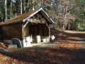
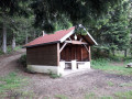
(4) On your return, continue along the path on the ridge to the Col du Chantoiseau (elevation 907) and its comfortable shelter.
Red Rectangle markings
(6) Take the path that climbs behind the shelter, and immediately at the first fork, leave the path on the right (Yellow Triangle) and take the one on the left up to the hamlet known as Les Plaines.
(7) Then turn left onto the path that passes to the left of the farm and climbs towards the summit. Leave the path to visit the statue of the Virgin (elevation 1124) and admire the panoramic view.
(8) Turn round and retrace your steps back to the pass.
(7) Follow the track which climbs to the left across the meadow to the summit of the Tremontkopf (elevation 1091). Then descend, more or less along the ridge, to the Col de Hirtzelach.
(9) From the pass, follow the very pleasant path heading due west, running parallel to the Route de Fennematt but slightly higher up. It gradually moves further away from the road, running along a ridge and offering lovely views through the forest. Continue for over 2 km with very little change in altitude.
(10) Emerge from the forest and arrive level with the Lochberg Farm, situated below on the left. Continue to the Lochberg Pass.
(11) Pass the fence, turn left at the foot of the wayside shrine to Mary and climb to the summit of the Baerenkopf (elevation 1074) after passing the lovely CAF chalet, which is unfortunately closed.
Just past the summit, leave the main path marked with Red Rectangles and take a path on the left that winds its way down.
Red Rectangle-White-Red markings
(12) At the bottom of the slope, turn right onto a path that descends steadily and, after just over 1 km, you’ll reach a crossroads with four paths.
(13) The signposting isn’t very clear. Take the path almost directly opposite which leads down (the left-hand Fork in the road). You will then reach another crossroads with a magnificent beech tree bearing several signposts.
Blue Rectangle Markings
(14) Take the path on the left, which enters the pasture, running almost level with the ground. Follow the track through the pastures, cross several fences, and arrive at a tarmac road leading to Lachtelweiher Lake.
Walk round the lake to the north along the road leading to the car park.
Blue Ring Markings
(15) At the fork, leave the tarmac road heading right towards the car park and take the left-hand branch leading to a house above the lake. Pass to the right of the house to join the path which climbs quite steeply through the woods. Continue through the woods, then across the meadow to the Lochberg Farm Inn.
(16) Pass the farmhouse inn, follow the path up through the pasture to the (unnamed) pass, then turn left onto the track cutting south-west across the pasture to rejoin the Col du Lochberg.
(11) At the wayside shrine to Mary, head straight down the path directly opposite, which leads to the Col du Chat, where several paths converge.
(17) Take the path leading down, almost directly opposite. Be careful: it soon splits; leave the right-hand branch (Yellow Triangle) and take the left-hand one, which leads to the Col des Sept Chemins.
Red Ring markings
(18) Cross over to the opposite side towards what looks like an old quarry and find a very good path. Take this path on the right, keeping the quarry on your left.
Then, simply let the path lead you down to the car park at Château de Rosemont (S/E).



 Visorando Member
 Moderate

 Easy
 Difficult

