Tour of the Riervescemont Valley

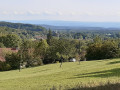
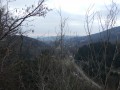
A lovely walk in the Southern Vosges with beautiful panoramic views, the Wissgrutt pastures and the chance to explore distinctive rocks and boulders (Grande Roche, Pierre Écrite, Roche du Serpent).

Details

2167908
Creation:
Last update:
Last review:
  • Walking
    Activity: Walking
  • ↔
    Distance: 12.37 mi
  • ◔
    Duration according to the author: 8 hrs 
  • ▲
    Difficulty: Very difficult

  • ⚐
    Back to start: Yes
  • ↗
    Ascent: + 2,848 ft
  • ↘
    Descent: - 2,844 ft

  • ▲
    Highest point: 3,678 ft
  • ▼
    Lowest point: 1,703 ft

Photos

Description of the walk

Head to Giromagny. In the town centre, take the D14 towards Riervescemont. After the hamlet of La Planche-le-Prêtre, park your car in the large car park situated along the stream beneath the ruins of Rosemont Castle

(S/E) Opposite the car park, cross the road and take the path that starts at the foot of the votive beech tree dedicated to the Virgin Mary – the spot where the White Lady is said to appear every 101 years – following the Yellow Disc markings towardsthe GR®5. Cross the forest track, continue climbing gently, then turn left to come out onto a tarmac road leading to the hamlet of ‘La Planche le Prêtre’ via Rue de la Fontaine du Cerf and then Rue de la Source. Turn right, then immediately left onto Rue de l’École.

When you reach the latter, turn right. Follow the path until you come out onto a tarmac road, which you should follow to the right (still following the Yellow Disc markings). At the end of this road, cross a pasture, taking care to close the gates properly. A little further on, you’ll reach the junction with theGR®5(marked with Red Rectangles)

(1). Turn right here and head up the paved road. After the last house, leave the road and take a path on the left that climbs through the woodland.

(2) You’ll emerge at the ‘Mont Jean’ pass and its major crossroads. Continue due north; theGR® follows a path that gently leads above the Mont Jean farm (a stopover lodge). Keep to the right; the climb becomes steeper. A few lovely clearings offer views of the landscape on the western slope.

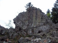
(3) On the right is the Grande Roche fountain, then a little further on, to the left and slightly below, the rock known as the “Grande Roche”. The path levels out and leads into a clearing..

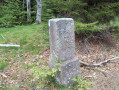
.(4) At the crossroads on the boundary between the municipalities (marked by red boundary stones), take a detour to the right, following the white signposts, to reach the “Pierre Écrite” and its mysterious inscriptions.

(5) Return to the previous crossroads.

(4) Turn right, following the boundary between the municipalities and its boundary stones bearing traces of red paint. The path descends to the Col de Chantoiseau refuge.

(6) Behind the refuge, leave the red triangle trail on your right and head straight up, following the red-and-white Red Rectangle markings ofthe GR®5towards Ballon d’Alsace. The climb is steep until you reach the “Gros Hêtre”.

(7) The ‘Gros Hêtre’ no longer exists, but a distinctive sign marks the spot. It is a 1930s-style Michelin concrete sign – a rare sight in the forest. Turn right, cross the Wissgrut pastures and head for the four-way junction at Wissgrut.

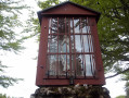
(8) Turn left towards the Ballon d’Alsace. At the next crossroads, veer right to reach the Wissgrut Shrine and enjoy the 360° view.

(9) Return to the Wissgrut crossroads.

(8) Turn left onto the path towards the Tremontkopf via aGR®5variant – marked with a Red Rectangle. Reach the summit.

(10) Leave the pastures and head into the woodland towards the Hirtzenlach Pass. The path follows the old border, marked by traditional boundary stones inscribed with ‘F’ for France and ‘D’ for Deutschland, erected after the 1870 war. Continue to the Unnamed Pass.

(11) Turn right, following the Red Triangle markings, for a short round trip of a few metres to the “Roche du Serpent” and its breathtaking view to the south.

Back at the Col Sans Nom, rejoin theGR®5path to the right, following the Red Rectangle markings. Reach the Col de Hirtzenlach.

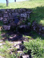
(12) Leave the borderline by taking a slightly left-hand path along the hillside. You’ll emerge onto the Fennematt pastures, then those of the Lochberg, and finally onto the pasture where the Doller spring is located.

(13) Turn right onto the climb up to the Lochberg Pass, reach the pass and enjoy the view from the wayside shrine.

(14) Leave the pasture and take the forest track leading down directly opposite, marked with the new Blue Ring sign. The descent is easy as far as the Col du Chat.

(15) Turn right onto a rough track, still marked with a Blue Ring, which descends steeply. Leave the path leading off to Riervescemont on your right. Join a good track, marked with a Red Rectangle, and follow it to the left as far as the Col des Sept Chemins.

(16) Join the main forest track towards the timber yard and head down towards the west (marked with a Red Ring). The descent is gentle and straightforward, leading back to the car park at Rosemont Castle (S/E).

Waypoints

  1. S/E : mi 0 - alt. 1,745 ft - Car park at the - Rosemontoise (rivière) - Affluent de la Savoureuse
  2. 1 : mi 1.45 - alt. 1,847 ft - Junction with the GR5
  3. 2 : mi 2.09 - alt. 2,362 ft - Col du Mont Jean (720m)
  4. 3 : mi 3.2 - alt. 2,933 ft - La Grande Roche (Fontaine and Rocher)
  5. 4 : mi 3.76 - alt. 3,077 ft - Crossroads at the municipal boundary
  6. 5 : mi 3.89 - alt. 3,186 ft - La Pierre Écrite
  7. 6 : mi 4.41 - alt. 2,982 ft - Covered shelter - Col de Chantoiseau (920m)
  8. 7 : mi 4.83 - alt. 3,435 ft - Le Gros Hêtre
  9. 8 : mi 5.1 - alt. 3,537 ft - Le Wissgrut (crossroads)
  10. 9 : mi 5.5 - alt. 3,678 ft - Our Lady of Wissgrut - Wissgrut
  11. 10 : mi 6.22 - alt. 3,583 ft - Tremonkopf
  12. 11 : mi 6.59 - alt. 3,307 ft - Unnamed pass - Roche du Serpent
  13. 12 : mi 7.32 - alt. 3,061 ft - Col du Hirtzelach (930m)
  14. 13 : mi 8.61 - alt. 3,173 ft - Fennematt pasture - Source de la Doller
  15. 14 : mi 8.99 - alt. 3,215 ft - Oratory of the - Col du Lochberg (979m)
  16. 15 : mi 9.98 - alt. 2,848 ft - Col du Chat (867m)
  17. 16 : mi 10.45 - alt. 2,434 ft - Covered shelter - Col des Sept Chemins (739m)
  18. S/E : mi 12.37 - alt. 1,749 ft - Car park at the - Château du Rosemont

Notes

Standard hiking kit, with good footwear and walking poles recommended. Don’t forget a jumper and a waterproof jacket (frequent thunderstorms in the late afternoon)
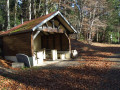
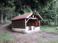
Covered shelters with tables, benches and a barbecue fireplace at the Col de Chantoiseau (6) and at the Carrefour des 7 Chemins (16).
There is a spring at La Grande Roche for animals. Otherwise, bring your own drinks.
Food and drink are available at Wissgrut, Fennematt and Lochberg,

Worth a visit

(5) In the small clearing at La Pierre Écrite, mysterious inscriptions and sketches catch the eye. Is it simply a stone bearing traces of erosion and doodles by idle shepherds, or a sacred stone with inscriptions dating back to ancient times? It is, in any case, listed as a historic monument.
(6) There are tables, benches and a barbecue here.
(16) An open shelter equipped with a barbecue (an exact replica of the Chantoiseau shelter).

Always be cautious and plan ahead when you're outdoors. Visorando and the author of this route cannot be held responsible for any accidents occurring on this route.

The GR® and PR® markings are the intellectual property of the Fédération Française de Randonnée Pédestre.

Reviews and comments

4.6 / 5
Based on 3 reviews

Reliability of the description
4.7 / 5
Ease of following the route
4.7 / 5
Route interest
4.3 / 5
Anne S.
Anne S.

Overall rating : 4 / 5

Date of your route : Aug 29, 2021
Reliability of the description : ★★★★☆ Good
Ease of following the route : ★★★★☆ Good
Route interest : ★★★★☆ Good
Very busy route : No

Estimated time: 8 hours 20 minutes; completed in 6 hours, including a break. Described as ‘very difficult’, but apart from two or three steep climbs, there was nothing technical or difficult.

Machine-translated

stephlods
stephlods

Overall rating : 5 / 5

Date of your route : Mar 03, 2021
Reliability of the description : ★★★★★ Very good
Ease of following the route : ★★★★★ Very good
Route interest : ★★★★★ Very good
Very busy route : No

A very well-signposted walk, which my partner and I completed in 6½ hours… Not for beginners – the first 5 kilometres really take it out of your calves 😁
A superb walk – I’d definitely recommend it

Machine-translated

Pierrot DAVID
Pierrot DAVID

Thank you for your review.
We’re always a bit nervous about the first review after suggesting a route. We’re delighted to hear that the description and route map allowed you to enjoy your walk with peace of mind.
See you soon on other routes on the Visorando website.
Pierrot

Machine-translated

kaola123
kaola123

Overall rating : 4.7 / 5

Date of your route : Oct 19, 2020
Reliability of the description : ★★★★★ Very good
Ease of following the route : ★★★★★ Very good
Route interest : ★★★★☆ Good
Very busy route : No

A lovely walk in the Vosges with a climb that really puts your legs to the test due to its length, before reaching the
of Le Chantoiseau. A lovely picnic as the sun came out. One last climb before reaching Wissgrut, then a walk along the ridge before heading back down via the Col des Sept Chemins.
We didn’t come across many people along the route, apart from on the ridge – I really enjoyed it...

Machine-translated

Other walks in the area

For more walks, use our search engine .

The GPS track and description are the property of this route's author. Please do not copy them without permission.