Mont Jean / Wissgrut / Baerenkopft mountain hut

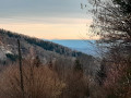
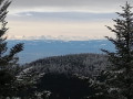
A lovely walk with plenty of magnificent views over the valley.

Details

3343059
Creation:
Last update:
Last review:
  • Walking
    Activity: Walking
  • ↔
    Distance: 11.47 mi
  • ◔
    Average duration: 7h 35 
  • ▲
    Difficulty: Difficult

  • ⚐
    Back to start: Yes
  • ↗
    Ascent: + 2,648 ft
  • ↘
    Descent: - 2,648 ft

  • ▲
    Highest point: 3,668 ft
  • ▼
    Lowest point: 2,218 ft

Photos

Description of the walk

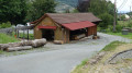
The walk starts at the Refuge du Mont Jean, a formerGR®5stopover lodge.

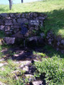
(S/E) Join the Red Rectangle-marked hiking trail, then head up to the left to the Grande Roche, where you can admire a lovely little spring.

(1) Continue along the Red Rectangle trail, pass the 931-metre altitude mark and arrive at a fork in the path.

(2) Turn right-hand way to make a round trip to the Pierre Écrite, a prehistoric monument.

(3) From here, turn back to the previous fork.

(2) Continue to the right along the Red Rectangle trail and head for the Col du Chantoiseau.

(4) Carry on to the left, passing to the left of the Chantoiseau shelter.

(5) Keep following the Red Rectangle to reach the Gros Hêtre.

(6) Turn right to reach the magnificent Wissgrut Plains.

(7) Turn left onto the Red Rectangle trail.
Climb up to the Virgin at an altitude of 1,124 metres, the highest point of the walk.

(8) Head back down to the Wissgrut Plains.

(7) Turn left onto the Red Rectangle to reach the Unnamed Pass.

(9) Continue due east to reach the Col du Hirtzelach.

(10) Carry on along the Red Rectangle trail to reach the Source de la Doller, where you can fill your water bottles with fresh water if needed.

(11) Carry on to the Lochberg farm, where you can enjoy a well-deserved cold beer.

(12) Return along the same path to the Unnamed Pass.

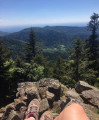
(9) Turn left towards the Roches du Serpent, which offer a marvellous view over the whole valley.

(13) Now carry on left, heading due west, following the Red Triangle to the Col du Chantoiseau.

(5) Return to the starting point via the same route as on the way out and head to the Refuge du Mont Jean (S/E).


Waypoints

  1. S/E : mi 0 - alt. 2,218 ft - Mont Jean mountain hut
  2. 1 : mi 1.01 - alt. 2,940 ft - Grande Roche and its spring
  3. 2 : mi 1.55 - alt. 3,077 ft - Junction. Return trip to La Pierre Écrite
  4. 3 : mi 1.75 - alt. 3,117 ft - Pierre Écrite
  5. 4 : mi 2.29 - alt. 2,982 ft - Col de Chantoiseau (920m)
  6. 5 : mi 2.31 - alt. 2,989 ft - Abri du Chantoiseau
  7. 6 : mi 2.72 - alt. 3,392 ft - Large beech tree
  8. 7 : mi 3.03 - alt. 3,537 ft - Crossroads
  9. 8 : mi 3.38 - alt. 3,668 ft - Unmarked - Wissgrut
  10. 9 : mi 4.54 - alt. 3,199 ft - Unnamed Pass
  11. 10 : mi 5.02 - alt. 3,058 ft - Col du Hirtzelach (930m)
  12. 11 : mi 6.38 - alt. 3,068 ft - Source of the - Source de la Doller
  13. 12 : mi 6.64 - alt. 2,966 ft - Lochberg Farm
  14. 13 : mi 8.92 - alt. 3,323 ft - Roche du Serpent
  15. S/E : mi 11.47 - alt. 2,218 ft - Mont Jean mountain refuge

Notes

There are several springs along the route
Magnificent views
Shaded paths through the woodland
There are also several shelters along the route

It’s best to wear good walking boots and carry walking poles.
Some of the paths are a bit challenging and slippery.

Always be cautious and plan ahead when you're outdoors. Visorando and the author of this route cannot be held responsible for any accidents occurring on this route.

The GR® and PR® markings are the intellectual property of the Fédération Française de Randonnée Pédestre.

Reviews and comments

4.8 / 5
Based on 2 reviews

Reliability of the description
5 / 5
Ease of following the route
5 / 5
Route interest
4.5 / 5
User 22845035
• Edited:

Overall rating : 5 / 5

Date of your route : Feb 20, 2026
Reliability of the description : ★★★★★ Very good
Ease of following the route : ★★★★★ Very good
Route interest : ★★★★★ Very good
Very busy route : No

A very beautiful hike in winter with snow on the hills.

Machine-translated

corentin@viso
corentin@viso ★
• Edited:

Overall rating : 4.7 / 5

Date of your route : Jul 20, 2024
Reliability of the description : ★★★★★ Very good
Ease of following the route : ★★★★★ Very good
Route interest : ★★★★☆ Good
Very busy route : No

A lovely walk to do in hot weather as it’s nice and cool in the woods.
Thanks for the route map – there are a few lovely viewpoints
There’s a farmhouse inn along the route, just in case.
If you’re coming by car, you can park a little further down from the starting point; the lodge’s grounds are private.

Machine-translated

lilyofthewest 24
lilyofthewest 24

Thank you ☺️

Machine-translated

Claude L2.
Claude L2.

Actually, I’d like to thank the author of this walk, even though I’ve made a slight variation to it, as I found there were too many back-and-forth sections.
As the higher sections are interesting (La Pierr’Ecrité, Le Wissgrut, Lohcberg, etc.), I’ve mapped out another route that takes in these spots in a circular fashion starting from Rosemont Castle (in the municipality of Vescemont). This route should be available on Visorando soon.

Machine-translated

Other walks in the area

For more walks, use our search engine .

The GPS track and description are the property of this route's author. Please do not copy them without permission.