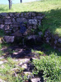
Around the Goutte de la Louvière

A walk around the valleys of Riervescemont, Vescemont, Lamadeleine and Rougegoutte, as well as the mountains on the north-eastern edge of the Belfort area.
A challenging walk, yet full of botanical and geological interest.

Details

3564988
Creation:
Last update:
Last review:
  • Walking
    Activity: Walking
  • ↔
    Distance: 6.48 mi
  • ◔
    Average duration: 4h 15 
  • ▲
    Difficulty: Moderate

  • ⚐
    Back to start: Yes
  • ↗
    Ascent: + 1,457 ft
  • ↘
    Descent: - 1,457 ft

  • ▲
    Highest point: 3,005 ft
  • ▼
    Lowest point: 1,755 ft

Photos

Description of the walk

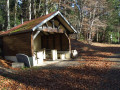
Park in the Château du Rosemont car park.

(S/E) Turn left onto the forest track marked with a Red Ring. Continue along this track, which climbs steadily, to reach the Col des Sept Chemins.

(1) Turn right onto the ridge path, signposted with a Yellow Ring. Continue uphill, then begin a short descent to reach a junction at the Source de la Louvière.

(2) Stay on the ridge path to the left, now marked with a Blue Disc. You’ll reach another crossroads.

(3) Turn right onto the path marked with a Red Ring and you’ll very soon reach another junction.

(4) Leave the signposted path and continue straight ahead along the ridge path (heading west). Pass Pointe des Roches, then further on cross the Route Forestière du Fayé. You’ll reach another junction at the end of the ridge path.

(5) Turn right onto the path marked with a Blue Disc. After thefirst hairpin bend to the right, take thesecond one and turn left following the signposted direction marked with a Red Triangle. You’ll reach the crossroads at the hamlet of Le Plainot.

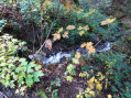
(6) Turn right, in a hairpin bend, onto the path marked with a Blue Triangle. Further on, cross the Goutte de la Louvière stream. Stay on this path until you reach a forest track.

(7) Take this track to the left – still signposted with a Blue Triangle – and follow it along the winding road to the car park at Château du Rosemont (S/E).

Waypoints

  1. S/E : mi 0 - alt. 1,755 ft - Car park - Château du Rosemont
  2. 1 : mi 1.84 - alt. 2,431 ft - Col des Sept Chemins (739m)
  3. 2 : mi 2.67 - alt. 2,831 ft - Source de la Louvière
  4. 3 : mi 2.95 - alt. 2,943 ft - Mini pass
  5. 4 : mi 3.25 - alt. 2,953 ft - Pointe des Roches nearby
  6. 5 : mi 4.11 - alt. 2,382 ft - Crossroads between two valleys
  7. 6 : mi 4.77 - alt. 1,909 ft - The hamlet of Le Plainot
  8. 7 : mi 5.7 - alt. 2,034 ft - Junction with forest track
  9. S/E : mi 6.48 - alt. 1,755 ft - Car park - Rosemontoise (rivière) - Affluent de la Savoureuse

Reviews and comments

3.7 / 5
Based on 4 reviews

Reliability of the description
3.8 / 5
Ease of following the route
4.3 / 5
Route interest
3 / 5
User 14839311

Overall rating : 3.7 / 5

Date of your route : Nov 08, 2025
Reliability of the description : ★★★★★ Very good
Ease of following the route : ★★★★☆ Good
Route interest : ★★☆☆☆ Disappointing
Very busy route : No

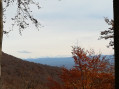
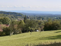
I didn't read the reviews before doing it, I should have... what is the real point of this route? The walk in the forest isn't unpleasant, but there are no views: I wonder where the photo with the view of the mountains was taken. It would have been nice to share the location and a picnic spot: these are some of the points of interest we look for in a successful hike.

Machine-translated

bouledjouidja rabah
bouledjouidja rabah
• Edited:

Hello
Glad you enjoyed the walk (it really is a lovely forest).
All the best for the future....

Machine-translated

Cracos
Cracos
• Edited:

Overall rating : 3.7 / 5

Date of your route : Apr 07, 2025
Reliability of the description : ★★★☆☆ Average
Ease of following the route : ★★★★☆ Good
Route interest : ★★★★☆ Good
Very busy route : No

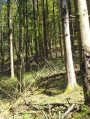
A lovely walk, mainly through the woods
Absolute tranquillity
Best avoided when the ground is slippery (risk of falling on the descent)

Machine-translated

bouledjouidja rabah
bouledjouidja rabah

Hello
I’ve changed the description.
Nevertheless, the forest remains magnificent (beech, fir, spruce, maple, etc.) and the high forests are also interesting....
Kind regards

Machine-translated

Marie90-4
Marie90-4
• Edited:

Overall rating : 3.7 / 5

Date of your route : Oct 25, 2020
Reliability of the description : ★★★★☆ Good
Ease of following the route : ★★★★☆ Good
Route interest : ★★★☆☆ Average
Very busy route : No

A 6 km climb to start with. Unfortunately, the foresters had been through with their machinery, so the ground was damaged, and as it had rained during the week… I’ll let you guess. Lovely view of the Alps. Was that why I got a bit confused? I went down too far. Didn’t see any signposts beforehand. So I had to improvise to get back down towards Le Plainot. An extra 3 km. I didn’t find this walk particularly interesting. Just a stroll through the woods, nothing more.

Machine-translated

bouledjouidja rabah
bouledjouidja rabah

Hello
I’ve updated the description.
Nevertheless, the forest remains magnificent (beech, fir, spruce, maple, etc.) and the high forests are also of interest....
Kind regards

Machine-translated

kty 90
kty 90

Overall rating : 3.7 / 5

Date of your route : Sep 20, 2020
Reliability of the description : ★★★☆☆ Average
Ease of following the route : ★★★★★ Very good
Route interest : ★★★☆☆ Average
Very busy route : No

A few minor corrections.
The walk is 10.95 km long
The elevation gain is _473.96 m__
There are no views...
I’d describe it as quite a physical hike; it goes up and down very steeply,
Just a lovely beech forest along the ridge path
Personally, I didn’t enjoy it

Machine-translated

Other walks in the area

For more walks, use our search engine .

The GPS track and description are the property of this route's author. Please do not copy them without permission.