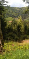
Tête des Mineurs as seen from the Château du Rosemont

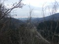
A woodland walk with views over the Louvière and Riervescemont valleys

Details

22030620
Creation:
Last update:
Last review:
  • Walking
    Activity: Walking
  • ↔
    Distance: 5.03 mi
  • ◔
    Average duration: 3h 10 
  • ▲
    Difficulty: Easy

  • ⚐
    Back to start: Yes
  • ↗
    Ascent: + 965 ft
  • ↘
    Descent: - 965 ft

  • ▲
    Highest point: 2,720 ft
  • ▼
    Lowest point: 1,755 ft

Photos

Description of the walk

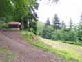
Start from the shaded car park at Rosemont Castle.

(S/E) Cross the Ruisseau de la Rosemontoise then turn right onto the forest track (marked with a Blue Triangle).

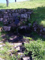
(1) At the Goutte de la Louvière junction, turn left, leaving the signposted path but staying on the same forest track.

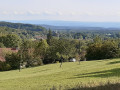
(2) Enjoy the view over the Plain Baleroy and turn left onto another forest track until you reach the three-way junction at the foot of the Tête des Mineurs.

(3) Turn left and continue to the ridge (altitude 830).

(4) On thisPR® route, turn left downhill and head for the Col des Sept Chemins.

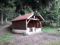
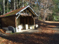
(5) At the Abri des Sept Chemins crossroads, turn left onto the forest road marked with a Red Ring and continue along this forest road until you reach the castle car park (S/E).


Waypoints

  1. S/E : mi 0 - alt. 1,755 ft - Shaded car park - Château du Rosemont
  2. 1 : mi 0.82 - alt. 2,031 ft - Goutte de la Louvière
  3. 2 : mi 1.23 - alt. 2,247 ft - View of the Plain Baleroy
  4. 3 : mi 2.02 - alt. 2,474 ft - At the foot of the Tête des Mineurs
  5. 4 : mi 2.85 - alt. 2,720 ft - Between Riervescemont and La Madeleine
  6. 5 : mi 3.17 - alt. 2,431 ft - Abri des 7 chemins
  7. S/E : mi 5.03 - alt. 1,755 ft - Shaded car park - Rosemontoise (rivière) - Affluent de la Savoureuse

Notes

This walk takes place mainly on forest tracks, which provide easy access to the route.

Always be cautious and plan ahead when you're outdoors. Visorando and the author of this route cannot be held responsible for any accidents occurring on this route.

The GR® and PR® markings are the intellectual property of the Fédération Française de Randonnée Pédestre.

Reviews and comments

4.5 / 5
Based on 2 reviews

Reliability of the description
5 / 5
Ease of following the route
4.5 / 5
Route interest
4 / 5
bouledjouidja rabah
bouledjouidja rabah

Hello
I’m glad you enjoyed the walk
All the best.

Machine-translated

Elie.
Elie.

Overall rating : 4 / 5

Date of your route : Apr 15, 2024
Reliability of the description : ★★★★★ Very good
Ease of following the route : ★★★★☆ Good
Route interest : ★★★☆☆ Average
Very busy route : No

A good route for a short walk with a slight climb

Machine-translated

guetty68
guetty68

Overall rating : 5 / 5

Date of your route : Jun 02, 2022
Reliability of the description : ★★★★★ Very good
Ease of following the route : ★★★★★ Very good
Route interest : ★★★★★ Very good
Very busy route : No

A lovely walk that I really enjoyed – not too much of a climb and, above all, some beautiful views – a real feast for the eyes.
A family walk.

Machine-translated

Other walks in the area

For more walks, use our search engine .

The GPS track and description are the property of this route's author. Please do not copy them without permission.