


Refine your search for walks in Lachtelweiher
Lachtelweiher walks


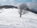
 The source of the Doller at the start of the Lachtelweiher
 Tourist office
 5.17 mi
 +1,142 ft
 -1,155 ft
 3h 20
 Moderate
 Departure from Haut-Rhin
This hike will take you to the Source de la Doller, which, contrary to what you might think, does not originate at the Ballon d'Alsace, but below the Schlumpf. During the hike, you will enjoy beautiful views of the Doller valley and have the opportunity to eat at one of the farmhouse inns along the route.
The summit of the Baerenkopf via Lake Lachtelweiher
 Visorando Member
 8.07 mi
+2,388 ft
-2,365 ft
5h 45
Moderate
Departure from Niederbruck (Haut-Rhin)
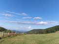
This hike passes by the small Lachtelweiher lake, which nestles peacefully at an altitude of 740 metres. The route passes numerous authentic farm inns, alternates between forests and stubble fields, climbs passes and peaks with panoramic views, and ventures close to the source of the Doller.
Schlumpf trail, Fennematt, Lochberg from Niederbruck
 8.54 mi
+2,103 ft
-2,077 ft
5h 45
Moderate
Departure from Niederbruck (Haut-Rhin)
Enjoy the beautiful view from the Schlumpf trail. The Grand Ballon and the Ballon d’Alsace will be visible among the other surrounding peaks overlooking the Masevaux valley floor. Make the most of this route to stop at the Ferme-Auberge du Lochberg for a bite to eat or enjoy a packed lunch at the Graber Breitenstein shelter.
From Lachtelweiher, a circular route that passes via the summits of the Baerenkopf and the Sudel
9.05 mi
+1,821 ft
-1,821 ft
5h 45
Moderate
Departure from Haut-Rhin
From Lachtelweiher (in the municipality of Kirchberg), a pleasant circular route follows the Doller valley, passing over the peaks of Baerenkopf and Sudel in the Southern Vosges and through the farmhouse inns at Lochberg and Bruckenwald. This circular route also has historical interest as it follows, for a long stretch along the ridge, theGR®5, which runs along the former border between France and Germany from 1871 until the First World War.
A climb to the Baerenkopf from the Entzenbach Farm Inn
 Tourism professional
 6.01 mi
+1,808 ft
-1,808 ft
4h 20
Moderate
Departure from Niederbruck (Haut-Rhin)
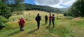
Starting from the secluded Entzenbach Farm Inn (612 m), this circular route takes you to another, very discreet farm inn in the Doller Valley, the Bruckenwald (750 m). Then, after a long climb to the Baerenkopf (1,074 m), at the summit of which stands one of the oldest mountain huts in the Vosges, the trail leads you to a third farmhouse inn, the Lochberg (910 m), before returning to your starting point.
Fennematt pasture and Baerenkopf refuge
6.29 mi
+1,365 ft
-1,365 ft
4h 05
Moderate
Departure from Lamadeleine-Val-des-Anges (Territoire-de-Belfort)
A lovely walk that follows a pleasant forest track to the Fennematt hut, then a short circular route to the Refuge de la Tête de l’Ours (Baerenkopf) between Haut-Rhin and the Territoire de Belfort.Return via the same route as the outward journey, with a short detour via the Col des Sept Chemins. This route is the least strenuous way to reach the Fennmatt hilltop or the nearby Lochberg inn.
Around the Baerenkopf
 11.07 mi
+2,644 ft
-2,635 ft
7h 25
 Difficult
Departure from Lamadeleine-Val-des-Anges (Territoire-de-Belfort)
A hike through high-altitude forests and meadows between the Territoire de Belfort and the Haut-Rhin. Passing by the source of the Doller, the Fennematt, the Schlumpf panoramic trail, the Lochberg farmhouse inn and the Baerenkopf, the route is dotted with several shelters, mountain huts and picnic areas, as well as numerous viewpoints.
The Wissgrut and the Baerenkopf as seen from Vescemont
 15.55 mi
+3,675 ft
-3,671 ft
8 hrs
 Very difficult
Departure from Riervescemont (Territoire-de-Belfort)
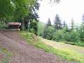
A lovely circular walk that allows you to enjoy superb beech forests whilst offering numerous views of the Southern Vosges. The panorama from the Vierge du Chaume du Wissgrut and the mystery of the Pierre Écrite add some remarkable points of interest. It’s not difficult, but may seem long to some: you can omit the eastern section, which loops via Baerenkopf, reducing the distance by more than 5 km and the elevation gain by 300 m, whilst retaining virtually the same attractions.