


Refine your search for walks in Col du Seuchet (2286m)
Col du Seuchet (2286m) walks


 Discover the Montagne de l'Arc via Lac du Carroley
 Visorando Member
 4.75 mi
 +1,496 ft
 -1,467 ft
 3h 30
 Moderate
 Departure from Mâcot-la-Plagne (Savoie)
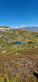
This hike is a longer version of the one suggested by the La Plagne Tourist Office. You will see Les Inversens and the summit of Bellecôte as you pass by the Carroley mountain and its small lake.
You will descend to Belle Plagne via the foot of Mont Saint-Jacques (2,407 m).
The Frasses Circular Route via the Col du Seuchet from Belle Plagne
 4.96 mi
+1,854 ft
-1,860 ft
3h 55
Moderate
Departure from Mâcot-la-Plagne (Savoie)
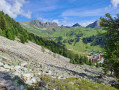
This walk takes you from meadows, where cows graze peacefully, to the fir forest overlooking the Tarentaise valley. It is a circular route that skirts around Mont Saint-Jacques. A very pleasant walk through the forest section during periods of hot weather.
Mont Saint Jacques
 Association / Club / Walk leader
 7.94 mi
+3,097 ft
-3,100 ft
6h 20
 Difficult
Departure from Bellentre (Savoie)
Mont Saint-Jacques overlooks the resort of La Plagne, but above all offers a magnificent view of numerous peaks in the Vanoise and Beaufortain ranges. You can even catch a glimpse of the Aiguilles d’Arves.
The Vanoise Express cable car also allows you to reach the summit from Peisey-Vallandry.
Mont Saint-Jacques and Tête des l'Arpettes from Belle Plagne
 4.16 mi
+1,450 ft
-1,470 ft
3h 10
Moderate
Departure from Mâcot-la-Plagne (Savoie)
This hike is not technically difficult and can be completed in half a day. It offers beautiful views, including two lookout points. The trails are sometimes difficult to see, so a GPS device may be useful, although the terrain is clear and the waypoints are visible from a distance at all times.You will pass through mountain pastures where cows may be present in season.
Walks near Col du Seuchet (2286m)
From Aime la Plagne to Belle Plagne via Mont Jovet
 10.25 mi
+3,681 ft
-3,796 ft
7h 55
Difficult
Departure from Aime (Savoie)
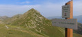
This hike can be done in a single day, but by taking your time, a short two-day trek allows you more time to admire the magnificent views of the mountains and valleys of the Vanoise and Tarentaise, as well as Mont Blanc. Doing it over two days gives us time to rest and take in these breathtaking landscapes. The climbs are relatively challenging and the ridge walk offers dizzying yet unforgettable experiences.
Descend from La Roche de Mio towards La Plagne Bellecôte
 4.47 mi
+0 ft
-2,592 ft
2h 05
Moderate
Departure from Bellentre (Savoie)
In summer, the resort of La Plagne offers a number of hiking routes that are very accessible thanks to the cable cars.
This entirely downhill walk allows you to admire the area from a high vantage point (2,710 m) and discover a varied mountain landscape along a very pleasant path to La Plagne Bellecôte.
Suitable for the whole family, provided everyone can cover this distance; please note that there are no shortcuts if you get tired.
La Grande Rochette via the Colorado chairlift
 3.94 mi
+702 ft
-1,719 ft
2h 25
Moderate
Departure from Mâcot-la-Plagne (Savoie)
The Colorado chairlift in La Plagne operates during the summer. It provides access to the summit of the Grande Rochette with a gentle ascent. From there, you can admire the magnificent south face of the massif.
Landry - Refuge Entre Le Lac
 10.52 mi
+4,751 ft
-112 ft
9h 00
Difficult
Departure from Landry (Savoie)
Étape de la Grande Traversée des Alpes dans la vallée de la Tarentaise autour du Mont Pourri jusqu'au lac de la Plagne où se trouve le refuge Entre Le Lac.
Refuge du Bois - Pralognan
 11.38 mi
+5,187 ft
-5,358 ft
9h 45
Difficult
Departure from Champagny-en-Vanoise (Savoie)
Day 4 of the circular route around the Grande Casse, from Champagny-le-Haut to Pralognan via the Tour du Merle and the Grand Bec.
Champagny-le-Haut – Refuge du Col du Palet
 9.25 mi
+4,757 ft
-1,115 ft
8h 25
Difficult
Departure from Champagny-en-Vanoise (Savoie)
Day1 of a two-circular route in the Vanoise National Park, from Champagny-le-Haut to the Refuge du Col du Palet. A fairly demanding ascent of 1,100 metres, but with a beautiful panorama to reward your efforts, particularly the view over Lac de la Plagne.
From the Refuge du Mont Pourri to the Refuge de la Martin
 9.19 mi
+3,071 ft
-3,757 ft
6h 55
Difficult
Departure from Peisey-Nancroix (Savoie)
The second stage of a 4-day walking tour around Mont Pourri. In the heart of the Vanoise National Park, this stage sets off from the Refuge du Mont Pourri and finishes at the Refuge de La Martin.
This is the most rocky stage, passing through the highest point of the tour at the Col de la Sachette. It is also the longest stage, but offers a great variety of scenery and a good chance of spotting chamois.
From the Entre le Lac Mountain Hut to the Arpont Mountain Hut
 22.63 mi
+5,837 ft
-5,351 ft
15h 30
 Very difficult
Departure from Peisey-Nancroix (Savoie)
This ninth stage takes place in the Vanoise massif. First along the GR® 5 to Val Claret and then via the Via Alpina, which crosses the Haute Vanoise before rejoining the GR® 5.From the refuge, the path joins the GR® 5 at Plan de la Grassaz. The view opens out onto a vast plateau. The path passes Lake Grattaleu, the Refuge du Palet and the pass of the same name. It descends towards Val Claret and leaves the GR® 5 for the Haute Vanoise variant via the Via Alpina and the GR® 55. It climbs towards the Col de Fresse but bypasses it to reach the Col de la Leisse. The trail descends beneath the Grande Motte glacier, skirting the Lac des Nettes, and reaches the Refuge de la Leisse. At the Croé-Vie bridge, the Via Alpina leaves the GR® 55, heads for the Refuge d’Entre Deux Eaux, and crosses the Torrent de la Rocheure to rejoin the GR® 5. It climbs towards Lac des Lozières and then, at the foot of the glaciers, runs along a ridge overlooking the Doron Termignon valley and reaches the Refuge de l’Arpont.
Refuge Entre Le Lac - Refuge de la Leisse
11.25 mi
+3,799 ft
-2,694 ft
8h 30
Difficult
Departure from Peisey-Nancroix (Savoie)
Étape de la Grande traversée des Alpes en Vanoise par une variante haute montagne avec passage de 2 cols (col du Palet et col de la Leisse).
From Les Arcs to the Mont Pourri Refuge via the Lakes Trail
 4.30 mi
+1,542 ft
-689 ft
3h 20
Moderate
Departure from Bourg-Saint-Maurice (Savoie)
The first stage of a 4-day circuit around Mont Pourri. In the heart of the Vanoise National Park, this stage sets off from a very modern ski resort and ends at the foot of the glaciers in a wild, unspoilt landscape. Breathtaking views of Bellecôte (north face), the Aliet and its magnificent debris cone, as well as the Grande Motte and the Plan de la Plagne valley.