


 Country:

 City:
City:


Start from Landry railway station.
(S) Walk to the village and the D87 towards Peisey Nancroix. Follow theGR®®5. The path climbs gently, crossing the road several times, to reach the hamlet known as Le Moulin (1,264 m).
(1) In the hamlet of Le Moulin, head towards Le Ponturin; cross the bridge and follow the left bank to Pont Romano (1,438 m).
TheGR®®5continues along the left bank and passes close to the reception building of the Glières municipal campsite. On the left, 5 minutes’ walk away, is the Baudin Bridge (1,471 m). TheGR®® follows the forest track leading to the Palais de la Mine. Continue along a land consolidation track; cross the D87 to reach Les Lanches.
(2) Cross the hamlet to rejoin the old road by crossing the Ponturin, which you then follow as far as the hamlet of Les Bettières.
(3) At Rosuel, the valley opens out into a wide delta dominated to the east by Mont Pourri (3,779 m) and the Dôme des Platières (3,473 m). Here, cross the torrent once more to reach the Rosuel refuge (1,556 m), which surprises with its modern architecture: a wave-shaped roof covered in grass. TheGR®®5leaves the path to La Gurraz on the left and takes the track that climbs through the Aliet alluvial fan. You then pass through a thicket of green alders before entering a larch forest, from where you can enjoy a bird’s-eye view of the Peisey valley and, in the distance, the south-eastern slope of the Beaufortain. Once through the forest, you reach a steeper slope forming a ridge whose gneiss outcrops have polished surfaces. A path to the left has been created by the National Park and the municipality of Peisey-Nancroix. TheGR®® then crosses the Ponturin one last time, via a footbridge at a place known as ‘Les perles du Ponturin’. After a final slope, you reach the junction (2,091 m). Leave theGR®® route briefly to head for the Refuge entre le Lac. The path follows the meandering torrent on the left bank and climbs gently up the valley to Lac de la Plagne.
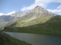
(4) Near the lake is the Refuge entre le Lac (2,145 m) (E).
 Visorando Member
 Moderate
  Association / Club / Walk leader
 Easy
Easy 
 Tourism professional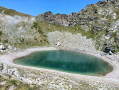
 Very difficult
