Refine your search for walks in Canal entre Champagne et Bourgogne
Canal entre Champagne et Bourgogne walks
 Heuilley-sur-Saône, the Saône banks and its junction with the Marne river

This route will take you along the banks of the Saône and to the mouth of the Marne-Saône canal.Take time to look at the lock-keeper's houses and the locks. Maybe you'll see swans, herons and cranes. Beautiful views of cattle farms and meadows.Just before you return to the starting point, you'll pass over the Pont de Garde, close to the two dams on the Saône and the last lock on the route.
 In the Vingeanne region, the Château de Rosières

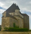
This easy hike will take you between Vingeanne and the canal to the Château de Rosières, a 15th-century fortified manor house that is still inhabited and operates as a bed and breakfast. It is open to visitors.
 In the Pays de Vingeanne around Dampierre-et-Fley

A beautiful hike that will take you from the banks of the Vingeanne and the Champagne-Burgundy Canal to the forests of the Val de Vingeanne.
 In the footsteps of Brunehaut around Renève

This route will take you to Oisilly. You will see a beautiful viaduct, which you can detour to see
, the Mirebeau Forest, Cheuge and its drawbridge, famous for the filming of the film "La Veuve Couderc", the Renève Forest and the village, its castle, its two very pretty wash houses, and its rather unusual war memorial. You can also visit the Halte Brunehaut to discover the history of Queen Brunehaut and the exhibition of Gallo-Roman remains found around Renève.
 Sommeville via Le Châtelet and the Haute-Borne menhir

This route offers panoramic views of several villages in the Marne Valley and takes you on a tour of several archaeological sites.
 Long circular around Saint-Dizier

Route around the town of Saint-Dizier, along the Marne and the canals. Markings: large blue dots on the pavements, pedestrian crossings marked "La grande boucle" and blue circle wooden markers.
 From the Citadel of Langres to Dijon
This route, initially designed to connect to the Culmont-Chalindrey railway junction, has been extended to Dijon due to the cancellation of the train service! It crosses the mustard fields of the Côte-d'Or and the former sand pits of La Tille, which have been converted into ponds that are more popular with fishermen than tourists.
 From Neufchâteau station to the Citadel of Langres (Navarre campsite)
This stage follows the southern part of the Eurovélo 19 "La Meuse à vélo" route (1,050 km from Langres to Rotterdam). From Neufchâteau, we follow the meandering Mouzon, a tributary of the Meuse. We then leave it behind, taking less travelled but more direct roads that avoid the meanders of the Meuse. We rejoin the EV19 just before the "Source de la Meuse" site, on the Langres plateau crossed by three watersheds. With the plateau reaching a height of 450 m, the gradients are not significant, but on arrival, you will need to make a little effort to climb the promontory on which the Citadel of Langres is perched. Your reward: a splendid view at dusk!
