Le Chalvet from Montgenèvre

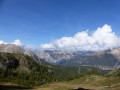
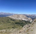
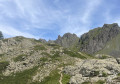
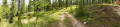
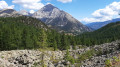
This circular walk starting from Montgenèvre will take you to the high-altitude area of Le Chalvet after a pleasant climb through the forest. All the while, you’ll enjoy breathtaking views of the Clarée Valley and the surrounding mountains.

Details

103728287
Creation:
Last update:
Last review:
  • Walking
    Activity: Walking
  • ↔
    Distance: 5.31 mi
  • ◔
    Average duration: 4h 35 
  • ▲
    Difficulty: Moderate

  • ⚐
    Back to start: Yes
  • ↗
    Ascent: + 2,507 ft
  • ↘
    Descent: - 2,533 ft

  • ▲
    Highest point: 8,438 ft
  • ▼
    Lowest point: 6,237 ft

Description of the walk

Meet at 90 Rue de la Pierre Grosse.

(S/E) Take the gentle path leading uphill to the right through the woods towards a viewing platform at a junction.

(1) Continue along the path leading uphill in front of you towards Le Chalvet. You’ll come to a fork in the path.

(2) Ignore the return path on the right. Carry on to the left until you reach a fork in the path.

(3) Ignore the path on your left and take the path climbing up to your right to Le Chalvet, at an elevation of 2,577.

(4) Head back down the same way until you reach thesecond fork you passed on the way up.

(2) Take the path on your left, which leads back to the Combe du Loup track.

(5) Take this wide, downhill track to the mid-station of the Chalvet cable car.

(6) Leave the station on your left, cross the track and head back down towards Montgenèvre via the path between the station and the playground (S/E).

Waypoints

  1. S/E : mi 0 - alt. 6,273 ft - Montgenèvre
  2. 1 : mi 0.63 - alt. 6,732 ft - The Grand Balcon
  3. 2 : mi 1.35 - alt. 7,428 ft - Junction A/R
  4. 3 : mi 1.58 - alt. 7,608 ft - Y-junction. A/R at the summit
  5. 4 : mi 2.16 - alt. 8,438 ft - Elevation 2577 - Station du Chalvet
  6. 5 : mi 3.6 - alt. 7,726 ft - La Combe du Loup
  7. 6 : mi 4.2 - alt. 6,995 ft - Télécabine du Chalvet
  8. S/E : mi 5.31 - alt. 6,273 ft - Montgenèvre

Notes

As the Chalvet Cable Car will be closed for maintenance during the summer of 2026, the descent between point (6) and Montgenèvre must therefore be made on foot.

Other walks in the area

For more walks, use our search engine .

The GPS track and description are the property of this route's author. Please do not copy them without permission.