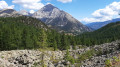
Fort Janus, starting from Montgenèvre

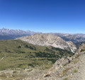
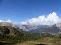
A visit to Fort Janus is a very interesting experience. To enable hikers and tourists to visit this fortification, I suggest a route that combines a mix of ski lifts and walking, which is sure to delight young and old alike.

Details

37555929
Creation:
Last update:
Last review:
  • Walking
    Activity: Walking
  • ↔
    Distance: 8.11 mi
  • ◔
    Average duration: 6h 50 
  • ▲
    Difficulty: Moderate

  • ⚐
    Back to start: Yes
  • ↗
    Ascent: + 3,527 ft
  • ↘
    Descent: - 3,524 ft

  • ▲
    Highest point: 8,310 ft
  • ▼
    Lowest point: 5,968 ft

Description of the walk

Park in the car park at the Télémix des Chalmettes.

(S/E) Take the Télémix to the top station.

(1) Then descend along the wide, well-secured track – which is separated for mountain bikers and walkers – to reach the lower station of the Gondrans chairlift.

(2) Take the chairlift to the top station.

(3) Descend along the path through the mountain pasture and, at the bottom of the descent, reach the Gondrans military complex.

(4) Continue along the wide track to reach the barrier on the road leading to Fort du Janus.

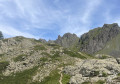
(5) Pass through the barrier, continue uphill along the wide track to complete the ascent to Fort du Janus and begin your tour of the Maginot Fort here (see ‘Practical Information’ for details of this tour).

(6) After the tour, take the opportunity to visit the ruins of the original fort.

(7) Begin the descent to return to the crossroads by the barrier.

(5) Turn left and head down the well-maintained, wide path running parallel to the Querelay ski lift. Return to the junction by the Gondrans chairlift station.

(2) Follow the same route back uphill to return to the upper station at Les Chalmettes.

(1) Take the Télémix to reach the Chalmettes Télémix car park (S/E).

Waypoints

  1. S/E : mi 0 - alt. 5,968 ft - Chalmettes Télémix car park
  2. 1 : mi 1.09 - alt. 7,182 ft - Chalmettes upper station
  3. 2 : mi 1.68 - alt. 6,877 ft - Gondrans lower station - La Durance
  4. 3 : mi 2.87 - alt. 8,028 ft - Gondrans top station
  5. 4 : mi 3.22 - alt. 7,694 ft - Gondrans Barracks
  6. 5 : mi 3.7 - alt. 7,789 ft - Barrier
  7. 6 : mi 4.64 - alt. 8,284 ft - Fort Janus Maginot
  8. 7 : mi 4.77 - alt. 8,307 ft - Fort Janus - Ouvrage du Janus
  9. S/E : mi 8.11 - alt. 5,968 ft - Chalmettes Télémix car park

Notes

(6) Fort Janus Maginot: this tour is organised every Thursday in summer by the Fort Janus Association. To take part, please register at Montgenèvre Town Hall. Price for 2023: €10. The price for the ski lifts is €12.50.
For the hike as described, the walking distances are: 600m descent and 320m ascent

Worth a visit

Reviews and comments

4.7 / 5
Based on 1 review

Reliability of the description
5 / 5
Ease of following the route
4 / 5
Route interest
5 / 5
User 17887118

Overall rating : 4.7 / 5

Date of your route : Jul 25, 2025
Reliability of the description : ★★★★★ Very good
Ease of following the route : ★★★★☆ Good
Route interest : ★★★★★ Very good
Very busy route : No

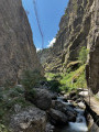
As the Chalmettes cable car was closed, we did this circuit except for the lower section, where we went through the forest.
Be careful between points 2 and 5, as the climb is quite steep along the ski lift. Perhaps we should have continued by climbing up a path between the ski lift and the Gondrans chairlift.
Bring water as there are no springs on the hike.
The view is extraordinary, with a 360° panorama. A must-see in Montgenèvre.

Machine-translated

Other walks in the area

For more walks, use our search engine .

The GPS track and description are the property of this route's author. Please do not copy them without permission.