


Refine your search for walks in Langoat
Langoat walks


 La Roche-Derrien and the Hortence Garden
 Visorando Member
 7.58 mi
 +469 ft
 -472 ft
 3h 55
3h 55
 Moderate
 Departure from Langoat (Côtes-d'Armor)
This walk begins and ends on the banks of the ponds at La Roche-Derrien (Crec’h an Goué). The route first takes us to St Anne’s Chapel, which is part of Kermézen Castle. We then cross the Hortence Garden (10ha), where a Dutch couple grow hydrangeas to export to the land of tulips. We finish by admiring the view of Le Jaudy from a promontory, the Oppidum de La Roche, with the Calvaire Chapel.
Quemperven and its surroundings
7.14 mi
+272 ft
-266 ft
3h 30
Moderate
Departure from Quemperven (Côtes-d'Armor)
Sunken paths and lush woodland all inspire a sense of calm and tranquillity during this walk, which features a few more challenging sections.
Tréguier and its surroundings
 7.32 mi
+525 ft
-545 ft
3h 50
Moderate
Departure from Minihy-Tréguier (Côtes-d'Armor)
7.32 mi
+525 ft
-545 ft
3h 50
Moderate
Departure from Minihy-Tréguier (Côtes-d'Armor)
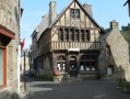
During this walk, you will discover Tréguier with its Saint-Yves cathedral, narrow cobbled streets and stone houses, including that of Ernest Renan, a famous writer of the late 19th century. You will also enjoy the banks of the Guindy, a small river that flows into the Jaudy. As both rivers are subject to tidal influences, it is advisable to set off an hour before high tide to make the most of the scenery.
The banks of the Guindy, the Kélomad Chapel and an old railway line
 7.06 mi
+338 ft
-322 ft
3h 35
Moderate
Departure from Tréguier (Côtes-d'Armor)
7.06 mi
+338 ft
-322 ft
3h 35
Moderate
Departure from Tréguier (Côtes-d'Armor)
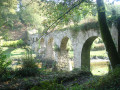
From Tréguier, the town of Ernest Renan and capital of Trégor with its Saint-Yves Cathedral, come and stroll along the Guindy. You will then discover the small Kélomad Chapel, rebuilt in the early 19th century, and walk along the old Nord-Trégor railway line.
The sunken paths north of Hengoat
7.33 mi
+262 ft
-266 ft
3h 35
Moderate
Departure from Hengoat (Côtes-d'Armor)
Hengoat, a small commune in the Côtes-d’Armor whose name can be translated into French as “The Old Wood” (hen = old and goat = wood), was voted “Commune of the World” in 2012.
This route, which unfortunately runs on tarmac for too much of the way, allows you to explore the surroundings of this Breton village via some very beautiful sunken paths.
A journey back in time with the Trégor routoirs
 7.08 mi
+315 ft
-292 ft
3h 30
Moderate
Departure from Pouldouran (Côtes-d'Armor)
7.08 mi
+315 ft
-292 ft
3h 30
Moderate
Departure from Pouldouran (Côtes-d'Armor)
After walking along the Bizien Mill Stream, you will come across the first routoirs. Then, after crossing the Rolland Mill, there is a whole route to explore the main routoirs of the Trégorrois region.
Walk through the heart of Trégor between Pouldouran and Troguéry
 4.91 mi
+171 ft
-154 ft
2h 25
4.91 mi
+171 ft
-154 ft
2h 25
 Easy
Departure from Pouldouran (Côtes-d'Armor)
Easy
Departure from Pouldouran (Côtes-d'Armor)
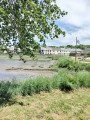
An easy walk offering typical landscapes between the river and the countryside, as well as numerous examples of Trégor’s heritage, including the famous flax-drying sheds, the cultivation of which brought prosperity to this corner of Trégor.
Hent Glas route around Hengoat
 6.07 mi
+243 ft
-236 ft
3h 00
Moderate
Departure from Hengoat (Côtes-d'Armor)
6.07 mi
+243 ft
-236 ft
3h 00
Moderate
Departure from Hengoat (Côtes-d'Armor)
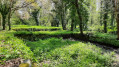
A walk through the Hengoat countryside: a peaceful, quiet route with no particular difficulties. You can take the time to listen, hear and admire the birds!The route is well signposted; the blue markings were put in place by volunteers from the Glad war dro Hengoad association (Hengoat heritage). A map of the route is available outside the town hall at the start of the walk.
A stroll through the heritage of Rospez
 5.54 mi
+102 ft
-102 ft
2h 40
Easy
Departure from Rospez (Côtes-d'Armor)
5.54 mi
+102 ft
-102 ft
2h 40
Easy
Departure from Rospez (Côtes-d'Armor)
This walk through the heritage of Rospez is offered by the "heritage" group of the "Ro'Spered" association.
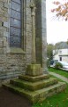
The remarkable sites linked together are very diverse: parish church, chapels, fountain, crosses or calvaries, flax scutching machine, Bronze Age tumulus, restored wash house... crossroads of three Roman roads...
A hike through the Rospez countryside, discovering the remains of a past dating back nearly three millennia...
From Poulloguer Pond to Coatascorn
 6.98 mi
+469 ft
-479 ft
3h 35
Moderate
Departure from Prat (Côtes-d'Armor)
6.98 mi
+469 ft
-479 ft
3h 35
Moderate
Departure from Prat (Côtes-d'Armor)
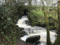
Although this walk uses a few tarmac roads, priority has been given here to forest paths and tracks open to farm machinery. In return, it offers magnificent scenery both around Poulloguer Pond and along the stream of the same name, with a very pleasant walk through the village of Coatascorn, a quintessential Trégor village with all its stone houses.
Land and sea around Trévou-Tréguignec
 4.81 mi
+217 ft
-220 ft
2h 25
Easy
Departure from Trévou-Tréguignec (Côtes-d'Armor)
4.81 mi
+217 ft
-220 ft
2h 25
Easy
Departure from Trévou-Tréguignec (Côtes-d'Armor)
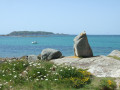
After passing through the Trestel Marshes nature reserve and the woodland overlooking it to the west, this route follows sections of the GR®34 via the small ports of Kériec and Le Goff. A lovely finish at Trestel’s fine-sand beach. Panoramic views of Île Tomé and the bird sanctuary of the Archipelago of the Seven Islands.
The coast between Trestel and Trélévern
6.66 mi
+554 ft
-554 ft
3h 35
Moderate
Departure from Trévou-Tréguignec (Côtes-d'Armor)
Three circular routes to suit everyone's needs, but all of them allow you to discover the Trégorrois region and the coast.
The Buguélès foreshore
 6.77 mi
+210 ft
-203 ft
3h 20
Moderate
Departure from Plougrescant (Côtes-d'Armor)
6.77 mi
+210 ft
-203 ft
3h 20
Moderate
Departure from Plougrescant (Côtes-d'Armor)
The Buguéles foreshore is a labyrinth covering more than 2,000 hectares, submerged at high tide but accessible at low tide. A maze of rocks, centred around six main islands – some of which are inhabited – criss-crossed by more or less defined paths.A real treat for exploring, for the views, and for taking photos.The circular walk returns via sunken paths beneath the trees.At high tide: do not venture onto the foreshore.
Trestel and Port-Blanc
 7.11 mi
+305 ft
-299 ft
3h 30
Moderate
Departure from Trévou-Tréguignec (Côtes-d'Armor)
7.11 mi
+305 ft
-299 ft
3h 30
Moderate
Departure from Trévou-Tréguignec (Côtes-d'Armor)
This hike in Trégor is not particularly difficult. After following the coast along the customs officers' path and catching a glimpse of Île des Femmes and Île Saint-Gildas, you will discover Port Blanc before heading inland to explore the Trestel marshes.
Around the Roche Jaune
 7.15 mi
+387 ft
-387 ft
3h 40
Moderate
Departure from Plouguiel (Côtes-d'Armor)
7.15 mi
+387 ft
-387 ft
3h 40
Moderate
Departure from Plouguiel (Côtes-d'Armor)
What could be more unusual than a hike in the bed of an estuary? What could be more romantic than a walk up the bed of a rushing stream? What could be more relaxing than a stroll through the green countryside of Trégor? What could be more spectacular than a panoramic view of an estuary?
You will discover all this during this walk, which we recommend you do at high tide with low or medium coefficients (below 80).
Port Blanc le Royau loop
 4.71 mi
+69 ft
-66 ft
2h 15
Easy
Departure from Penvénan (Côtes-d'Armor)
4.71 mi
+69 ft
-66 ft
2h 15
Easy
Departure from Penvénan (Côtes-d'Armor)
Between the communes of Penvénan and Trévou Tréguignec, the circuit takes you from Port Blanc to Plage du Royau, where you'll discover a beautiful coastline and local history.
Exploring the Guindy Valley
 7.37 mi
+164 ft
-171 ft
3h 30
Moderate
Departure from Cavan (Côtes-d'Armor)
7.37 mi
+164 ft
-171 ft
3h 30
Moderate
Departure from Cavan (Côtes-d'Armor)
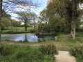
This walk between Cavan and Tonquédec is very easy. It begins and ends with a covered avenue lined with sculptures: this is the Vallée des Arts. Unfortunately, over time, some of the sculptures have disappeared. After exploring the Guindy Valley, you’ll finish with the ‘Apple Tree Avenue’: a wide avenue lined with around a hundred apple trees of various species, where anyone is free to pick apples.
From Port L'Epine to the Vallée des Moulins via Trestel
 7.17 mi
+446 ft
-427 ft
3h 40
Moderate
Departure from Trélévern (Côtes-d'Armor)
7.17 mi
+446 ft
-427 ft
3h 40
Moderate
Departure from Trélévern (Côtes-d'Armor)
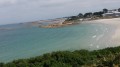
This walk in the Trégorrois region will take you first to Palud beach (Port l'Epine), then to the woods of Trévou-Tréguirec, before visiting the hinterland of Trélévern with its streams and lakes, and finally to the Vallée des Moulins along the Ruisseau de Dourdu. Finally, the coastal path runs along the cove of Perros, with Perros-Guirec filling the horizon to the west.
The Trieux Mills, starting from Pontrieux
 5.59 mi
+404 ft
-387 ft
2h 55
Easy
Departure from Pontrieux (Côtes-d'Armor)
5.59 mi
+404 ft
-387 ft
2h 55
Easy
Departure from Pontrieux (Côtes-d'Armor)
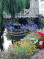
Pontrieux, a charming little town, serves as the starting point for this idyllic walk along the Trieux upstream.
There used to be twenty-five mills between Pontrieux and Guingamp. Many of them still remain. Let’s set off to explore this river.
The Pointe de Plougrescant
 8.20 mi
+308 ft
-315 ft
4h 00
Moderate
Departure from Plougrescant (Côtes-d'Armor)
8.20 mi
+308 ft
-315 ft
4h 00
Moderate
Departure from Plougrescant (Côtes-d'Armor)
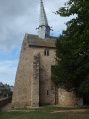
The Pointe de Plougrescant is recognised around the world due to Castel-Meur: the house between the rocks. The hike starts at Saint-Gonery Chapel, equally famous for its crooked lead bell tower. The hike continues via the Baie de l'Enfer where you can admire the Jaudy estuary, then on to Pointe du Château - the most northerly point of this route - to see Castel Meur (private property) and finally to discover the gulf before returning to the departure point along the west coast of the point.
Brélidy and its surroundings
 7.94 mi
+515 ft
-545 ft
4h 05
Moderate
Departure from Brélidy (Côtes-d'Armor)
7.94 mi
+515 ft
-545 ft
4h 05
Moderate
Departure from Brélidy (Côtes-d'Armor)
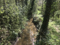
A very pleasant walk through the forest with a few slightly challenging sections, but these should not put off beginners as they are more than made up for by the lovely views of the local rivers, far from the noise of the town.
It ends with the panoramic view from the oppidum.
From Kerbors, the banks of the Jaudy and the early vegetable fields.
7.60 mi
+233 ft
-233 ft
3h 40
Moderate
Departure from Kerbors (Côtes-d'Armor)
The Jaudy, along with the Guindy, are the two coastal rivers that form the Lézardrieux peninsula. This ends in the English Channel via the famous Sillon de Talbert (a strip of sand 3 km long and 100 m wide). Come and discover, on the way out, the Ria du Jaudy and its rugged coastline, and on the way back, follow the vegetable fields (mainly artichokes and cauliflowers).
Trieux peninsula between Kerbors and Brestan
 7.97 mi
+308 ft
-308 ft
3h 55
Moderate
Departure from Kerbors (Côtes-d'Armor)
7.97 mi
+308 ft
-308 ft
3h 55
Moderate
Departure from Kerbors (Côtes-d'Armor)
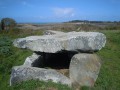
A sea and land circuit on the wild peninsula, to discover the mouth of the Jaudy and the oldest granite rocks in France, at Port-Béni (1.7 billion years old).
Always check the tide times.
From east to west, Estuary, Islets and Craggy rocks at Plougrescant
 5.85 mi
+108 ft
-102 ft
2h 45
Easy
Departure from Plougrescant (Côtes-d'Armor)
5.85 mi
+108 ft
-102 ft
2h 45
Easy
Departure from Plougrescant (Côtes-d'Armor)
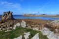
This route takes you on a tour of the different faces of the Plougrescant coastline, with a variety of landscapes. The islands of Loaven and Er, which punctuate the Jaudy estuary, are the scene of major oyster-farming activity at low tide. At high tide, the islands are popular for water sports, especially kayaking.Then there's the rugged coastline of the northern tip, where raw nature and moorland take on their full character.
The Jaudy estuary and the covered walkway of Men ar Rompet
 1.93 mi
+125 ft
-125 ft
1h 00
Easy
Departure from Kerbors (Côtes-d'Armor)
1.93 mi
+125 ft
-125 ft
1h 00
Easy
Departure from Kerbors (Côtes-d'Armor)
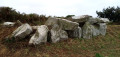
A very short hike that starts off the trail, following the right bank of the Jaudy estuary. It then quickly heads inland, offering some beautiful views of the sea. At the end of the trail, you can visit a very beautiful covered alley, which is well preserved.
N.B. Do not undertake this hike at high tide (see practical information).
From Tonquédec to the castle ruins via the Léguer
7.26 mi
+371 ft
-381 ft
3h 40
Moderate
Departure from Tonquédec (Côtes-d'Armor)
There is virtually no elevation gain on this walk in the Trégor forest. Just magnificent scenery, starting with paths through chestnut trees, then a walk along the banks of the Léguer, ending with a visit to the imposing ruins of Tonquédec Castle. At the end of the walk, don't forget to visit the village church.
Castles and chapels in the Trégor
7.14 mi
+587 ft
-617 ft
3h 50
Moderate
Departure from Tonquédec (Côtes-d'Armor)
The chapels of Kerrivoalan and Saint-Gildas on the one hand; but also Kergrist Castle (a private residence open to visitors only in summer) and, of course, the ruins of Tonquédec Castle and its oratory on the other; and finally the mills at Traoumorvan, Kergrist and Kergrot bear witness, throughout this route, to a Brittany that was once warlike, devout and agricultural, but has now become a tourist destination.
To the east of Tonquédec
 7.15 mi
+236 ft
-236 ft
3h 30
Moderate
Departure from Tonquédec (Côtes-d'Armor)
7.15 mi
+236 ft
-236 ft
3h 30
Moderate
Departure from Tonquédec (Côtes-d'Armor)
We are not inviting you to hike towards Tonquédec Castle, which was dismantled around 1626 on the orders of Richelieu and is situated to the north-west of the village of the same name, but rather to the south-east of this village. There we will find the Guindy, a river dear to the people of Trégor, as well as green sunken paths in lush countryside.