


Grande traversée des Alpes

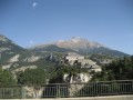
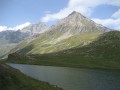
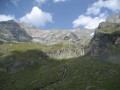
Grande Traversée des Alpes de la Tarentaise au Queyras en passant par la Vanoise.
Details
Creation:
Last update:
Last review:
–
–
-
 Activity: Walking
 -
 Distance: 111.98 mi
 -
 Average duration: 8 days
 -
 Difficulty: Difficult
 -
-
 Back to start: No
 -
 Ascent: + 33,333 ft
 -
 Descent: - 27,844 ft
 -
-
 Highest point: 9,022 ft
 -
 Lowest point: 2,438 ft
 Country:

 City:
City:


Photos
Stages of the route
This route needs several days, find the details below:
Other walks in the area
Landry - Refuge Entre Le Lac
 Visorando Member
10.52 mi
+4,751 ft
-112 ft
9h 00
Difficult
Visorando Member
10.52 mi
+4,751 ft
-112 ft
9h 00
Difficult
 Departure from Landry (Savoie)
Étape de la Grande Traversée des Alpes dans la vallée de la Tarentaise autour du Mont Pourri jusqu'au lac de la Plagne où se trouve le refuge Entre Le Lac.
Charmettes Circular in Peisey-Nancroix
4.57 mi
+1,335 ft
-1,335 ft
3h 15
 Moderate
Departure from Peisey-Nancroix (Savoie)
Moderate
Departure from Peisey-Nancroix (Savoie)
A short walk for children through the hamlets between Le Villaret and Vallandry.
Much of the ascent is by cable car (free of charge). Afterwards, it’s a pleasant walk through the forest with lovely views of the valley and, if the weather is fine, the chance to see Mont Blanc.
The Vernettes Chapel
 Association / Club / Walk leader
 2.96 mi
+617 ft
-614 ft
1h 55
2.96 mi
+617 ft
-614 ft
1h 55
 Easy
Departure from Peisey-Nancroix (Savoie)
Easy
Departure from Peisey-Nancroix (Savoie)
The Chapelle des Vernettes is a highlight of Baroque religious art in the Tarentaise region and a must-see hike in the Peisey Valley.
Its main advantage is its accessibility, which can become a problem in the height of summer when many cars make the trip.
The Aiguille Rousse
 6.78 mi
+3,281 ft
-3,281 ft
6h 00
Difficult
Departure from Peisey-Nancroix (Savoie)
6.78 mi
+3,281 ft
-3,281 ft
6h 00
Difficult
Departure from Peisey-Nancroix (Savoie)
Whether seen from Nancroix or Les Vernettes, where it displays its impressive red cliff face, or from Le Rosuel, where it resembles a castle tower, the Aiguille Rousse is always impressive! However, it is only the chance of the relief that gives it this appearance of a watchtower over the valley. Its neighbour, the Aiguille Grive, is significantly higher, but also easier to access. Indeed, it is better not to be afraid of heights at the top of the Rousse!
Lake Etroit
 4.29 mi
+2,661 ft
-2,661 ft
4h 15
Moderate
Departure from Peisey-Nancroix (Savoie)
4.29 mi
+2,661 ft
-2,661 ft
4h 15
Moderate
Departure from Peisey-Nancroix (Savoie)
Another classic in the Peisey valley, with a bird's eye view of the village and a beautiful panorama of Mont Pourri. The route is steep and somewhat exposed, but it is possible to make a round trip via the descent route.
Circular walk from the Chapelle des Vernettes, starting at La Chénarie
 2.32 mi
+1,106 ft
-1,109 ft
2h 00
Moderate
Departure from Peisey-Nancroix (Savoie)
2.32 mi
+1,106 ft
-1,109 ft
2h 00
Moderate
Departure from Peisey-Nancroix (Savoie)
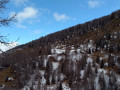
A lovely circular walk through the Ruisseau de Poncet valley, passing through the Caro Blanc forest and the Vernettes Chapel.
There are a few fairly steep climbs, but you’ll be rewarded with a lovely view halfway through the walk.
Pointe de Friolin
 Tourism professional
 8.57 mi
+4,478 ft
-4,472 ft
7h 50
Difficult
Departure from Bellentre (Savoie)
8.57 mi
+4,478 ft
-4,472 ft
7h 50
Difficult
Departure from Bellentre (Savoie)
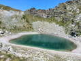
A lovely hike that allows you to enjoy very different terrains: forest, alpine pastures, rocks. Beautiful view of the Beaufortain, especially the Pierra Menta, and allows you to approach the menacing north face of Bellecôte. As a bonus, an easy 3000-metre peak.
Lac de la Portette
 7.02 mi
+2,539 ft
-2,513 ft
5h 25
Moderate
Departure from La Côte-d'Aime (Savoie)
7.02 mi
+2,539 ft
-2,513 ft
5h 25
Moderate
Departure from La Côte-d'Aime (Savoie)
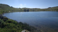
Lac de la Portette is a beautiful hiking destination in the Beaufortain, at the foot of the Grande Pareï cliff. And as I've always preferred loops to round trips, the Col du Mont Rosset and the return via the Balme refuge offer a nice bonus with views of the Pierra Menta, an iconic peak if ever there was one.
For more walks, use our search engine .
The GPS track and description are the property of this route's author. Please do not copy them without permission.

