


Refine your search for walks in Lac du Clou (2370 m) - Vallée de la Tarantaise
Lac du Clou (2370 m) - Vallée de la Tarantaise walks


 Lac du Clou and Col de l'Aiguille
 Visorando Member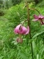
 7.15 mi
 +2,703 ft
 -2,703 ft
 5h 40
5h 40
 Moderate
 Departure from Sainte-Foy-Tarentaise (Savoie)
A magnificent circular if you don't have fog like we did.
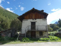
Lac du Clou and Lacs Verdet via Le Monal
 10.05 mi
+3,501 ft
-3,497 ft
7h 40
Moderate
Departure from Sainte-Foy-Tarentaise (Savoie)
10.05 mi
+3,501 ft
-3,497 ft
7h 40
Moderate
Departure from Sainte-Foy-Tarentaise (Savoie)
In autumn, around the hamlet of Le Monal, the larch trees set the valley ablaze, whilst on the opposite slope the Mont Pourri glaciers glisten in the sun. Higher up, it’s the Balmes glaciers that steal the show.This hike to the lakes is a real feast for the eyes.
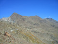
Pointe d’Ormelune and the Lakes Circular Route
 14.07 mi
+5,023 ft
-5,020 ft
12 hrs
14.07 mi
+5,023 ft
-5,020 ft
12 hrs
 Very difficult
Departure from Sainte-Foy-Tarentaise (Savoie)
Very difficult
Departure from Sainte-Foy-Tarentaise (Savoie)
A long and beautiful route in the Alpes Grées (the Haute Tarentaise border range) combining a walk through a listed village (Le Monal), an ascent of a listed valley (du Clou), a summit of the border range offering sweeping views of the French and Italian Alps, and finally a circular route allowing you to explore a fine variety of glacial lakes.
Regarding the ‘Very Difficult’ rating for the route: see the ‘Practical Information’ section.This hike is reserved for fit and experienced hikers.
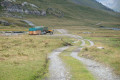
From the Mario Bezzi refuge to the Chenal car park via the Col du Rocher Blanc
 7.92 mi
+2,031 ft
-3,937 ft
5h 25
7.92 mi
+2,031 ft
-3,937 ft
5h 25
 Difficult
Departure from Valgrisenche (Aosta Valley)
Difficult
Departure from Valgrisenche (Aosta Valley)
The final day of the Tour de l’Archeboc features a long, beautiful climb to the Col du Rocher Blanc, followed by a descent on the French side back to our starting point at Chenal. Views of the Italian and then French glaciers throughout today’s route.
Archeboc Circuit
30.96 mi
+10,476 ft
-10,479 ft
4 days
Difficult
Departure from Sainte-Foy-Tarentaise (Savoie)
A four-day loop with three nights in mountain huts, starting from the Chenal car park in Sainte-Foy Tarentaise, between France and Italy via the Archeboc, Chalet de l’Épée and Mario Bezzi mountain huts.
No technical difficulties on the route: the difficulty here depends solely on the distance and the elevation gain.
Very few people along the entire route (completed in mid-August). Beautiful, varied views every day.
Walks near Lac du Clou (2370 m) - Vallée de la Tarantaise
From Le Chenal to the Refuge de l’Archeboc
 8.69 mi
+2,467 ft
-1,388 ft
6h 10
Moderate
Departure from Sainte-Foy-Tarentaise (Savoie)
8.69 mi
+2,467 ft
-1,388 ft
6h 10
Moderate
Departure from Sainte-Foy-Tarentaise (Savoie)
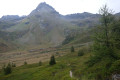
First stage of the Tour de l’Archeboc. The route runs mainly through the forest with lovely views of Mont Pourri right from the start, leading to the Refuge de l’Archeboc.
Tour of the Alpes Grées
 55.38 mi
+20,118 ft
-18,793 ft
7 days
Difficult
Departure from Sainte-Foy-Tarentaise (Savoie)
55.38 mi
+20,118 ft
-18,793 ft
7 days
Difficult
Departure from Sainte-Foy-Tarentaise (Savoie)
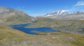
The Franco-Italian Alpes Grées mountain range lies in Savoie on the French side, and spans two valleys in Italy: the Aosta Valley and the Piedmont Valley.
Much of the Grées Alps is covered by two national parks: the Vanoise and the Gran Paradiso.
A truly alpine route where you’ll remain above 2,300 metres, with magnificent views of the glaciers, not to mention the sections through the Fontine and Beaufort mountain pastures.
Chenal – Mario Bezzi Refuge
 8.01 mi
+3,907 ft
-2,037 ft
7h 05
Difficult
Departure from Sainte-Foy-Tarentaise (Savoie)
8.01 mi
+3,907 ft
-2,037 ft
7h 05
Difficult
Departure from Sainte-Foy-Tarentaise (Savoie)
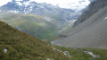
A steady climb taking you through La Combaz and the listed village of Le Monal with its small lakes, with a breathtaking view of Mont Pourri in the background; further up, you’ll cross the Vallon du Clou, which has been listed and protected since March 2013, to reach the Col du Rocher Blanc (2,830 m), and then descend to the Refuge de Mario Bezzi.
From the Refuge de l’Archeboc to the Refuge Chalet de l’Épée via the Col du Mont
 8.32 mi
+3,921 ft
-2,805 ft
7h 15
Difficult
Departure from Sainte-Foy-Tarentaise (Savoie)
8.32 mi
+3,921 ft
-2,805 ft
7h 15
Difficult
Departure from Sainte-Foy-Tarentaise (Savoie)
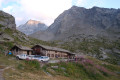
The second stage of the Tour de l’Archeboc, which features the greatest elevation gain of the entire route. The day begins with a climb of around two hours to the Col du Mont, which offers a magnificent view of what lies ahead: a long descent on the Italian side to the bottom of the Valgrisenche, followed by a climb back up to the Refuge Chalet de l’Epée.
From the Turia Refuge to Les Arcs 2000 via the mountain pastures of La Riondaz
 5.63 mi
+1,647 ft
-2,569 ft
4h 00
Moderate
Departure from Villaroger (Savoie)
5.63 mi
+1,647 ft
-2,569 ft
4h 00
Moderate
Departure from Villaroger (Savoie)
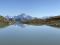
The fourth and final stage of a 4-day circuit around Mont Pourri. In the heart of the Vanoise National Park, this stage sets off from the Turia mountain hut and finishes at the starting point in Les Arcs 2000. A walk past the Turia Glacier and the Grand Col, with small glacial lakes reflecting Mont Blanc. Blueberries, heather, forests and a gentle return to civilisation.
From the Refuge de la Martin to the Refuge de Turia via La Gurraz
 6.47 mi
+3,615 ft
-2,828 ft
6h 05
Difficult
Departure from Villaroger (Savoie)
6.47 mi
+3,615 ft
-2,828 ft
6h 05
Difficult
Departure from Villaroger (Savoie)
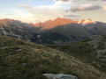
The third stage of a 4-day hiking tour around Mont Pourri. In the heart of the Vanoise National Park, this stage sets off from the La Martin Refuge and ends at the foot of Mont Turia and the refuge of the same name. The route takes you past glaciers and small lakes, and passes close to the very picturesque village of La Gurraz.
Breathtaking views of Mont Blanc and all the mountains stretching towards the Italian border.
Mario Bezzi – Benevolo
 7.31 mi
+3,648 ft
-3,629 ft
6h 30
Difficult
Departure from Valgrisenche (Aosta Valley)
7.31 mi
+3,648 ft
-3,629 ft
6h 30
Difficult
Departure from Valgrisenche (Aosta Valley)
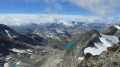
Hike up the magnificent glacial valley, which marks the end of the Val Grisenche, overlooking the imposing Glariettez Glacier. Access to the Val de Rhême via the Col de Bassac-Déré (3,082 m), then a descent through a high-mountain landscape to Lac de Golettaz, where the seracs are reflected in the water. The route then descends through the mountain pastures to the Refuge Benevolo (2,285 m).
From Les Arcs to the Mont Pourri Refuge via the Lakes Trail
 4.30 mi
+1,542 ft
-689 ft
3h 20
Moderate
Departure from Bourg-Saint-Maurice (Savoie)
4.30 mi
+1,542 ft
-689 ft
3h 20
Moderate
Departure from Bourg-Saint-Maurice (Savoie)
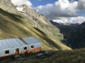
The first stage of a 4-day circuit around Mont Pourri. In the heart of the Vanoise National Park, this stage sets off from a very modern ski resort and ends at the foot of the glaciers in a wild, unspoilt landscape. Breathtaking views of Bellecôte (north face), the Aliet and its magnificent debris cone, as well as the Grande Motte and the Plan de la Plagne valley.
From the Refuge du Mont Pourri to the Refuge de la Martin
 9.19 mi
+3,071 ft
-3,757 ft
6h 55
Difficult
Departure from Peisey-Nancroix (Savoie)
9.19 mi
+3,071 ft
-3,757 ft
6h 55
Difficult
Departure from Peisey-Nancroix (Savoie)
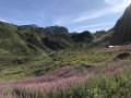
The second stage of a 4-day walking tour around Mont Pourri. In the heart of the Vanoise National Park, this stage sets off from the Refuge du Mont Pourri and finishes at the Refuge de La Martin.
This is the most rocky stage, passing through the highest point of the tour at the Col de la Sachette. It is also the longest stage, but offers a great variety of scenery and a good chance of spotting chamois.
From the Chalet de l’Épée mountain hut to the Mario Bezzi mountain hut
 6.01 mi
+2,044 ft
-2,313 ft
4h 35
Moderate
Departure from Valgrisenche (Aosta Valley)
6.01 mi
+2,044 ft
-2,313 ft
4h 35
Moderate
Departure from Valgrisenche (Aosta Valley)
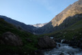
The third stage of the Tour de l’Archeboc, between France and Italy. A day offering panoramic views of several French and Italian glaciers. Shorter in distance and elevation gain than the other days of the tour, but with a few slightly more technical sections (scree slopes).