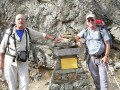
From the Mario Bezzi refuge to the Chenal car park via the Col du Rocher Blanc

The final day of the Tour de l’Archeboc features a long, beautiful climb to the Col du Rocher Blanc, followed by a descent on the French side back to our starting point at Chenal. Views of the Italian and then French glaciers throughout today’s route.

This walk is part of a multi-day hike: Tour de l'Archeboc

Details

107399513
Creation:
Last update:
Last review:
  • Walking
    Activity: Walking
  • ↔
    Distance: 7.92 mi
  • ◔
    Average duration: 5h 25 
  • ▲
    Difficulty: Difficult

  • ⚐
    Back to start: No
  • ↗
    Ascent: + 2,031 ft
  • ↘
    Descent: - 3,937 ft

  • ▲
    Highest point: 9,285 ft
  • ▼
    Lowest point: 5,571 ft
  • ⚐ Country: Italy
  • ⚐
    Area: Alps
  • ⚐ City: Valgrisenche 
  • ⚑
    Start: N 45.540898° / E 7.018012°
  • ⚑
    End: N 45.546274° / E 6.913335°
  • ❏
    IGN map(s): Ref. 3532ET, 3532ETR
  • Hour-by-hour weather

Photos

Description of the walk

(S) Leave the refuge heading south towards the stream. Take the footbridge over the stream and climb up the other side.

(1) At a fork in the road, turn right (leaving the path on the left that climbs towards Lago Vuert). Follow route 12D and begin a steady climb up the mountainside, heading north-north-west then north-west.

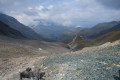
(2) At another junction, follow route 12D to the left towards the Col du Rocher Blanc. Climb up a small valley, west-north-west, through increasingly rocky terrain. You will reach the pass, which marks the border between Italy and France.

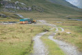
(3) Descend on the other side, due west. After a brisk descent, you’ll reach the Balmes mountain pasture.

(4) Then turn left (south-west) onto a track that descends gently to Lac du Clou.

(5) At the fork in the road, keep to the left and continue the descent along the track.

(6) Carry on along the track, ignoring a path that branches off to the right (towards Le Monal).

(7) When the track takes a hairpin bend to the right, take the path leading straight ahead. Further on, join another path and follow it to the right as far as the hamlet of Le Fenil.

(8) Return to the track and follow it to the left. At a hairpin bend to the right, carry on straight ahead. Further on (elevation 1768), take the hairpin bend to the right. Pass a few chalets on the right and continue along a small road to quickly reach the Chenal car park (E).

Waypoints

  1. S : mi 0 - alt. 7,477 ft - Rifugio Mario Bezzi
  2. 1 : mi 0.24 - alt. 7,493 ft - Fork in the road
  3. 2 : mi 1.82 - alt. 8,593 ft - Junction – Valley entrance
  4. 3 : mi 2.54 - alt. 9,285 ft - Col du Rocher Blanc ou col de Vaudet (2835m)
  5. 4 : mi 4.4 - alt. 7,543 ft - Junction – Les Balmes
  6. 5 : mi 5.33 - alt. 7,277 ft - Fork in the road - Lac du Clou (2370 m) - Vallée de la Tarantaise
  7. 6 : mi 5.85 - alt. 7,005 ft - Junction
  8. 7 : mi 6.49 - alt. 6,444 ft - Start of the path
  9. 8 : mi 6.87 - alt. 6,161 ft - Junction with the track – Le Fenil
  10. E : mi 7.91 - alt. 5,571 ft - Chenal car park

Notes

Very few people on this walk until you reach the path leading to Lac Noir

A fairly steady climb and a brisk descent

Worth a visit

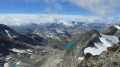
Lovely views towards the Italian side of the Mario Bezzi refuge and the glacier, then over the Grapillon valley.

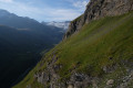
On the descent, lovely views of the Balmes Glacier and Mont Pourri.

Other walks in the area

For more walks, use our search engine .

The GPS track and description are the property of this route's author. Please do not copy them without permission.