From the Turia Refuge to Les Arcs 2000 via the mountain pastures of La Riondaz

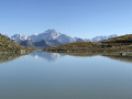
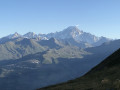
The fourth and final stage of a 4-day circuit around Mont Pourri. In the heart of the Vanoise National Park, this stage sets off from the Turia mountain hut and finishes at the starting point in Les Arcs 2000. A walk past the Turia Glacier and the Grand Col, with small glacial lakes reflecting Mont Blanc. Blueberries, heather, forests and a gentle return to civilisation.

This walk is part of a multi-day hike: Tour of Mont Pourri

Details

n°2620844
Creation:
Last update:
Last review:
  • Walking
    Activity: Walking
  • ↔
    Distance: 5.63 mi
  • ◔
    Average duration: 4h 00 
  • ▲
    Difficulty: Moderate

  • ⚐
    Back to start: No
  • ↗
    Ascent: + 1,647 ft
  • ↘
    Descent: - 2,569 ft

  • ▲
    Highest point: 8,340 ft
  • ▼
    Lowest point: 6,319 ft

Photos

Description of the walk

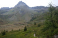
(S) From the refuge, take the path that heads straight down westwards towards the Aiguille Rouge. Climb up to the La Riondaz mountain pasture.

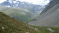
(1) At the top, veer left and follow the ridge towards the scree slopes and a small stream. Cross this stream and follow the cairns (west-south-west) towards the foot of the Aiguille Rouge. You’ll come to the Riondaz glacial lake (facing Mont Blanc and surrounded by magnificent flowers).

(2) Retrace your steps back to the Riondaz mountain pasture.

(1) Head down to the left, heading north-west. Cross the footbridge over the Ruisseau du Lavancher. Then continue downwards.

(3) At the junction, turn left (north-east).

(4) At the junction with the Villaroger nature trail, continue to the left along a gentle ascent.

(5) At the fork in the road, take the path on the left and continue uphill towards the ski runs.

(6) Follow the ski run up to the left, keeping the Plan des Violettes chairlift line on your right.

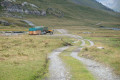
(7) At the Drosset chairlift lower station, turn left. Follow the path up beneath the chairlift line as far as the second pylon (not counting those at the station). Then turn right onto the path that enters the forest. Continue along the path through the forest until you reach the car park at the entrance to Les Arcs 2000 (E).

Waypoints

  1. S : mi 0 - alt. 7,871 ft - Refuge de Turia
  2. 1 : mi 0.38 - alt. 7,930 ft - Riondaz mountain pasture
  3. 2 : mi 0.74 - alt. 8,340 ft - Lac de Riondaz
  4. 3 : mi 2.3 - alt. 6,955 ft - Junction
  5. 4 : mi 2.78 - alt. 6,375 ft - Nature trail
  6. 5 : mi 3.36 - alt. 6,319 ft - Fork in the road
  7. 6 : mi 4.39 - alt. 6,575 ft - Ski run
  8. 7 : mi 4.78 - alt. 6,949 ft - Drosset chairlift
  9. E : mi 5.63 - alt. 6,932 ft - Les Arcs 2000 – Car park

Notes

As this stage is quite short, do take the time to visit the glacial lakes – it’s well worth it.

Worth a visit

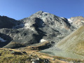
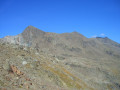
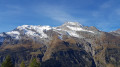
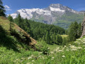
Stunning views of Mont Turia, the Aiguille du Saint-Esprit and the Aiguille Rouge.
Plenty of chamois to spot, and a view of Mont Turia from the mountain hut in the evening.
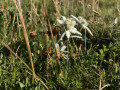
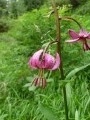
Magnificent flowers, including edelweiss.

Reviews and comments

4.7 / 5
Based on 1 review

Reliability of the description
5 / 5
Ease of following the route
5 / 5
Route interest
4 / 5
Liguori
Liguori

Overall rating : 4.7 / 5

Date of your route : Sep 07, 2023
Reliability of the description : ★★★★★ Very good
Ease of following the route : ★★★★★ Very good
Route interest : ★★★★☆ Good
Very busy route : No

I just wanted to point something out: you recommend hiking up from the Turia mountain hut to Lake Riondaz; then, further on, you say not to miss the ‘glacial lakes’. I went there – there’s a small, cairn-marked path starting from the spot where there’s a sign prohibiting the picking of flowers. But the lakes are completely dry. To be honest, I don’t see the point of making the detour (you still have to climb 150 metres up the scree), as the view from the refuge or on the path towards Les Arcs is the same.
I actually set off from La Savinaz, climbed up to the Turia refuge and came back down to Le Planay, from where I made my way back to La Thuile. You’ll need to arrange to be picked up by car.
Liguori.

Machine-translated

BERTHET Christian
BERTHET Christian

Hello
I’m planning to walk round Mont Pourri in four days, camping near the mountain huts, but I can’t seem to load the route onto my phone, which helps me along the way.
Is there a solution?
Thank you for your reply

Machine-translated

Other walks in the area

For more walks, use our search engine .

The GPS track and description are the property of this route's author. Please do not copy them without permission.