From the Refuge de la Martin to the Refuge de Turia via La Gurraz

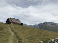
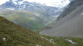
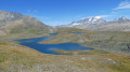
The third stage of a 4-day hiking tour around Mont Pourri. In the heart of the Vanoise National Park, this stage sets off from the La Martin Refuge and ends at the foot of Mont Turia and the refuge of the same name. The route takes you past glaciers and small lakes, and passes close to the very picturesque village of La Gurraz.
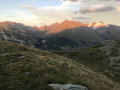
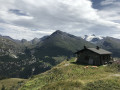
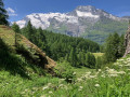
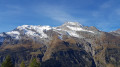
Breathtaking views of Mont Blanc and all the mountains stretching towards the Italian border.

This walk is part of a multi-day hike: Tour of Mont Pourri

Details

n°2620697
Creation:
Last update:
Last review:
–
  • Walking
    Activity: Walking
  • ↔
    Distance: 6.47 mi
  • ◔
    Average duration: 6h 05 
  • ▲
    Difficulty: Difficult

  • ⚐
    Back to start: No
  • ↗
    Ascent: + 3,615 ft
  • ↘
    Descent: - 2,828 ft

  • ▲
    Highest point: 7,927 ft
  • ▼
    Lowest point: 5,164 ft

Photos

Description of the walk

From the refuge, you can take a round trip to explore the face of the Savinnaz Glacier and the Martin. This guide will take you there, but you can shorten the walk by skipping this detour (saving around 45 minutes and 200 m of elevation gain).

(S) From the refuge, take the path leading up towards the west-north-west (the path opposite the refuge door). Follow the path towards the glaciers. Chamois are often spotted here in the morning, so keep a close watch.

(1) Continue west-north-west until you reach a stream. From there, the route is only roughly marked, so take care! Turn left and head up alongside the stream to approach the La Martin and La Savinaz glaciers. Descend by sight towards the 2307-metre altitude you passed on the way up.

(1) Descend via the same route as on the way up to the refuge.

(S) Follow the path below the refuge and immediately head north. Descend to reach the Savinaz Waterfall.

(2) Cross the stream and continue downwards. Follow a series of hairpin bends until you reach a track.

(3) Carry on straight ahead until you reach a car park.

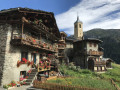
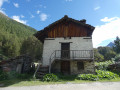
(4) Turn right to explore the narrow streets of the village of La Gurraz (pronounced “Gur”), typical of the valley’s architecture and featuring flower-filled balconies.

(5) Retrace your steps.

(5) Turn right and start climbing (north-north-west). Follow the winding path; the climb is steep but the view of Mont Blanc is magnificent. Ignore the turn-off to the left for the hamlet of Le Fenil. Head south and reach the hamlet of Le Cousset.

(6) Turn right and continue climbing towards the Refuge de Turia. Follow the Ruisseau des Fresses and reach the refuge (E).

Waypoints

  1. S : mi 0 - alt. 7,080 ft - Refuge de la Martin
  2. 1 : mi 0.45 - alt. 7,598 ft - Junction of the circular Glacier Loop
  3. 2 : mi 2.27 - alt. 6,437 ft - Cascade de la Savinaz
  4. 3 : mi 3.57 - alt. 5,243 ft - Junction
  5. 4 : mi 3.74 - alt. 5,217 ft - La Gurraz car park
  6. 5 : mi 3.93 - alt. 5,164 ft - The village of La Gurraz
  7. 6 : mi 5.69 - alt. 6,916 ft - Cousset
  8. E : mi 6.47 - alt. 7,867 ft - Refuge de Turia

Notes

Turia Mountain Hut, 2,410 m:
Claire welcomes you all summer long
19 beds – Tel: 06 95 26 54 63
refuge.turia@vanoise-parcnational.fr
http://refuge-turia.vanoise.com/

Worth a visit

Watch the chamois in the evening on Mont de la Gurraz.

Go for a walk on the Turia Glacier (please note: glacier walking requires proper preparation).

Visit Lake Riondaz beneath the Grand Col and the Aiguille Rouge.

Other walks in the area

For more walks, use our search engine .

The GPS track and description are the property of this route's author. Please do not copy them without permission.