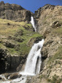
From the Chalet de l’Épée mountain hut to the Mario Bezzi mountain hut

The third stage of the Tour de l’Archeboc, between France and Italy. A day offering panoramic views of several French and Italian glaciers. Shorter in distance and elevation gain than the other days of the tour, but with a few slightly more technical sections (scree slopes).

This walk is part of a multi-day hike: Tour de l'Archeboc

Details

104269889
Creation:
Last update:
Last review:
  • Walking
    Activity: Walking
  • ↔
    Distance: 6.01 mi
  • ◔
    Average duration: 4h 35 
  • ▲
    Difficulty: Moderate

  • ⚐
    Back to start: No
  • ↗
    Ascent: + 2,044 ft
  • ↘
    Descent: - 2,313 ft

  • ▲
    Highest point: 8,711 ft
  • ▼
    Lowest point: 7,477 ft
  • ⚐ Country: Italy
  • ⚐
    Area: Alps
  • ⚐ City: Valgrisenche 
  • ⚑
    Start: N 45.588807° / E 7.060179°
  • ⚑
    End: N 45.54075° / E 7.018194°
  • ❏
    IGN map(s): Ref. 3532ET, 3532ETR
  • Hour-by-hour weather

Photos

Description of the walk

(S) From the refuge, head west, in the opposite direction to the previous day’s arrival, following the panoramic path and Route 11, which you’ll follow all day. Ignore the paths branching off to the right.

(1) At a junction you passed through the previous day, carry on straight ahead (south) and slightly downhill along the mountainside.

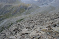
(2) At a junction, continue south-south-west along the panoramic path. Ford two streams. Then begin a climb, traversing west-north-west. Further on, follow tight switchbacks through a scree slope (very well signposted) to reach an unnamed pass (elevation 2610).

(3) Continue south and descend, alternating between traverses and switchbacks. Cross a stream and climb gently again. Pass the altitude of 260 m and descend to a junction. You can turn left here for a round trip to Lac de Saint-Martin (allow for an elevation gain of around 200 m to reach the lake).

(4) Turn right towards the Mario Bezzi Refuge and continue downhill.

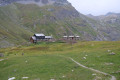
(5) At the next junction, turn right, continuing downhill with the refuge visible further down. You’ll arrive at the Mario Bezzi Refuge (E).

Waypoints

  1. S : mi 0 - alt. 7,769 ft - Refuge de l'Épée (2370m)
  2. 1 : mi 0.63 - alt. 7,497 ft - Junction – Panoramic trail
  3. 2 : mi 1.42 - alt. 8,015 ft - Junction of paths – Panoramic trail
  4. 3 : mi 2.24 - alt. 8,514 ft - Unnamed pass
  5. 4 : mi 5.04 - alt. 8,520 ft - T-junction
  6. 5 : mi 5.66 - alt. 7,976 ft - Junction
  7. E : mi 6.01 - alt. 7,477 ft - Rifugio Mario Bezzi

Notes

There is no water along the route. There are a few scree slopes to cross, all of which were very well signposted when we were there.

There are also a few streams to cross, some via footbridges, others by wading, but these posed no difficulty during our visit (check with the refuge wardens at the start of the season).

Worth a visit

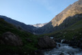
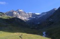
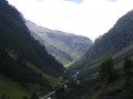
Magnificent views of the glaciers and the valley throughout the day, particularly towards the end on the Gliairetta Glacier at the bottom of the valley, home to the Mario Bezzi mountain hut.

Other walks in the area

For more walks, use our search engine .

The GPS track and description are the property of this route's author. Please do not copy them without permission.