From the Refuge du Mont Pourri to the Refuge de la Martin

The second stage of a 4-day walking tour around Mont Pourri. In the heart of the Vanoise National Park, this stage sets off from the Refuge du Mont Pourri and finishes at the Refuge de La Martin.
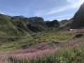
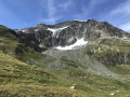
This is the most rocky stage, passing through the highest point of the tour at the Col de la Sachette. It is also the longest stage, but offers a great variety of scenery and a good chance of spotting chamois.

This walk is part of a multi-day hike: Tour of Mont Pourri

Details

n°2620649
Creation:
Last update:
Last review:
  • Walking
    Activity: Walking
  • ↔
    Distance: 9.19 mi
  • ◔
    Average duration: 6h 55 
  • ▲
    Difficulty: Difficult

  • ⚐
    Back to start: No
  • ↗
    Ascent: + 3,071 ft
  • ↘
    Descent: - 3,757 ft

  • ▲
    Highest point: 8,891 ft
  • ▼
    Lowest point: 6,785 ft

Photos

Description of the walk

From the refuge, there are two options: either head straight down towards the Chalet du Geay, or follow the path opposite up towards the Écomusée. The route mapped out and described here follows the second option.

(S) From the refuge, cross the small stream and head east along the ascending path towards the Écomusée, passing via the Plan de la Citra. Follow this balcony-like path, which crosses a series of streams, to the Écomusée (formerly the Refuge Regaud; exhibition on the ascent of Mont Pourri).

(1) Continue south and follow the path which descends quite steeply to a junction.

(2) Turn left (south-east). Cross a few streams and continue south.

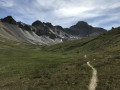
(3) Follow theGR®5to the left (south) and walk along the long, flat stretch of the Plan de la Plagne.

(4) Just before the Chalets de la Plagne, turn left (east) towards the Col de la Sachette. Climb up to the mountain pastures of the Plan de la Sache.

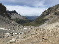
(5) Continue due east towards the Col de la Sachette. Turn left, then right, and climb (south-east) through scree and snowfields. Reach the pass (panoramic view).

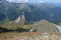
(6) Descend on the other side. Take care: there is a short exposed section, but it is secured by a chain. Reach the Vallon de la Sache.

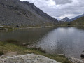
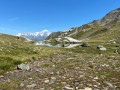
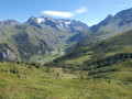
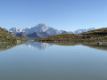
(7) Continue along the valley path, with its gentler slopes and lakes surrounded by cotton grass, offering superb views of the Savinaz glaciers. Reach the Chalet de la Sache d’en haut.

(8) Continue downwards until you reach a junction near the Chalet de la Sache d’en bas.

(9) Turn left and cross the Ruisseau de la Sachette. Leave the chalet on your left and head uphill, heading north.

(10) At Plan des Pierres, continue north-west along the balcony path overlooking Lac du Chevril and the Tignes Dam. This will take you to the Refuge de La Martin (E).

Waypoints

  1. S : mi 0 - alt. 7,772 ft - Refuge du Mont Pourri
  2. 1 : mi 0.58 - alt. 8,087 ft - Eco-museum
  3. 2 : mi 1.14 - alt. 7,228 ft - Carro
  4. 3 : mi 2.5 - alt. 6,867 ft - GR5 junction. Near the - Ponturin (torrent)
  5. 4 : mi 2.98 - alt. 6,923 ft - Chalets de la Plagne
  6. 5 : mi 3.99 - alt. 7,920 ft - Map of La Sache
  7. 6 : mi 4.95 - alt. 8,855 ft - Col de la Sachette
  8. 7 : mi 6.23 - alt. 7,835 ft - Sache Valley
  9. 8 : mi 6.76 - alt. 7,431 ft - Chalet de la Sache d’en haut
  10. 9 : mi 7.27 - alt. 6,785 ft - Crossroads
  11. 10 : mi 8.35 - alt. 6,982 ft - Plan des Pierres
  12. E : mi 9.19 - alt. 7,087 ft - Refuge de la Martin

Notes

Refuge de la Martin (2,155 m):
Warden: Julia and Pascal
Tel: 07 78 51 45 29
http://www.refuge-lamartin.vanoise.com

Bivouacking is permitted; please ask the warden.

Depending on the season, remember to bring small crampons, particularly for the Col de la Sachette, which may be snow-covered.

This stage is long, hence the ‘difficult’ rating; you need to be mindful of your stamina and the weather. As the first stage is shorter, it is also possible to stop for the night at the Refuge Entre-le-Lac rather than the Refuge du Mont Pourri.

Worth a visit

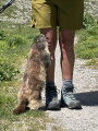
It is very common to spot chamois in the morning on the slopes around the Col de la Sachette.

Magnificent panoramic views, including:
- the hanging glacier to the north-east, visible from the Vallon de la Sache
- the scree slopes in the Vallon de la Sachette
- the Aiguilles de la Sassière and its glacier
- Lac du Chevril and its dam

Always be cautious and plan ahead when you're outdoors. Visorando and the author of this route cannot be held responsible for any accidents occurring on this route.

The GR® and PR® markings are the intellectual property of the Fédération Française de Randonnée Pédestre.

Reviews and comments

4.8 / 5
Based on 2 reviews

Reliability of the description
4.5 / 5
Ease of following the route
5 / 5
Route interest
5 / 5
Isabelle L.
Isabelle L.

Overall rating : 5 / 5

Date of your route : Aug 31, 2026
Reliability of the description : ★★★★★ Very good
Ease of following the route : ★★★★★ Very good
Route interest : ★★★★★ Very good
Very busy route : No

Varied (climbing up a valley, crossing a pass, a ridge walk) and offering panoramic views of the Grande Sassière glacier. Visibility was poor due to the clouds early in the day, but it was a lovely experience all the same. No particular difficulties; it is a bit long, admittedly, but it’s doable!
NB: There weren’t many people around when we were there – it was the last week of the season – but I imagine it’s much busier in summer.

Machine-translated

Elise26
Elise26
• Edited:

Overall rating : 4.7 / 5

Date of your route : Aug 02, 2024
Reliability of the description : ★★★★☆ Good
Ease of following the route : ★★★★★ Very good
Route interest : ★★★★★ Very good
Very busy route : No

Please note: there is a dangerous stretch of about 100 metres after the Col de la Sachette, which is indeed very ‘exposed’. This section should be avoided by those prone to vertigo, those with children, and in wet weather as the ground is slippery. There were no safety measures in place – no chains – when we passed through in early August 2024. The warden at a nearby mountain hut explained to us that the rock there is very crumbly and that it is difficult to secure this section.

Machine-translated

Other walks in the area

For more walks, use our search engine .

The GPS track and description are the property of this route's author. Please do not copy them without permission.