


Refine your search for walks in La Possession
La Possession walks


 La Possession – Grande Chaloupe
 Visorando Member
 4.76 mi
 +1,122 ft
 -1,135 ft
 3h 10
3h 10
 Moderate
 Departure from Réunion
Eighth stage of the island tour, following the railway line as closely as possible. After the long flat stretch of the previous stages, this short stage sees a return to uphill terrain. As access to the tunnel is officially prohibited, you must go via the Chemin des Anglais, which includes sections with steep gradients. This is a very old paved path that is now a must-do hike on the island.
Mafate via the Rivière des Galets
 Tourist office
 10.40 mi
+440 ft
-449 ft
5h 10
Moderate
Departure from La Possession (Réunion)
10.40 mi
+440 ft
-449 ft
5h 10
Moderate
Departure from La Possession (Réunion)
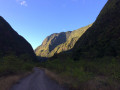
The Cirque de Mafate is accessible from many different points. The flat track is easy to follow and suitable for everyone. Families can come on this walk and turn back at any time. You can even take a dip in the Rivière des Galets. The track runs straight ahead, winding its way between rock faces that grow ever higher as you go.
Sans-Souci – Roche Plate
 10.39 mi
+4,117 ft
-2,087 ft
8h 20
10.39 mi
+4,117 ft
-2,087 ft
8h 20
 Difficult
Departure from Saint-Paul (La Réunion) (Réunion)
Difficult
Departure from Saint-Paul (La Réunion) (Réunion)
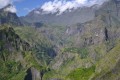
What hiker hasn’t dreamt of walking the Cirque de Mafate on Réunion? This hike is renowned for being challenging, with a considerable elevation gain. But the scenery is spectacular!
Please note: the elevation gain given is an overestimate; it is actually only about 1,200 metres uphill and 800 metres downhill.
Îlet des Orangers via the canal
 17.14 mi
+4,409 ft
-4,409 ft
8 hrs
17.14 mi
+4,409 ft
-4,409 ft
8 hrs
 Very difficult
Departure from Saint-Paul (La Réunion) (Réunion)
Very difficult
Departure from Saint-Paul (La Réunion) (Réunion)
One way to access the Cirque de Mafate is from Sans Souci. The pipeline path may seem long, but the landscape overlooking the Rivière des Galets from a height of 500 m is breathtaking. From above, you can see Deux Bras and the narrow gorge through which the Rivière des Galets flows out of the Cirque de Mafate.
The canal path has a gentle slope. After the water catchment, access to Îlet des Orangers is via a narrow gorge after a steep climb.
Estimated elevation gain: approximately 700 metres.
The tour of the Plaine d'Affouche via Îlet à Guillaume
 16.08 mi
+5,591 ft
-5,591 ft
12h 15
Difficult
Departure from Saint-Denis (La Réunion) (Réunion)
16.08 mi
+5,591 ft
-5,591 ft
12h 15
Difficult
Departure from Saint-Denis (La Réunion) (Réunion)
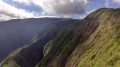
Located at an altitude of around 1,400 metres, the Plaine d’Affouche overlooks Îlet à Guillaume and forms an integral part of the Roche Écrite Reserve. Keep your ears and eyes peeled, as you may spot or hear the tuit-tuit, a bird found only on Réunion and exclusively in this part of the island.
Please note: this hike can be completed in under 8 hours. The elevation gain is overestimated: there is approximately 1,500 metres of ascent and descent, not 2,375.
The Bassin Vital
 1.44 mi
+686 ft
-686 ft
1h 15
Moderate
Departure from Saint-Paul (La Réunion) (Réunion)
1.44 mi
+686 ft
-686 ft
1h 15
Moderate
Departure from Saint-Paul (La Réunion) (Réunion)
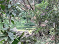
Étang Saint-Paul is designated as a nature reserve. There are several walking routes around it, including the Bassin Vital trail. Perched at an altitude of just over 150 metres, you can reach it via a short, fairly steep climb or by following a circular route. The views over Étang Saint-Paul are absolutely stunning! You can combine this walk with others in the area.
Bottle Rock
 2.08 mi
+1,024 ft
-1,017 ft
1h 50
Moderate
Departure from La Possession (Réunion)
2.08 mi
+1,024 ft
-1,017 ft
1h 50
Moderate
Departure from La Possession (Réunion)
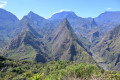
This short hike offers magnificent views of the Mafate cirque on one side and the coast of La Possession on the other, with the Dos-d'Àne islet in the foreground. This is the easiest place to get a spectacular, unobstructed view of Mafate.
La Roche Écrite via Dos d'Âne
13.58 mi
+4,436 ft
-4,416 ft
5 hrs
Very difficult
Departure from La Possession (Réunion)
La Roche Écrite rises to 2,276 metres and is accessible from several points. The route via Dos d'Ane is one of the longest, but also one of the most beautiful, with frequent views of the Cirque de Mafate in the first section. Some sections along the ridge are vertiginous and offer unique views. The detour via the Mare aux Cerfs and the Caverne Soldat adds an extra dimension to this long, challenging route.
Roche Écrite from Camp Mamode
 11.69 mi
+3,553 ft
-3,553 ft
8h 30
Difficult
Departure from Saint-Denis (La Réunion) (Réunion)
11.69 mi
+3,553 ft
-3,553 ft
8h 30
Difficult
Departure from Saint-Denis (La Réunion) (Réunion)
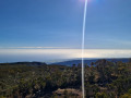
Roche Écrite offers a beautiful view of the Cirque de Salazie, Gros Morne, Piton des Neiges, Col des Boeufs (access to Mafate) and beautiful views of the Cirque de Mafate, Grand Bénare and Maido. From Camp Mamode, access is less difficult than from Grand Ilet and shorter than from Dos d'Âne.
The Chemin Pavé Lougnon
2.17 mi
+768 ft
-771 ft
1h 40
 Easy
Departure from Saint-Paul (La Réunion) (Réunion)
Easy
Departure from Saint-Paul (La Réunion) (Réunion)
The Saint-Paul region once had three paved roads: the Chemin Charrette Boeuf, the Chemin du Bernica and the Chemin Pavé Lougnon. They were built by Governor Antoine Desforges-Boucher in the18th century. Goods were previously transported from the hills above Saint-Paul to the town via unpaved tracks, which is why Antoine Desforges-Boucher decided to build these paved roads. The route of the Chemin Pavé de Lougnon was rediscovered by Albert Lougnon.
The Mercure Trail
 6.27 mi
+2,635 ft
-2,635 ft
5h 10
Moderate
Departure from Saint-Denis (La Réunion) (Réunion)
6.27 mi
+2,635 ft
-2,635 ft
5h 10
Moderate
Departure from Saint-Denis (La Réunion) (Réunion)
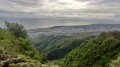
The Mercure Trail is one of the island’s most popular trails. It connects La Providence to Le Brulé. It is also the first stage of the GRR2, or the last, depending on which direction you take it. The first part of the trail shares a section with the botanical trail. It runs the entire length through the beautiful Providence Departmental Forest, one of the first forests to be modified by humans and a true green lung just a stone’s throw from the town.
The Providence Botanical Trail
 1.59 mi
+614 ft
-614 ft
1h 15
Easy
Departure from Saint-Denis (La Réunion) (Réunion)
1.59 mi
+614 ft
-614 ft
1h 15
Easy
Departure from Saint-Denis (La Réunion) (Réunion)
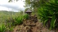
Located a short walk from Saint-Denis, this short trail allows you to discover some of the island’s endemic plants. It winds through one of the first forests to have been altered by humans. This trail is easily manageable with young children and offers beautiful views of Saint-Denis during the first part of the walk. It is also the starting point ofthe GR® R2. This walk shares a section with the Sentier Mercure, one of the island’s most popular trails.
Aurére – Cayenne
 4.46 mi
+1,565 ft
-2,812 ft
3h 25
Moderate
Departure from La Possession (Réunion)
4.46 mi
+1,565 ft
-2,812 ft
3h 25
Moderate
Departure from La Possession (Réunion)
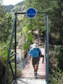
A detour to the centre of Mafate.
From Saint-Paul to Trou d'Eau via the beaches
9.42 mi
+75 ft
-89 ft
4h 25
Moderate
Departure from Saint-Paul (La Réunion) (Réunion)
The west of Réunion is very popular for its white sandy beaches stretching for miles! Starting from Saint-Paul, you’ll come across plenty of sights. Some beaches are particularly beautiful when they’re not crowded. Of course, you can take your time visiting the coastal towns along the way or taking a dip in the water. There are plenty of places to stop for refreshments all along the route! But we strongly recommend bringing a hat!
Cayenne - Roche Plate
4.34 mi
+3,583 ft
-1,683 ft
5h 05
Difficult
Departure from La Possession (Réunion)
The passage near the Ravine Grand Mère caldera is breathtaking.
Tour of the old town of Saint-Denis
3.24 mi
+98 ft
-112 ft
1h 35
Easy
Departure from Saint-Denis (La Réunion) (Réunion)
This itinerary offers a tour of Saint-Denis (Reunion Island), allowing you to visit the prefecture and see the main sights: colonial houses, the market and the jetty, in particular.
In Saint-Denis, avoid travelling during ‘rush hour’; opt for off-peak times instead to avoid wasting time in traffic jams.
Scout Trail starting from Grand Place
 7.28 mi
+4,288 ft
-2,090 ft
7h 05
Difficult
Departure from La Possession (Réunion)
7.28 mi
+4,288 ft
-2,090 ft
7h 05
Difficult
Departure from La Possession (Réunion)
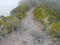
The famous Scout Trail, where the ridge sections offer impressive views of the Mafate cirque.
La Nouvelle - Le Bélier
4.09 mi
+1,926 ft
-1,227 ft
3h 35
Moderate
Departure from La Possession (Réunion)
The final stage of the Mafate circular loop.
From Col des Bœufs to La Nouvelle
 7.02 mi
+2,087 ft
-2,073 ft
5h 05
Moderate
Departure from La Possession (Réunion)
7.02 mi
+2,087 ft
-2,073 ft
5h 05
Moderate
Departure from La Possession (Réunion)
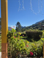
The hike from Col des Bœufs to La Nouvelle offers an accessible route for exploring the Cirque de Mafate. This excursion can be done in one day or over two days if you book a lodge. It allows you to discover the Plaine des Tamarins, the small hamlets of La Nouvelle (considered the capital of Mafate) and Marla.
From Col des Bœufs to Marla
8.25 mi
+2,451 ft
-2,438 ft
5h 55
Difficult
Departure from La Possession (Réunion)
From the Col des Bœufs, a forest track leads you to the edge of the Cirque de Salazie, where you’ll discover the majestic pass and its breathtaking views over the Cirque de Mafate. Your walk begins on a path carved into the mountainside, offering a dizzying view. You’ll then enter the tamarind forest. After crossing a clearing, you’ll descend towards the pebble-strewn river, discovering a hidden pool along the way. Finally, a short climb takes you to the village of Marla, where you can rest.
More walks in La Possession
Select a point of interest below: