La Nouvelle – Hell-Bourg

A lovely walk – long but not too difficult, apart from the climb up and descent from the Col de Fourche.

This walk is part of a multi-day hike: Les 3 cirques de La Réunion : Salazie - Cilaos - Mafate

Details

n°7837
Creation:
Last update:
Last review:
  • Walking
    Activity: Walking
  • ↔
    Distance: 10.81 mi
  • ◔
    Average duration: 7h 45 
  • ▲
    Difficulty: Difficult

  • ⚐
    Back to start: No
  • ↗
    Ascent: + 3,156 ft
  • ↘
    Descent: - 4,724 ft

  • ▲
    Highest point: 6,391 ft
  • ▼
    Lowest point: 2,228 ft

Photos

Description of the walk

(S) Next to La Nouvelle school, take theGR® R1, marked in red and white, which climbs towards the Col des Bœufs.
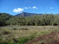
Continue across the Plaine des Tamarins to reach the junction of the Col des Bœufs and the Fork in the road.

(1) Then turn right towards the Col de la Fourche and head for it.

(2) Leave theGR® here and turn right.
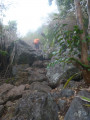
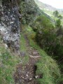
Take care here: there is a steep, vertiginous section for a few metres as soon as you begin the descent.
Follow the path as it enters the Ravine des Merles. Cross a footbridge over the Ravine Pont du Chien.

(3) Cross it and continue the descent via a series of hairpin bends to rejoin the Ravine du Grand Sable and the junction with the GRR1.

(4) Cross the ravine and turn right onto the GRR1. Walk on level ground across the Grand Sable plain. At the shelter, turn left. The path then winds twice before emerging into the Ravine Camp d’Henri.

(5) Continue along theGR® and, after a long descent, you’ll reach a junction of paths past the houses at Mare d’Affouches.

(6) Keep to the right on theGR®. You’ll soon come to a road; follow it to the junction with a path near the Anciens Thermes d’Hell Bourg.

(7) Turn left and walk through Hell Bourg to return to the starting point (E).
Then simply follow the tarmac road back up to Hell-Bourg.

Waypoints

  1. S : mi 0 - alt. 4,659 ft - La Nouvelle
  2. 1 : mi 2.26 - alt. 5,935 ft - Crossroads of the mountain passes
  3. 2 : mi 2.66 - alt. 6,214 ft - Col de la Fourche
  4. 3 : mi 4.25 - alt. 4,567 ft - Pont du Chien Ravine
  5. 4 : mi 5.33 - alt. 3,392 ft - GRR1 junction
  6. 5 : mi 6.74 - alt. 3,268 ft - Camp d’Henri Ravine
  7. 6 : mi 7.86 - alt. 2,421 ft - Houses at Mare d’Affouches
  8. 7 : mi 9.9 - alt. 3,028 ft - Crossroads. Turn left towards the > - Anciens thermes d'Hell-Bourg
  9. E : mi 10.81 - alt. 3,091 ft - Hell Bourg

Worth a visit

Don’t forget to pass by the ancient thermal baths before arriving in Hell-Bourg.

Always be cautious and plan ahead when you're outdoors. Visorando and the author of this route cannot be held responsible for any accidents occurring on this route.

The GR® and PR® markings are the intellectual property of the Fédération Française de Randonnée Pédestre.

Reviews and comments

5 / 5
Based on 1 review

Reliability of the description
5 / 5
Ease of following the route
5 / 5
Route interest
5 / 5
gattuso17
gattuso17

Overall rating : 5 / 5

Date of your route : Jan 03, 2020
Reliability of the description : ★★★★★ Very good
Ease of following the route : ★★★★★ Very good
Route interest : ★★★★★ Very good

A 17.62 km hike completed in 4 hours 30 minutes.
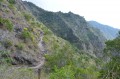
A climb up to the Col de Fourche, but the view is well worth the effort when you catch sight of the Cirque de Mafate and Salazie on either side. Along the way, we saw the Plaine des Tamarins: simply magnificent.
This is followed by a descent, which is a bit steep in places, down to Hell Bourg.
Once you reach the Mare d’Affouches, don’t be put off by the climb up the road to the old thermal baths at Hellbourg.
It can be challenging due to its length, especially if you’re tackling the stages back-to-back to complete the circuit of the three cirques.

Machine-translated

Laetitia L2.
Laetitia L2.

Thank you

Machine-translated

gazok54
gazok54 ★

I think that’s a good resolution.
Have a lovely walk.

Machine-translated

Laetitia L2.
Laetitia L2.

Good evening, gazok54,
Thank you for this information; we’ll have another look at the route. Perhaps we’ll take the bus from Col des Boeufs or Le Bélier, as we’re not fit enough to tackle such a long walk.

Machine-translated

gazok54
gazok54 ★

Good evening, Laetitia L2…
The duration given by the author seems entirely accurate given the distance and elevation gain. However, if you’re average walkers, be warned: 17.4 km and 963 m of elevation gain isn’t within everyone’s capabilities.

Machine-translated

Laetitia L2.
Laetitia L2.

Hello,
Can anyone confirm the duration of this route (7 hours) and its difficulty level? We are average walkers. Thank you

Machine-translated

Other walks in the area

For more walks, use our search engine .

The GPS track and description are the property of this route's author. Please do not copy them without permission.