Sans-Souci – Roche Plate

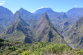
What hiker hasn’t dreamt of walking the Cirque de Mafate on Réunion? This hike is renowned for being challenging, with a considerable elevation gain. But the scenery is spectacular!
Please note: the elevation gain given is an overestimate; it is actually only about 1,200 metres uphill and 800 metres downhill.

This walk is part of a multi-day hike: Cirque de Mafate

Details

9841
Creation:
Last update:
Last review:
  • Walking
    Activity: Walking
  • ↔
    Distance: 10.39 mi
  • ◔
    Average duration: 8h 20 
  • ▲
    Difficulty: Difficult

  • ⚐
    Back to start: No
  • ↗
    Ascent: + 4,117 ft
  • ↘
    Descent: - 2,087 ft

  • ▲
    Highest point: 4,469 ft
  • ▼
    Lowest point: 1,644 ft

Photos

Description of the walk

From St Paul coach station, a Karouest minibus (route 8.5) takes you to the start of the track leading to the footpath in the hills above St Paul, in the Sans Souci neighbourhood.
(S/E) Join theGR® via a track suitable for vehicles. Reach the reservoir at a place called Les Filaos.

(1) Continue south-east above the Ravine Amédée; the gently ascending path, after crossing several ravines, leads to Îlet St-Ange.

(2) Stay on the ‘Canalisation des Orangers’ path, which remains level throughout. Allow about 1 hour to reach the start of the path.
Pass under a small waterfall (hold onto the safety line to avoid slipping) before reaching the Lataniers junction.

(3) Continue towards Les Orangers.
It’s all flat going right up to the Orangers water intake! At the intake, you’ll need to climb up over some boulders. Reach the Îlet des Orangers.

(4) Head towards Roche Plate. After a short stretch that appears level but isn’t, the path plunges down towards the Grand-Mère ravine. As with the approach to Les Orangers, the route winds its way between boulders – some of which you’ll need to climb over – and steps.

(5) Just before reaching the ridge, there is a fork to the right. This leads to La Brèche, but it is much safer to follow the main path, which is still marked in white.
Leave the path climbing up to the Maïdo on your right to begin the descent towards Roche Plate. There is a short section along a ledge (a few dozen metres) on the left, overlooking the drop-off. The handrail is anchored into the rock face.
The route quickly leads into the casuarina trees. Lodges appear amidst the carefully cultivated plots of land. Head to the centre of the village where the lodges are located (E).

Waypoints

  1. S : mi 0 - alt. 1,644 ft - Saint Paul, Sans Souci district
  2. 1 : mi 0.32 - alt. 1,811 ft - Reservoir
  3. 2 : mi 2.38 - alt. 2,454 ft - Îlet St-Ange
  4. 3 : mi 7.29 - alt. 2,539 ft - Lataniers crossroads
  5. 4 : mi 8.02 - alt. 3,228 ft - Îlet des Orangers
  6. 5 : mi 9.07 - alt. 4,206 ft - La Brèche
  7. E : mi 10.39 - alt. 3,658 ft - Roche Plate

Notes

Make sure you bring a hat and plenty of water, as there are no water sources along the route (apart from the water intake, of course). The path leading to Îlet des Orangers is very sunny. There is little shade.
There are lodges at Îlet des Orangers and Roche Plate.

Worth a visit

St Paul: don’t miss the market, which is bursting with colour, scents and flavours!!!

Always be cautious and plan ahead when you're outdoors. Visorando and the author of this route cannot be held responsible for any accidents occurring on this route.

The GR® and PR® markings are the intellectual property of the Fédération Française de Randonnée Pédestre.

Reviews and comments

4.7 / 5
Based on 2 reviews

Reliability of the description
4.5 / 5
Ease of following the route
5 / 5
Route interest
4.5 / 5
igouana
igouana

Overall rating : 5 / 5

Date of your route : Dec 08, 2025
Reliability of the description : ★★★★★ Very good
Ease of following the route : ★★★★★ Very good
Route interest : ★★★★★ Very good
Very busy route : No

A beautiful way to enter Mafate
A bit long; it took us 7½ hours, not counting breaks, but it's really worth it: it's so beautiful!
Flat at the start and a nice climb at the end
We did the whole circuit in 4 days: it's the first time we've found that the walking times indicated on the signs are accurate :-)

Machine-translated

larigotte25
larigotte25

Hello,
I’d like to go on this hike with my children, aged 8 and 12. They aren’t very experienced hikers, but I’m quite hopeful given the long flat section of the route.
Do you think a hike like this is feasible for an 8-year-old? Or should I just resign myself to going on my own?

Thank you in advance for your replies.

Pascal

Machine-translated

Aurélie G4.
Aurélie G4.

Overall rating : 4.3 / 5

Date of your route : Jul 23, 2015
Reliability of the description : ★★★★☆ Good
Ease of following the route : ★★★★★ Very good
Route interest : ★★★★☆ Good

A lovely, long walk – when the weather’s fine, it’s magnificent to enter Mafate via this route. Tip: make sure you save some energy for the climb up to the pass towards the end of the route, as you’ll start to feel the fatigue setting in. It took us 8 hours, but we did take several short breaks.

Machine-translated

tiout
tiout

Apart from a short stretch of about 400 metres at the start of Sans Souci… But it’s an easy climb (the sort where you can have a chat with friends).

Machine-translated

catimini974
catimini974

It’s true – from Sans Souci to the Orange Tree Canal, it’s all flat terrain!

Machine-translated

tiout
tiout

If you take the path through the orange groves, the climb isn’t too steep from ‘Sans Souci’. It’s actually quite an easy walk.

It becomes a challenging walk if you head from Sans Souci via Ilet Alcide and Le Maïdo, then descend over flat rock.

Machine-translated

Nono
Nono ★

Hello,

we’re having a few issues with calculating elevation gains on Réunion. So please don’t take these figures too literally. This is particularly true as, on the map, the path appears to follow the contour lines on a steep slope, making it very difficult for our software to calculate altitudes and elevation gains accurately. You’ll get a better idea by comparing the map and the diagram.

Arnaud

Machine-translated

nigloo974
nigloo974

Hello, over 3,100 metres in 6 hours – you’re in great shape!

Machine-translated

Other walks in the area

For more walks, use our search engine .

The GPS track and description are the property of this route's author. Please do not copy them without permission.