From Deux Bras to Îlet à Malheur via the footbridge

Here’s a pleasant way to explore the northern part of the Mafate cirque via a path that climbs on the way there and therefore descends on the way back – a rare route for entering Mafate.
If you’re fit enough, you can complete the round trip in a single day. Otherwise, you can easily stay overnight at Îlet à Malheur (remember to book) and make the return journey the following day, for example via Aurère (see the Îlet à Malheur – Deux Bras route via the La Noix basin).

Details

n°1703979
Creation:
Last update:
Last review:
  • Walking
    Activity: Walking
  • ↔
    Distance: 3.80 mi
  • ◔
    Average duration: 4h 15 
  • ▲
    Difficulty: Moderate

  • ⚐
    Back to start: No
  • ↗
    Ascent: + 2,838 ft
  • ↘
    Descent: - 955 ft

  • ▲
    Highest point: 3,107 ft
  • ▼
    Lowest point: 820 ft

Photos

Description of the walk

To reach the start point, you’ll need to take a 4x4 taxi (mafatais taxis) from the village of Rivière des Galets to the hamlet of Deux Bras. (€8 one way in January 2019; book your journey in advance).
To reach the taxi pick-up point in the village of Rivière des Galets, follow Rue de la Libération to the end. Take the stony track; after 500 metres, you’ll reach the car park and the barrier controlling access to the Rivière des Galets.
After a 12km journey by 4x4 (a route that can be done on foot but isn’t very pleasant) and several fords, you’ll arrive at Deux Bras, where the hiking trail begins.

(S/E) Take the path at the far end of the 4x4 turning area. You’ll soon come to the first ford, followed by three more. You can cross either over the large stones or through the water, which is normally knee-deep.

(1) After the fourth ford, take the path up the slope on the right bank of the River des Galets (GR®R2route towards Aurère). The path climbs up a fairly steep slope. Pass by the small Cabris spring.

(2) Immediately after the Cabris spring, turn left towards Aurère, leaving the path signposted ‘Grand Place, Cayenne’ on your right. The path climbs up the side of Cap Miné and very quickly reaches another junction.

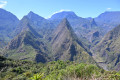
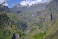
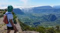
(3) Keep turning left towards Aurère. The mountain-side path is secured by a railing at the most vertiginous sections. Discover some beautiful viewpoints. The path still bears the marks of the drilling required to blast a route through the rock, hence the name Cap Miné. Walk past a small wayside shrine dedicated to Saint Expeditus and, shortly afterwards, arrive at the Bord Bazar viewpoint (picnic table).

(4) Take the path furthest to the right, signposted ‘Îlet à Malheur’, via the footbridge. Leave the sign for Aurère on your left. Head down a superb path through the casuarina trees.

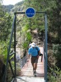
(5) Cross the ravine via the footbridge, then head back up towards Îlet à Malheur. The track ends in front of the chapel (E).

Waypoints

  1. S : mi 0 - alt. 856 ft - Start from Deux Bras - Rivière des Galets (fleuve)
  2. 1 : mi 0.96 - alt. 906 ft - Fourth ford
  3. 2 : mi 1.58 - alt. 1,411 ft - Turn-off after the Cabris spring, on the left
  4. 3 : mi 1.9 - alt. 1,621 ft - Start of the climb up to Cap Miné
  5. 4 : mi 2.99 - alt. 3,084 ft - Bord Bazar
  6. 5 : mi 3.56 - alt. 2,303 ft - Footbridge
  7. E : mi 3.8 - alt. 2,740 ft - Chapel at Îlet à Malheur

Notes

There are several lodges at Îlet à Malheur or further on at Îlet à Bourse. Book before setting off.
Book a return journey in a 4x4 taxi before setting off.
Check the water level in the Rivière des Galets before setting off on the hike (there are several river crossings).
It can get quite busy at the Deux Bras starting point, but most of the people there are day-trip hiking groups with guides heading towards Cayenne.

Worth a visit

You will arrive at Îlet à Malheur. The name derives from an event that took place there in the days when the great planter families (Debassyns, Chatel, Ysautier…) dominated the island’s economy. Some slaves would escape and hide in the hills. The planters would hire ‘slave hunters’ to bring them back, dead or alive. In 1829, a detachment led by Mr Guichard discovered a camp of ‘maroons’ who were living self-sufficiently in this area. He massacred around forty people there.

Always be cautious and plan ahead when you're outdoors. Visorando and the author of this route cannot be held responsible for any accidents occurring on this route.

The GR® and PR® markings are the intellectual property of the Fédération Française de Randonnée Pédestre.

Reviews and comments

5 / 5
Based on 1 review

Reliability of the description
Not used
Ease of following the route
Non utilisé
Route interest
5 / 5
pabaille
pabaille

I didn’t do this particular walk exactly as it was described, as I left it until the end to head towards Aurere.
I downloaded this walk anyway, though, as it gave me the base map for the route I was interested in.

Machine-translated

Orando974
Orando974 ★
• Edited:

Overall rating : 5 / 5

Date of your route : Jul 14, 2020
Reliability of the description : Not used / Not applicable
Ease of following the route : Not used / Not applicable
Route interest : ★★★★★ Very good
Very busy route : Yes

A 5½-hour round-trip hike with a detour via Aurère and the Bassin la Noix on the way there. A magnificent hike, surely one of the most beautiful ways to enter Mafate. Some of the views are simply breathtaking! The same goes for the gorges at the Bras Bémale footbridge. The walk is neither too easy nor too challenging; only the final few metres towards Aurère are a little more difficult. You can stock up on supplies in Aurère or at Îlet à Malheur. There is also a spring just before the end of the climb at Bord Bazar.

Machine-translated

Other walks in the area

For more walks, use our search engine .

The GPS track and description are the property of this route's author. Please do not copy them without permission.