Country:

 City:


Start from the Chemin du Bac, which begins on the Route de la Plage between the Swiss Vapeur Parc and the Aquaparc. Park in the triangular car park at the foot of the tennis courts located before the Aquaparc, or in the car park along the Route de la Plage (pay-and-display).
Here and there, you’ll find yellow signposts for walking trails or red ones for cycle paths.
(S/E) Follow the Chemin du Bac north-eastwards, keeping the Aquaparc on your left (the outdoor slides are clearly visible). At the end, take the cycle path on the right and walk parallel to the Rhône on your left (there are two access points to the riverbank along the way).
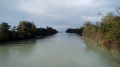
(1) Take the Passerelle des Grangettes to cross the Rhône (thereby moving from the canton of Valais to the canton of Vaud). On the opposite bank (map of the area), turn left towards Villeneuve and initially follow a cycle path. After just under a hundred metres, let the path veer to the right and continue straight on along a gravel track.
(2) At the next junction (building on the right), go straight on. Walk with the Rhône on your left and a damp, bushy area on your right (poplars, reeds, etc.).
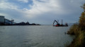
(3) At the next junction, carry on straight ahead. You’ll come to a sort of small clearing on the banks of the Rhône, about a hundred metres upstream from where it flows into the lake (there are facilities belonging to a gravel-quarrying company on the opposite bank).
(4) Retrace your steps back to the previous junction.
(3) Then turn left onto the narrow tarmac path that leads into the forest. Stay on this path and ignore the faint tracks on either side.
(5) At the crossroads, turn right towards the building you saw on the way there.
(2) At the end of the path, follow the gravel track to the left. Cross the Rhône again via the Passerelle des Grangettes.
(1) On the other bank, turn right onto the cycle path alongside the Rhône. At the corner by the Aquaparc, turn left onto the Chemin du Bac and, at the end, you’ll reach the car park (S/E).

 Visorando Member
 Difficult

 Very difficult