


Refine your search for walks in Port-Valais
Port-Valais walks


 The mouth of the Rhône where it flows into Lake Geneva
 Visorando Member

 3.43 mi
 +66 ft
 -69 ft
 1h 40
 Easy
 Departure from Port-Valais (Valais)
A short walk along the Rhône to where it flows into Lake Geneva. After setting off through an urbanised area, you walk through a damp woodland area with, always in the background, the peaks of the Vaud Alps, the Diablerets, the Chablais and the Dents du Midi.
Taney – Saint-Gingolph
9.85 mi
+2,352 ft
-5,768 ft
6h 35
 Difficult
Departure from Vouvry (Valais)
This eleventh stage will take you from Taney to Saint Gingolph. The route begins in the Loz valley at the foot of Mont Gardy and Les Jumelles, before climbing the final two passes, Lovenex and La Croix. The route continues along the River Morge, following the border with France. At Novel, the path turns towards Mont Cornin, passing through La Frîtaz and winding down towards Lake Geneva at Saint Gingolph.
La Grande Jumelle
 8.10 mi
+3,829 ft
-3,829 ft
7h 05
Difficult
Departure from Vouvry (Valais)
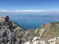
A not too busy hike up to a summit offering a vast panoramic view. A relatively challenging route with some aerial passages requesting a certain sense of itinerary at times. The beginning of the hikes passes through Tanay site and its lake.
Le Grammont
 7.83 mi
+3,776 ft
-3,776 ft
6h 55
Difficult
Departure from Vouvry (Valais)
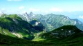
Passing through the preserved site of Tanay, with its lake, you climb to a summit that offers a unique view of Lake Geneva and a wide panorama of the surrounding mountains. A popular hike with steep sections but no technical difficulty.N.B. The calculated elevation gain is slightly overestimated; the actual cumulative elevation gain is close to 1,000 metres.
Alamon from Miex
6.17 mi
+2,936 ft
-2,936 ft
5h 25
Difficult
Departure from Vouvry (Valais)
A little-visited summit, accessible in mid-season and offering beautiful views. The climb starts in the forest and passes through the protected site of Taney and its lake. The hike ends in the mountain pastures.
Cornettes de Bise from Miex
 9.83 mi
+4,721 ft
-4,705 ft
8 hrs
 Very difficult
Departure from Vouvry (Valais)
A very varied route for climbing the Cornettes de Bise from Switzerland. The summit, the highest in the region alongside the neighbouring Mont de Grange (2,432 m), offers a superb panorama. The descent through the Combe de la Chaux du Milieu takes place in a stunning, unspoilt setting, and the village of Tanay is enchanting.
A long hike with significant elevation gain, which requires a good level of fitness.
Saint Gingolph - La Chapelle d'Abondance
10.74 mi
+6,010 ft
-3,934 ft
10h 10
Difficult
Departure from Saint-Gingolph (Haute-Savoie)
Itinéraire de la traversée des Alpes. Etape des rives du lac Léman au Val d'Abondance. Franchir les montagnes du Chablais par une longue grimpette de 1850m en traversant les alpages pour passer le Col de Bise puis redescendre à la station de ski de la Chapelle d'Abondance. Cet itinéraire offre de très beaux panoramas sur le plus grand lac d'Europe et sur le sommet des Cornettes de Bise.
GTA, Great Alpine Crossing via the GR®5 and GR®55. From Lake Geneva to Nice.
 342.76 mi
+99,633 ft
-100,915 ft
21 days
Very difficult
Departure from Saint-Gingolph (Haute-Savoie)
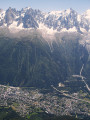
The Grande Traversée des Alpes (GTA) mainly follows the GR®5, with a few possible variations such as the crossing of the Haute Vanoise via the GR®55 and the Via Alpina, which this route takes instead of the GR®5 route via the Col de l’Iseran. It crosses the French Alps from north to south, from Saint-Gingolph to Nice. The guide includes web links to the many accommodation options along the route or nearby: mountain huts, lodges, campsites, cabins and shelters, excluding hotels. Although this guidebook details the GTA as a three-week trek, it can be adapted to suit your own pace, with stages of varying lengths, either completed in one go or in sections over several years. This journey, fuelled by the joy of freedom in unspoilt natural surroundings, will remain a superb and unforgettable experience, offering, moreover, the opportunity to meet many people with whom you can share this same passion for the mountains.
From Saint-Gingolph to the Chalets de Bise
 7.66 mi
+5,013 ft
-1,348 ft
7h 55
Difficult
Departure from Saint-Gingolph (Haute-Savoie)
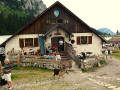
This first stage of the Grande Traversée des Alpes (GTA), from Lake Geneva to the Mediterranean, takes place in the Chablais massif. The path climbs up the Novel valley on the left bank of the Morge, below the hamlet of La Meurtaz, then follows the D30 road, which it overlooks after the hamlet of Jordy. On leaving Novel, the path winds its way above the hairpin bends of the D30 to La Planche. There, it leaves the main valley route to climb due south towards the chalets of Neuteu and on to the Col de Bise, before descending to the Chalets de Bise.
Along the shores of Lake Geneva from one Saint-Gingolph to the other
 1.61 mi
+102 ft
-102 ft
0h 50
Easy
Departure from Saint-Gingolph (Haute-Savoie)
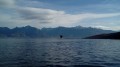
On the southern shore of Lake Geneva, two neighbouring municipalities are both called Saint-Gingolph; one is in Switzerland, the other in France. This short walk takes you from one to the other, first along the lake and then through the streets higher up. You’ll be treated to some stunning views and a rich heritage.
Along the shores of Lake Geneva from Villeneuve to Montreux.
 3.27 mi
+177 ft
-167 ft
1h 40
Easy
Departure from Villeneuve (Canton de Vaud) (Vaud)
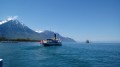
A pleasant walk along the "Riviera of Lake Geneva", with superb panoramic views of the lake and surrounding peaks, the grand residences of Montreux and the famous Château de Chillon. This walk is proposed as a one-way trip with the option of returning either by boat or on foot.
Torgon – Taney
6.05 mi
+3,068 ft
-1,982 ft
5h 25
Difficult
Departure from Vionnaz (Valais)
This tenth stage will take you from Torgon to Lake Taney. The route begins with a fairly steep climb to La Caux, then becomes more pleasant as it reaches Le Planellet. Les Dents once again offer magnificent views. The route continues with a descent towards the Col de Blancsex, down to the Plan de l’Ortie. The path climbs back up towards La Charmille with a few tricky sections, but these are secured by chains. A final climb leads to the Col de Taney before reaching the lovely Lac de Taney.
La Dent d'Oche from Novel
 Association / Club / Walk leader
 8.89 mi
+4,478 ft
-4,475 ft
8 hrs
Very difficult
Departure from Novel (Haute-Savoie)
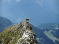
La Dent d'Oche is accessible via various routes. This one starts from a place called "La Planche" above Novel. It passes through "les chalets de Neuteu", the Pavis pass, the portes d'Oche, the lac de la case, the planchamp pass, the dent d'Oche and returns via the Rebollion pass, the Neuve pass, the Neuva dessous, the enclos, and finally "la Planche".
This route allowed us to see many ibex in different places and the local flora.
Pointe de Pétalouse
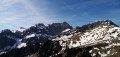 5.80 mi
+2,175 ft
-2,175 ft
4h 35
 Moderate
Departure from Novel (Haute-Savoie)
A little-visited peak, more accessible than the neighbouring Pic de Borée and offering a beautiful panorama. The walk takes place in superb surroundings.
Pic de Borée from Novel
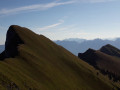 5.61 mi
+2,510 ft
-2,510 ft
4h 45
Difficult
Departure from Novel (Haute-Savoie)
A summit offering superb views of both Lake Geneva and the Chablais massif. This route via the south face offers a walk in a beautiful natural setting. It also avoids the hassle of the ski lifts at the Thollon ski resort (north face, more crowded).
Lac et Pas de Lovenex
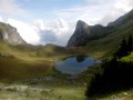 4.81 mi
+2,497 ft
-2,490 ft
4h 25
Difficult
Departure from Novel (Haute-Savoie)
Niché dans un cadre sauvage, le Lac de Lovenex constitue le but de cette randonnée franco-suisse. On passe d'abord au Pas de Lovenex, afin de bénéficier d'une vue unique sur ce petit lac qui apparaît comme suspendu au-dessus du Lac Léman visible à l'arrière-plan.
La Grande Jumelle from Novel
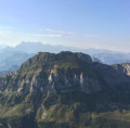 8.00 mi
+3,967 ft
-3,960 ft
7 hrs
Very difficult
Departure from Novel (Haute-Savoie)
An original route to climb a little-visited summit from which you can enjoy sweeping views. A relatively demanding route, with exposed sections along the summit ridge, set in a very beautiful landscape.
Tour of the two peaks of Oche from Novel
 8.13 mi
+3,747 ft
-3,750 ft
7h 00
Difficult
Departure from Novel (Haute-Savoie)
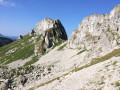
This hike takes you around two iconic twin peaks in the Chablais region, the famous Dent d'Oche and its lesser-known neighbour, the Château d'Oche. The first part of the loop offers superb views of the impressive north faces of these two peaks. The second part, via the chalets of Oche and the Portes du même nom, opens onto the Bise nature reserve and the lakes of Darbon and Neuteu. The final descent takes place in the forest near the French-Swiss border.
Roc de Rianda from Novel
 6.60 mi
+2,530 ft
-2,500 ft
5h 15
Difficult
Departure from Novel (Haute-Savoie)
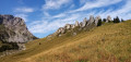
Situated between the Pic de Borée (to the north) and the prestigious Dent d’Oche (to the south), the Roc de Rianda is a wild and little-visited peak. This is evident: part of the route follows poorly marked paths or goes off-trail. A good sense of direction and navigation is therefore required. The route takes in some truly beautiful scenery and passes at the foot of the impressive north faces of the Château d’Oche and the Dent d’Oche.
The Rhône plain and the vineyards of Vionnaz
 3.27 mi
+522 ft
-515 ft
1h 55
Easy
Departure from Vionnaz (Valais)
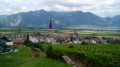
Between two ascents of the surrounding peaks, or when these are shrouded in clouds or under snow, a short, easy walk across the plain and along the boundary between vineyards and forest, exploring the rich heritage of the old village of Vionnaz.
Arvouin Lake and Vernaz Pass
 4.96 mi
+1,138 ft
-1,138 ft
3h 15
Moderate
Departure from La Chapelle-d'Abondance (Haute-Savoie)
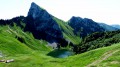
An excellent family hike. You can go as far as the pass or stop at the lake, which is already a very beautiful setting. Beautiful views of the Dents du Midi (climb to the lake) and the Cornettes de Bise (from the pass).
You are in a protected area! See the regulations in the practical information section.
Pointe d'Arvouin
3.99 mi
+1,460 ft
-1,434 ft
3h 05
Moderate
Departure from La Chapelle-d'Abondance (Haute-Savoie)
The ascent of a picturesque peak offering a bird's eye view of Lake Arvouin and a beautiful view of the Cornettes de Bise, the highest point in the area.
N.B. Route within a protected natural area: see recommendations in the practical information.
Le Haut Sex from Sevan
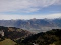 3.74 mi
+1,437 ft
-1,437 ft
3h 00
Moderate
Departure from La Chapelle-d'Abondance (Haute-Savoie)
A summit that doesn’t look like much from below but offers a superb panorama of the Chablais peaks, the Vaud Alps, the Valais Alps and Mont Blanc. A very varied circular route, alternating between forest, mountain pastures and ridges, tracks, paths and trails, with short steep climbs and gentle slopes.
Le Linleu from Sevan
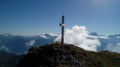 3.79 mi
+1,627 ft
-1,627 ft
3h 10
Moderate
Departure from La Chapelle-d'Abondance (Haute-Savoie)
Climb to a local viewpoint offering a 360° panorama of the Vaud and Valais Alps, Mont Blanc, the Abondance Valley and the main peaks of the Chablais, as well as Lake Geneva. A hike that lends itself to several variations and additions.
N.B. Route within a protected natural area: see recommendations in the practical information.
Douert and Mouët mountain pastures from Sevan Devant
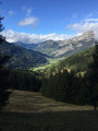 5.34 mi
+1,273 ft
-1,253 ft
3h 35
Moderate
Departure from La Chapelle-d'Abondance (Haute-Savoie)
A pretty circular route overlooking the Abondance valley with views of the Dents du Midi. A limited elevation gain and a two-level route with no difficulty. The alpine walk proposed here is both interesting and scenic.
From the Chalets de Bise to the Trébentaz Refuge
 8.20 mi
+3,924 ft
-2,740 ft
7h 10
Difficult
Departure from La Chapelle-d'Abondance (Haute-Savoie)
This second stage continues the traverse of the Chablais. The route winds through the beautiful Abondance valley amidst magnificent, tranquil scenery. From the Chalet de Bise, there is a steep climb up to the Pas de la Bosse. From the pass, the path descends to the chalets of Chevenne, then follows the Sechet stream, continuing the descent along the right bank to the Chapelle d’Abondance. It runs alongside the Thoules stream and then the Dranse, which it leaves at the hamlet of Le Moulin, before climbing towards Sur Bayard to the Chalet des Crottes. From there, it is best to leave the main GR®5 route and, via a western path, follow the detour leading to the Refuge de Trébentaz, as the Refuge de la Haute Bise – shown on the IGN map – no longer offers accommodation.
Lake Darbon from Bise
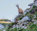 4.11 mi
+2,116 ft
-2,106 ft
3h 45
Moderate
Departure from La Chapelle-d'Abondance (Haute-Savoie)
A superb hike starting from the Chalets de Bise, to discover Lake Darbon, a little gem nestled among the rocks.
⚠️ This route crosses the protected natural area of the Cornettes de Bise. To avoid disturbing the wildlife and preserve its habitat, please respect the regulations in force (see practical information). ANYONE WHO FAILS TO DO SO WILL BE FINED.
Cornettes de Bise from Bise
 6.40 mi
+3,888 ft
-3,862 ft
6 hrs
Very difficult
Departure from La Chapelle-d'Abondance (Haute-Savoie)
One of the most beautiful hikes in the Chablais! A long and demanding route, where you walk in sumptuous surroundings. From the summit, the highest in the region along with the neighbouring Mont de Grange (2,432 m), there is a superb panorama of Lake Geneva, the Chablais peaks, the Swiss Alps and the Mont Blanc massif.
N.B. Route within a protected natural area: see recommendations in the practical information section.
Tête de Charousse and Crête du Velan
 4.17 mi
+1,900 ft
-1,900 ft
3h 35
Moderate
Departure from La Chapelle-d'Abondance (Haute-Savoie)
An ascent to a pass, a ridge walk facing the imposing Cornettes de Bise massif, and a descent through pastures. A beautiful setting and superb views. A fairly short hike, recommended for a beautiful autumn day.
N.B. Route within a protected natural area: see recommendations in the practical information section.
Château d'Oche from Bise
 5.46 mi
+2,671 ft
-2,654 ft
4h 50
Difficult
Departure from La Chapelle-d'Abondance (Haute-Savoie)
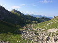
The Roc du Château d'Oche offers a majestic panorama of both Lake Geneva and the Northern Alps. This hike takes you up via a route through the stunning setting of Bise, with less elevation gain than the route from the usual starting point at La Fétiuère and several options for the return journey.
N.B. Route within a protected natural area: see the recommendations in the practical information.
From Bise to Lake Fontaine via Ubine
5.35 mi
+1,742 ft
-2,293 ft
4h 00
Moderate
Departure from La Chapelle-d'Abondance (Haute-Savoie)
If you want to discover the mountains in all their forms, both mineral and human, take this challenging route.
You are in a protected area! See the regulations in the practical information section.
Tour of the four passes starting from the Chalets de Bise
 7.38 mi
+3,734 ft
-3,717 ft
6h 40
Difficult
Departure from La Chapelle-d'Abondance (Haute-Savoie)
A cross-border hike that takes in four passes within the Bise nature reserve. Superb views of the Cornettes de Bise and the surrounding peaks, as well as lakes, await you.
N.B. Route within a protected natural area: see recommendations in the practical information section.
Chalets de Mens and Pointe de la Bosse tower
 4.10 mi
+2,113 ft
-2,113 ft
3h 45
Moderate
Departure from La Chapelle-d'Abondance (Haute-Savoie)
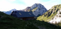
A loop in a beautiful alpine setting at the foot of two majestic peaks, Mont Chauffé on the way up and the Cornettes de Bise on the way down.
N.B. Route within a protected natural area: see recommendations in the practical information.
The tour of Mont Chauffé
 8.50 mi
+3,077 ft
-3,064 ft
6h 35
Difficult
Departure from La Chapelle-d'Abondance (Haute-Savoie)
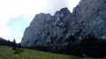
A circular trail around Mont Chauffé with superb views of the north face of this summit (an impressive limestone wall), the Cornettes de Bise and the Dents du Midi. The Vallon d'Ubine offers a wild setting, enhanced by the presence of herds of livestock.
N.B. Route within a protected natural area: see recommendations in the practical information section.
Cornettes de Bise from Chevenne
 5.76 mi
+3,963 ft
-3,963 ft
6h 05
Difficult
Departure from La Chapelle-d'Abondance (Haute-Savoie)
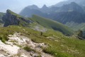
A common route to the Cornettes de Bise when staying in the upper Abondance Valley. A long route with elevation gain, leading to a magnificent setting. From the summit, the highest in the region along with the neighbouring Mont de Grange (2,432 m), there is a superb panorama of Lake Geneva, the Chablais peaks, the Swiss Alps and the Mont Blanc massif.
N.B. Route within a protected natural area: see recommendations in the practical information section.
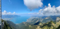
Circular walk around the Rochers de Naye starting from Caux
 9.73 mi
+4,334 ft
-4,314 ft
8h 15
Very difficult
Departure from Montreux (Canton de Vaud) (Vaud)
Les Rochers de Naye (2,042 m): A unique panoramic view of the Swiss and French Alps, from the Eiger to Mont Blanc and Lake Geneva. In particular, you can see the neighbouring peaks of the Dent de Jaman and Cape aux Moines, the French-speaking Jura, much of the Fribourg Pre-Alps and the Vaud Alps, including the Diablerets massif; the Bernese Oberland with the Eiger-Mönch-Jungfrau trio; as well as Mont Dolent and the Aiguille Verte in the Mont Blanc massif.
La Chapelle d'Abondance - Refuge de Chesery
13.80 mi
+3,907 ft
-745 ft
9h 45
Difficult
Departure from La Chapelle-d'Abondance (Haute-Savoie)
Itinéraire de la traversée des Alpes. De La Chapelle d’Abondance passer par le Haut Giffre pour un intermède suisse. Cette étape domine la Haute Vallée de la Dranse d'Abondance, passe par le domaine skiable des Portes du Soleil.
Vous êtes sur une zone protégée. Voir la réglementation dans les informations pratiques.
Dranse d'Abondance and the Ruisseau des Mattes waterfalls
 5.09 mi
+817 ft
-820 ft
3h 05
Easy
Departure from La Chapelle-d'Abondance (Haute-Savoie)
Discover the banks of the Dranse d'Abondance from La Chapelle d'Abondance towards Châtel and two beautiful waterfalls on the Ruisseau des Mattes.
On the banks of the Dranse, see practical information.
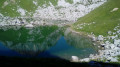
Darbon Lake from Fontaine Lake
 6.94 mi
+2,756 ft
-2,762 ft
5h 35
Difficult
Departure from Vacheresse (Haute-Savoie)
An original route to reach Lake Darbon. The outward journey takes place in a wilder and less frequented setting than the usual route from the Chalets de Bise, which are crossed on the return journey due to a closed path on the original route. If you wish to avoid them, it is of course possible to return from the lake via the same route as on the outward journey.
N.B. Route within a protected natural area: see recommendations in the practical information.
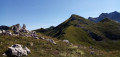
Pointe de Bénevent
 5.61 mi
+2,579 ft
-2,566 ft
4h 50
Difficult
Departure from Vacheresse (Haute-Savoie)
The ascent of a little-visited peak in the renowned Bise area. A hike featuring a few tricky sections, which can be done as a round trip or a circular hike.
A shorter, easier version is suitable for a family hike in beautiful, unspoilt surroundings.
N.B. Route within a protected natural area: see the recommendations in the practical information.
The Morclan tour from Châtel
 7.50 mi
+2,585 ft
-2,569 ft
5h 40
Moderate
Departure from Châtel (Haute-Savoie)
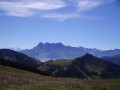
A beautiful, challenging "all-in-one" hike: beautiful mountain pastures, views of the surrounding peaks (Mont de Grange and Cornettes de Bises), 360° panorama from the summit of Morclan (Dents du Midi, Mont Blanc massif, Lake Geneva, Rhône Valley, etc.).
The Border Ridge and Pointe de Recon from le Morclan
 6.42 mi
+1,007 ft
-3,533 ft
3h 50
Moderate
Departure from Châtel (Haute-Savoie)
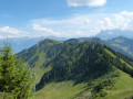
A pleasant walk along the border ridge from the Morclan chair lift. Variations are possible (and described) to give more ascent. Opportunities for great views across the mountains in the Chatel Area and into Switzerland, including the Montreaux end of Lac Leman.
Bel Air via the Chalets de Pertuis
 6.23 mi
+1,772 ft
-1,752 ft
4h 25
Moderate
Departure from La Chapelle-d'Abondance (Haute-Savoie)
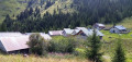
A lovely circular hike in the Vallée d’Abondance offering stunning views of the area’s main peaks. A simple return trip to the Chalets de Pertuis makes for a lovely family hike.
Route around La Chapelle-d’Abondance via Les Mattes
 11.35 mi
+3,652 ft
-3,632 ft
7 hrs
Very difficult
Departure from La Chapelle-d'Abondance (Haute-Savoie)
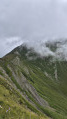
A very beautiful route in this northern part of Mont Grange.
A lovely viewpoint at Les Mattes overlooking the Aiguilles du Midi on the Swiss side.
At the Croix des Cornillons, there’s a view over the valley towards Châtel.
You are in a protected area! Please see the regulations in the practical information section.
Pointe d'Autigny from Ubine
 4.93 mi
+1,273 ft
-1,293 ft
3h 20
Moderate
Departure from Vacheresse (Haute-Savoie)
A pretty little summit with extensive views, a short, easy climb in the wild setting of the Vallon d'Ubine with a beautiful view of the north face of Mont Chauffé.
Vallon d'Ubine and Pointe de Lachau
 3.01 mi
+1,549 ft
-1,539 ft
2h 45
Moderate
Departure from Vacheresse (Haute-Savoie)
A small, unassuming peak, the Pointe de Lachau offers superb views of the Cornettes de Bise, the highest point in the area, and Mont Chauffé. Dominated by the impressive north face of Mont Chauffé, the Vallon d'Ubine is a beautiful setting and the simple climb to the Col d'Ubine is a lovely walk in itself with young children.
N.B. Route within a protected natural area: see recommendations in the practical information.
A circular route from the Abondance Valley to the Dent d’Oche
18.48 mi
+8,638 ft
-8,622 ft
2 days
Very difficult
Departure from Abondance (Haute-Savoie)
A two-day trek with two long stages and significant elevation gain. The route starts at the foot of the impressive Mont Chauffé, passes by the Chalets de Bise and Lac de Darbon before ascending the Dent d’Oche, which offers a superb panoramic view of Lake Geneva. The return route takes you via Lac de la Cse d’Oche, Lac Fontaine and the Chalets d’Ubine. In summer, you’ll come across Abondance cows, goats and ibex.
You are in a protected area! Please see the regulations in the practical information section.
Mont Chauffé
 3.92 mi
+2,799 ft
-2,799 ft
5 hrs
Very difficult
Departure from Abondance (Haute-Savoie)
An isolated and little-visited summit in a wild setting, offering a superb 360° panorama of Lake Geneva, the Chablais, the Dents du Midi and the Mont Blanc Massif. A route for experienced hikers, with very steep slopes, aerial passages and several easy rock climbing sections.
N.B. Route within a protected natural area: see recommendations in the practical information section.
Pointe d'Autigny from Abondance
 5.59 mi
+1,982 ft
-1,982 ft
4h 20
Moderate
Departure from Abondance (Haute-Savoie)
A pretty little summit with extensive views, which we recommend climbing via the Abondance side. Beautiful views of the Cornettes de Bise and the north face of Mont Chauffé, as well as Lake Geneva.
La Cergniaulaz, Le Molard and Le Folly
6.10 mi
+1,883 ft
-1,883 ft
4h 25
Moderate
Departure from Montreux (Canton de Vaud) (Vaud)
A magnificent hike starting from the Auberge de la Cergniaulaz restaurant with free parking. Accessible in summer with the chance to see fields full of daffodils in early May, and in winter on snowshoes or touring skis. It's quite a climb at the start, but the surrounding mountain scenery and the beauty of the forests and wildlife make you forget the effort. The view of the lake on the descent from the summit of Folly is breathtaking, and if you're there around August, you can refuel with thousands of wild blueberries on the way down from Molard. The Cergniaulaz restaurant offers semi-gourmet dishes but is very hiker-friendly, and you can also enjoy some typical dishes such as planchette, fondue or rösti. Their tart of the day was to die for.