Along the shores of Lake Geneva from one Saint-Gingolph to the other

On the southern shore of Lake Geneva, two neighbouring municipalities are both called Saint-Gingolph; one is in Switzerland, the other in France. This short walk takes you from one to the other, first along the lake and then through the streets higher up. You’ll be treated to some stunning views and a rich heritage.

Details

859154
Creation:
Last update:
Last review:
  • Walking
    Activity: Walking
  • ↔
    Distance: 1.61 mi
  • ◔
    Average duration: 0h 50 
  • ▲
    Difficulty: Easy

  • ⚐
    Back to start: Yes
  • ↗
    Ascent: + 102 ft
  • ↘
    Descent: - 102 ft

  • ▲
    Highest point: 1,352 ft
  • ▼
    Lowest point: 1,220 ft

Photos

Description of the walk

Start at the western end of Quai André Chevallay, at the entrance to Saint-Gingolph when coming from Évian-les-Bains via the D1005 (towards the lakeside). Park in the car park at the start of the quay, just past the traffic lights on the D1005.

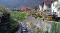
(S/E) Head east and walk downhill towards the lake. Follow the quay straight ahead, either on the footpath on its left-hand side, or further to the left still, on a lawn between the quay and the lake. When you reach the village hall, continue along a wide gravel path running alongside the lake. Pass a memorial to Jean Moulin and you’ll arrive at the historic starting point ofthe GR®5.

(1) Then turn right towards Nice (signposted as 620 km away, no less...). After a few metres, turn left, cross a footbridge over the River Morge and enter Swiss territory. Continue straight ahead, pass through a large gate and walk past a restaurant on your left. Return to the lakeside and reach the Saint-Gingolph jetty.

(2) Carry on eastwards, ignoring Rue du Port which leads uphill to the right, and walk alongside the small harbour. Continue along a small sandy beach. At the corner of the Lifeguard building, go up a flight of steps on the right. At the top, turn right onto a gravel path that leads up to the main road. Cross the road at the pedestrian crossing, then turn left and head uphill along Rue du Tonkin. Cross the railway line at the level crossing and turn right to reach Saint-Gingolph CFF station.

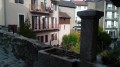
(3) Continue along the car park, passing a fountain on your right, then turn right onto Rue de la Chapelle and emerge onto Place de la White Cross. Walk past the chapel and continue along the dead-end street (Chemin des Gabelous). Cross the historic Pont d’en Haut over the Morge and cross the border once more. Then turn right and immediately left to walk past the church on your right.

At the corner, turn left and head up Rue de l’Église. At the junction, take the second right, Rue du 23 Juillet 1994. Pass the monument to those executed by firing squad, then walk alongside the cemetery. At the T-junction, turn right and begin the descent.

Pass a block of flats on your left, wind your way down Rue de l’Étang and go under the bridge of the disused railway line. At the traffic lights, cross the D1005 and take the first turn left then right to return to the car park on Quai André Chevallay (S/E).

Waypoints

  1. S/E : mi 0 - alt. 1,250 ft - Quai André Chevallay – Car park
  2. 1 : mi 0.51 - alt. 1,227 ft - Historical starting point of the GR5 - Morge (rivière) - Affluant du Léman
  3. 2 : mi 0.61 - alt. 1,227 ft - Saint-Gingolph jetty - Lac Léman
  4. 3 : mi 0.83 - alt. 1,289 ft - Gare de Saint-Gingolph (Suisse)
  5. S/E : mi 1.61 - alt. 1,250 ft - Quai André Chevallay – Car park

Notes

A good pair of trainers is sufficient for this short walk along tarmac paths.

Bars and restaurants near the Saint-Gingolph jetty (2), shops in the town centre. Generally, you can pay in euros or Swiss francs.

Although border checks are very rare on the two footbridges crossing the Morge, remember to carry valid identification.

A detailed map is useful (at the very least, the one accompanying this description).

Other possible starting points:
- Car park situated between Rue de l’Église and Route de Novel (France).
- Saint-Gingolph railway station (Switzerland) (3): a small car park with a parking disc, and a larger car park with a pay-and-display machine. It is, of course, possible to get there by train from Switzerland (there is no rail link with France).
- Saint-Gingolph jetty (Switzerland) (2): for those arriving by boat only, for a stopover on the tour of the Haut Lac. For boat timetables, see the Compagnie Générale de Navigation website.

Hike undertaken by the author on 4 November 2017.

Worth a visit

- Numerous viewpoints overlooking Lake Geneva, its Swiss shore and the peaks of the Vaud Alps, all along Quai André Chevallay, at the jetty (2) and at the harbour, and from Rue du 23 juillet 1944.
- Numerous information boards along the entire route.
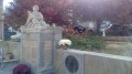
- A memorial to Jean Moulin at the end of Quai André Chevallay.
- Historic starting point ofthe GR®5(1). Information sign; signpost pointing towards Nice, 620 km away...
- Memorial to four crew members who perished in the sinking of a materials transport vessel in March 1963, between the jetty and the small harbour.
- Chapel of Saint-Gingolph (Switzerland), Place de la White Cross. Former chapel of the castle (now demolished), built in the 17th century.
- Pont d’en Haut bridge over the Morge and small checkpoints. For a long time, this was the only route between Savoy and Switzerland along this stretch of the Lake Geneva shore.
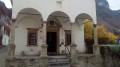
- Church of Saint-Gingolph (France), built in the 18th century.
- Monument to those shot: on 23 July 1944, in retaliation for an attack by resistance fighters, six hostages were shot and the village of Saint-Gingolph (France) was set on fire. The inhabitants were able to seek refuge with their neighbours in Saint-Gingolph (Switzerland).

Historical background:

The village of Saint-Gingolph was founded in the 8th century. Its name refers to Saint Gangolf of Avallon (died 760), now regarded as the patron saint of cuckolded husbands... In the 16th century, the Chablais region was occupied by the people of Valais. In 1569, the Treaty of Thonon established the border between Valais and the Duchy of Savoy along the course of the River Morge: this is how the village of Saint-Gingolph came to be split in two, a situation that persists to this day. Source: Wikipedia.

The presence of a Rue du Tonkin near the station on the Swiss side refers to the railway line known as the ‘Tonkin Line’, which linked Evian-les-Bains in France (Haute-Savoie department) to Saint-Maurice in Switzerland (Canton of Valais). The origin of its name probably stems from the fact that the engineers who designed it had previously built the Tonkin line in northern Vietnam when that country was a French colony, and that they are said to have encountered similar geological conditions there.
- In Switzerland, the section linking Saint-Maurice to Saint-Gingolph was opened in 1878 and remains in service today.
- In France, the 18-kilometre section linking Evian-les-Bains to Saint-Gingolph was opened in 1886, closed to passengers in 1936 and closed to freight in 1988. Until 1998, a seasonal tourist train ran on this section as far as Le Bouveret (where the Rhône flows into Lake Geneva). Since then, this section has been completely disused and vegetation is reclaiming the land (walkers can easily see this near the church in Saint-Gingolph and at the bottom of Rue des Étangs).

Always be cautious and plan ahead when you're outdoors. Visorando and the author of this route cannot be held responsible for any accidents occurring on this route.

The GR® and PR® markings are the intellectual property of the Fédération Française de Randonnée Pédestre.

Reviews and comments

4.7 / 5
Based on 2 reviews

Reliability of the description
4.5 / 5
Ease of following the route
4.5 / 5
Route interest
5 / 5
Lemy
Lemy
• Edited:

Overall rating : 4.3 / 5

Date of your route : Sep 29, 2024
Reliability of the description : ★★★★☆ Good
Ease of following the route : ★★★★☆ Good
Route interest : ★★★★★ Very good
Very busy route : No

We went on this walk (very easy in trainers) one Sunday at midday. It was a bit of a special case as this walk was part of my rehabilitation programme following a hip replacement operation less than three weeks ago. So I did it in trainers and with a walking stick.
A few comments:
- The first section is very pleasant as it has recently been upgraded by the local council (wide pavement, grass verges, picnic tables). No problem walking with children and pushchairs.
- When you reach the end, do not turn right onto the GR5 as the bridge over the Morge has recently been destroyed, presumably as a result of the bad weather in 2015. Turn left onto the footbridge crossing the Morge; at the end, turn right then left to rejoin the route.
- Further on, heading towards the rescue centre, do not go all the way there; instead, turn right up the steps to rejoin the main road. You can also go for a swim (yes, even at the end of September – there was a lady there who’d just come out of the lake).
- The rest of the route follows the description exactly. Just a note if you’re with children: this second section takes you through the village streets and there are cars about.
- Otherwise, it’s a very pleasant walk, and the village is very charming. It took me about 1 hour to 1 hour 10 minutes to complete the route with my walking stick.
I recommend it
(note: average rating as the description needs updating; otherwise it would be 5/5)

Machine-translated

titi06480
titi06480

Overall rating : 5 / 5

Date of your route : Jul 08, 2024
Reliability of the description : ★★★★★ Very good
Ease of following the route : ★★★★★ Very good
Route interest : ★★★★★ Very good
Very busy route : No

A pleasant, easy walk along the lake
A few information boards explain the history and daily life of the village

Machine-translated

Other walks in the area

For more walks, use our search engine .

The GPS track and description are the property of this route's author. Please do not copy them without permission.