Refine your search for walks in Henvic
 Stroll on Callot Island near Carantec

A charming little stroll on Callot Island in Northern Brittany. Pleasant beaches and a beautiful granite chapel, perched on a hill, enhance the walk.
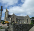
The island is home to a few houses, but above all a superb little chapel, visible from afar because it's perched on a hillock. The granite chapel is open to visitors.
The walk is enhanced by beautiful beaches, as the northern part of the island is rather wild.
 Barnenez Peninsula and Térénez Cove
Barnenez is best known for the cairn that dominates the headland and stands out in the landscape. It is also a peninsula that you can walk around. Whether you walk along the Anse de Térenez or the Morlaix River, at high or low tide, you will find yourself in a multifaceted place, with the majestic site of the entrance to the Morlaix River and its iconic monuments as a backdrop.
 Along the Anse de Térénez

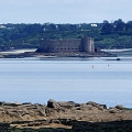
Discover the Finistère region of Trégor and the Bay of Morlaix, protected by Vauban with the Château du Taureau. Discover that here too you are in oyster country.
You will also see the Barnénez peninsula, famous for its spectacular cairns: stone tombs dating from the Neolithic period (around 4,000 BC).
 From Roscoff to the Sainte-Anne islet in Saint-Pol-de-Léon

Route from Roscoff to the Sainte-Anne islet following the GR®34, with beautiful viewpoints.
 From Port Blanc Beach to Térénez and back
Hike along the GR®34 at the eastern entrance to Morlaix Bay. Not particularly difficult, but there are a few tricky descents and ascents. The trail passes by some magnificent properties and offers breathtaking views of Morlaix Bay. Best done in both directions, at different times of day and at different times of the tide.
 Pointe du Diben circular in Plougasnou
From Perros to the pine forest, follow the customs path that winds through the heart of the Port du Diben and along the rugged coastline.
 The Tour of Batz Island

With alternating fine white sandy beaches, rugged rocky coastlines and green landscapes, the island of Léon enjoys a microclimate where early potatoes are the main crop, grown in soil fertilised by seaweed.
 Three steeples path

This trail passes through three communes: Plouzévédé, Trézilidé and Tréflaouénan and takes you through fields, woods and along streams.The route is signposted in Turquoise Blue and White. A 10 km circuit with a possible short cut down to 8 km.
 The Roc'h circuit in the Monts d'Arrée

Roc'h ar Feunteun, Roc'h Trédudon, Roc'h Trévézel, a line of jagged ridges.
In the heart of the Armorique Regional Nature Park, the Monts d'Arrée rise up in a landscape of moors, heather and gorse. These landscapes give off a surprising impression, marked by unreality, mystery and authenticity, which we know well in inland Brittany.
 The tip of Armorique

A beautiful hike, much of it taking place along the seafront corniche. Along the way, you can add a visit to a Gallo-Roman site and take a refreshing dip!
 In the countryside and around Lake Drennec

A varied route where you can discover aspects of the Breton countryside that have changed little over time. Cross moors and woods, pass through isolated hamlets to return to the lake and its landscaped surroundings.
 Locquémeau and the cliffs of Trédrez

From the small village of Locquémeau, after discovering Pointe du Dourven, which marks the southern side of the Léguer estuary, you are invited to explore the inland countryside of the "Lokémaltèques" before returning down the customs officers' path to admire the cliffs of Trédrez and the magnificent panorama of the Trégor coast.
Please note: GR® trail diversion, see here
 Coastal and countryside trail via Pointe de Séhar

After crossing the Port of Locquémeau and the Pointe de Séhar, the route follows part of the GR®34 towards the Trédrez cliffs. The return journey is via small country roads, offering views of beautiful traditional buildings.
 On the heights of Locquémeau

Locquémeau is known for its seaside. This short circuit takes you on a journey of discovery through the hinterland, passing through the small village and its beautiful church. You will also discover a discreet covered alley at the top of a cairn.
 On the heights of Pointe de Séhar

After following the coastline, this route takes you up to a higher point to discover Pointe de Séhar and the port of Locquemeau via a section of the GR®34 trail. Beautiful views of Lannion Bay.
 Pointe and site of Dourven near Locquemeau

The GR®34 leads to the Dourven site, which has unfortunately been partially disfigured since Storm Ciaran in November 2023, but still retains its charm for its views. The coastal path passes near Saint-Quiriou or Kirio Beach and its fountain. The rest of the route follows small roads to the village of Locquémeau and its beautiful church.
Please note: GR® diversion, see here.
 Monts et Vallées circuit in Pencran

With its rich church and parish enclosure, Pencran stretches across the hill south of Landerneau and then plunges down into green rural valleys. The first part of this trail leaves the village and passes through residential neighbourhoods facing Landerneau. It then joins the countryside, following paths through the woods and farm tracks. In addition to the parish enclosure, you will discover the bucolic atmosphere of a tree-lined canalised stream and the surprising Fontaine de la Vierge (Virgin's Fountain), set in a small, well-preserved sanctuary.
 Circular around Ile Grande (Tour de l'Ile Grande)

An easy coastal walk. A short return trip toward the center of the island leads to a viewpoint and a superb covered walkway.
 Tro Sant Riwal circuit

Nestled in a green valley, this commune has all the charm of the mountain countryside, with its sunken lanes, hedgerows, streams and rugged terrain.
The name of the commune comes from the name of the parish patron saint, Saint Rivoal, formerly Riwall, the name of a large family that emigrated from Brittany to Great Britain in the 5th and 6th centuries.
Saint-Rivoal has been awarded the "Communes du Patrimoine Rural de Bretagne" (Communes of Rural Heritage in Brittany) label.
 Mine canal and Rivière d'Argent in Huelgoat

Does the Rivière d'Argent (Silver River), which glitters beneath the canopy of trees, owe its name to its bright sparkle in the twilight, or is it the nuggets that have escaped from the old mine that give it such a luminous appearance? The walk, which follows the mine's supply channel and then the turbulent course of the river, may provide the answer.
It appears that the route is no longer passable between points 4 and 6. If you venture there, please confirm this on the comments page.
 Discovery tour of the Huelgoat Forest

In the heart of the Huelgoat Forest, this woodland setting hides a wealth of heritage treasures. The Mine Canal will take you to the old silver-lead mine and then on to the most iconic sites in this legendary forest.
More walks in Henvic
Select a point of interest below:
