Country:

 City:
City:


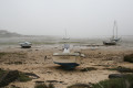
The start is just after the bridge on the D21, in the south of the island. Parking is available near the bridge or along the D21 before reaching Île Grande.
Red and white markings
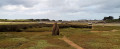
(S) Take the path on the left (west) and follow the coast. Pass the islet of Rulosquet (on your left). Take the small road on the right, then turn left immediately and continue to a junction.
(1) Continue to the left (west), along the coast. At the next junction, turn left and you’ll reach a fountain. Take the path on the left, heading due south, to a headland (unnamed on the IGN map). Continue along the coast (northwards) to the Saint-Sauveur jetty.
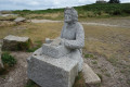
(2) Continue north, past the campsites. You’ll reach the bird observatory (a building and a pit with cut-out figures of puffins). Continue north.
(3) Turn left towards the headland of Toul-ar-Staon, which offers a view over the sea in a wild setting. Retrace your steps.
(3) Continue eastwards along the coast. Turn south and head for Porz Guen beach (spelt ‘Porz Gwen’ locally). Swimming is possible at high tide (and in season). Walk along the beach and continue along the coast, first northwards then eastwards. Ignore a path branching off to the right and reach the junction with a footpath.
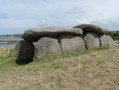
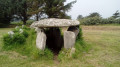
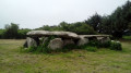
(4) Take the path on the right, through ferns and scrub. Wind your way up a few bends to reach the summit of Runn al Lannou (“the summit of the moor”, unnamed on the IGN map), from where you can enjoy a stunning view. Continue south and, at the next junction, turn left into Rue du Dolmen. After about 150 metres, you’ll find the well-preserved covered passageway on the right.
(5) Retrace your steps towards the coast (north).
(4) Carry on to the right (east), along the coast. You’ll reach Porz Gélen (sailing school). Carry on south, past a small road.
(6) Continue along the coast, turning right then left. Return to the starting point, level with the D21 bridge (S/E).


 Visorando Member
 Moderate