


Refine your search for walks in Gignod
Gignod walks


 From the Chaligne Refuge to the Mont Fallere Refuge via Pointe Chaligne
 Visorando Member
 7.08 mi
 +3,432 ft
 -1,969 ft
 6h 15
6h 15
 Difficult
 Departure from Gignod (Aosta Valley)
The second stage of the Tour du Mont Fallere promises a day of stunning views. Once you’ve completed the climb up to the ridges, the path alternates between descents and ascents, offering panoramic views of the Matterhorn to begin with, followed by the entire Aosta Valley and the peaks along the border.
Between Étroubles and Saint-Rhémy-en-Bosses
 8.14 mi
+1,306 ft
-1,296 ft
4h 55
8.14 mi
+1,306 ft
-1,296 ft
4h 55
 Moderate
Departure from Étroubles (Aosta Valley)
Moderate
Departure from Étroubles (Aosta Valley)
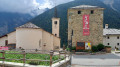
A route to discover the typical villages that line the famous Col du Grand Saint-Bernard road. On the way there, you will follow the Via Francigena to climb up to the village of Saint-Rhémy-en-Bosses, renowned for its cured ham. You will also pass through the villages of Étroubles, Saint-Oyen, Cerisey and Les Bosses, characterised by stone chalets with slate roofs.
From Étroubles to the Chaligne refuge
 6.07 mi
+2,756 ft
-571 ft
5h 10
Moderate
Departure from Étroubles (Aosta Valley)
6.07 mi
+2,756 ft
-571 ft
5h 10
Moderate
Departure from Étroubles (Aosta Valley)
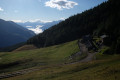
First day of the Tour du Mont Fallere. It’s a fairly quick day’s climb, mainly through woodland, to reach the Chaligne refuge. The route alternates between quiet forest tracks and some good, steeper sections of climb, with no technical difficulties.
 The pass between Mont Flassin and Testa Cordellaz
 7.97 mi
+4,154 ft
-4,157 ft
6 hrs
7.97 mi
+4,154 ft
-4,157 ft
6 hrs
 Very difficult
Departure from Saint-Rhémy-en-Bosses (Aosta Valley)
Very difficult
Departure from Saint-Rhémy-en-Bosses (Aosta Valley)
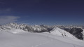
A superb route that begins in a larch forest and continues over a succession of hilltops. The arrival at the pass beneath Mont Flassin offers a phenomenal view. From Gran Paradiso to the Grandes Jorasses, via the Matterhorn and so many others. The panorama is exceptional.
From the Mont Fallère Refuge to Étroubles via Mont Vertosan
 8.25 mi
+1,371 ft
-5,056 ft
5h 00
Moderate
Departure from Saint-Pierre (Aosta Valley)
8.25 mi
+1,371 ft
-5,056 ft
5h 00
Moderate
Departure from Saint-Pierre (Aosta Valley)
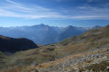
The final day of the Tour du Mont Fallere. The first part of the day involves climbing to the Col Fenêtre, followed by a bonus ascent to the summit of Monte di Vertosan (3,821 m) for an exceptional 360° panorama (Mont Blanc – Grand Combin – Matterhorn – Gran Paradiso).
This is followed by a long descent, with a fairly steep, winding first section, then a fast, rolling track through the forest to round off the circular tour.
Along the Rû near Refugio Champillon, Doues
7.56 mi
+646 ft
-627 ft
4h 00
Moderate
Departure from Doues (Aosta Valley)
Drive via Doues to the Doues - Champillon parking lot below the Refugio Champillon (a beautiful drive with magnificent views). From here, you can walk to the Refugio (1-hour climb) or take a relaxed stroll along the Rû (water channels), which is what I did (see route). Enjoy the beautiful views of both the mountains and the Ollomont valley. You can keep walking for as long as you like. Return the same way.
Lake Joux and Mount Joux
 7.88 mi
+1,312 ft
-1,316 ft
4h 45
Moderate
Departure from Saint-Pierre (Aosta Valley)
7.88 mi
+1,312 ft
-1,316 ft
4h 45
Moderate
Departure from Saint-Pierre (Aosta Valley)
A pleasant route that alternates between mountain pastures and forests to reach Mont Joux. This modest peak offers a view of Monte Bianco. The route also offers a wide panorama of peaks ranging from 3,000 to almost 4,000 metres, such as Punta Pousset (3,046) above Cogne, Grivola (3,969), the Grand Paradis massif and Punta del Ran (3,272) in the Ruitor massif.
Rifugio and Lago Fallère
 8.89 mi
+2,641 ft
-2,635 ft
6h 25
Difficult
Departure from Saint-Pierre (Aosta Valley)
8.89 mi
+2,641 ft
-2,635 ft
6h 25
Difficult
Departure from Saint-Pierre (Aosta Valley)
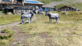
A magnificent route featuring an open-air museum. The climb to the refuge is dotted with numerous sculptures. You will be surprised by strange creatures, characters and animals hidden behind trees or rocks. The route features around 300 pieces, all created by Siro Vierin. Between the Fallère Refuge and Lago Fallère, you will walk along the Tour du Mont Fallère trail.
Saint-Rhemy - Courmayeur
 Association / Club / Walk leader18.44 mi
+5,725 ft
-7,064 ft
13h 30
Very difficult
Departure from Saint-Rhémy-en-Bosses (Aosta Valley)
Association / Club / Walk leader18.44 mi
+5,725 ft
-7,064 ft
13h 30
Very difficult
Departure from Saint-Rhémy-en-Bosses (Aosta Valley)
It’s the last day. The descent from the Col de Malatra is magnificent. It’s the last pass at almost 3,000 metres. You can see the path from afar, winding up the mountainside. After that, the solitude will be over. We rejoin the TMB from the Bonatti Refuge and its throng of hikers. The descent towards Courmayeur is superb, but once you reach the tarmac, it’s a very long way.
Saint-Rhémy-en-Bosses - Ollomont
 12.27 mi
+4,757 ft
-5,423 ft
9h 45
Very difficult
Departure from Saint-Rhémy-en-Bosses (Aosta Valley)
12.27 mi
+4,757 ft
-5,423 ft
9h 45
Very difficult
Departure from Saint-Rhémy-en-Bosses (Aosta Valley)
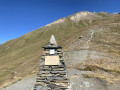
Today's stage uses the "TDC" trail, which is also a section of the Alta Via N°1 of the Aosta Valley and the Sentiero Italia Tappa 11.
Hike with a brief description, to be followed with the Visorando app.
Ollomont – Saint-Rhémy
11.82 mi
+5,410 ft
-4,649 ft
10h 10
Very difficult
Departure from Ollomont (Aosta Valley)
An average day on paper, but the fatigue is setting in. But it’s the penultimate day. The route is still clearly marked, so we don’t waste too much time getting lost. A stop at the Refuge de Champillon is a must. There’s a climb through the fields. The Col de Champillon is the last major pass before the finish.
Ollomont - Dzovennoz
 9.22 mi
+4,180 ft
-3,724 ft
7h 55
Very difficult
Departure from Ollomont (Aosta Valley)
9.22 mi
+4,180 ft
-3,724 ft
7h 55
Very difficult
Departure from Ollomont (Aosta Valley)
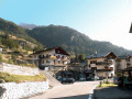
We leave the "TDC" to follow Alta Via No. 1 in the Aosta Valley until it crosses the road leading to Bionaz. In the old village, above the church and near a fountain, the trail marked Col de Breuson (Brison) begins.
Hike with a brief description, to be followed with the Visorando app.
A route around the Combins massif
 46.50 mi
+18,724 ft
-19,944 ft
7 days
Difficult
Departure from Saint-Rhémy-en-Bosses (Aosta Valley)
46.50 mi
+18,724 ft
-19,944 ft
7 days
Difficult
Departure from Saint-Rhémy-en-Bosses (Aosta Valley)
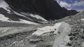
This seven-stage trek around Les Combins differs in a few ways from the classic tour. It allows you to hike in complete tranquillity in a sumptuous and diverse setting between the mid- and high-mountain ranges, where you will climb to over 3,000 metres. You will encounter dozens of marmots, ibex and herds of Herens cows. A few remnants of glaciers add to the alpine atmosphere of this trek, whose highest point is the Col du Mont Gelé at 3,144 metres.
Important note.Plan for two bus journeys on this route.
Day 2: to reach Liddes on thesecond day from the Grand-Saint-Bernard Pass, see the timetable hereDay 7: for the return journey from Ollemont to Saint-Rhémy-en-Bosses, see the bus timetable here
Saint-Rhémy-en-Bosses - Grand Saint-Bernard Hospice
 3.03 mi
+2,487 ft
-36 ft
3h 35
Moderate
Departure from Saint-Rhémy-en-Bosses (Aosta Valley)
3.03 mi
+2,487 ft
-36 ft
3h 35
Moderate
Departure from Saint-Rhémy-en-Bosses (Aosta Valley)
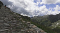
An easy warm-up walk in preparation for a 3/4 tour of Les Combins. From the car park located after Saint-Rhémy, in a hairpin bend at an altitude of 1,730 m, coming from Saint-Rhémy-en Bosses, on Route 27 of the Col du Grand Saint-Bernard. The route follows the Via Alpina Red R117.
Fenêtre de Sereina
 6.17 mi
+2,930 ft
-2,930 ft
5 hrs
Difficult
Departure from Saint-Rhémy-en-Bosses (Aosta Valley)
6.17 mi
+2,930 ft
-2,930 ft
5 hrs
Difficult
Departure from Saint-Rhémy-en-Bosses (Aosta Valley)
The route starts from the car park at the Saint-Rhémy-en-Bosses ski resort, which is easily reached from Aosta.
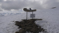
You quickly reach the mountain pastures after an initial climb through a larch forest. You pass a group of stone houses with slate roofs at the Arp du Bois Desot. Then, the landscape opens out onto the ridge of a vast mountain pasture which leads easily to the Fenêtre de Serena, where the view stretches across the French and Italian Alps as far as the eye can see.
Circular route via Crétaz-Saint-Martin
6.73 mi
+2,037 ft
-2,034 ft
4h 50
Moderate
Departure from Aymavilles (Aosta Valley)
Starting from the charming La Pineta campsite, this walk takes you on a journey of discovery through the region, combining history, nature and quaint little hamlets.
The route alternates between country lanes, nature trails and sections through villages. Some sections may be more challenging, with paths that are occasionally steep, narrow or rugged. A good level of fitness and suitable footwear are therefore recommended.
The route favours quiet paths and tracks as much as possible to avoid roads. However, a few road crossings are unavoidable during the walk.
A wonderful way to discover the region in a different light, whilst making the most of its landscapes and heritage.
Fenêtre de Ferret from the Grand Saint-Bernard Hospice
 3.71 mi
+1,558 ft
-1,535 ft
3h 05
Moderate
Departure from Italy
3.71 mi
+1,558 ft
-1,535 ft
3h 05
Moderate
Departure from Italy
A high-altitude hike between Switzerland and Italy, the climb to the Fenêtre de Ferret from the Grand-Saint-Bernard Hospice offers a real immersion in the wild, rocky atmosphere of the Valais Alps.
The trail starts in the mystical atmosphere of the Hospice, at 2,469 m, between high-altitude lakes, cairns and pastures where the tinkling of bells can sometimes be heard. Very quickly, you rise into a majestic alpine setting, surrounded by rocks, silence... and sometimes a little company: the route is relatively busy in high season.
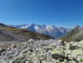
The climb to the Fenêtre de Ferret (2,698 m, very well marked) takes place in a grandiose setting, with unobstructed views of Mont Dolent, Grand Golliat, and the hanging glaciers of the Italian Val Ferret. Once at the pass, the reward is complete: the panorama opens up to 360°, embracing the Swiss and Italian valleys. The contrast between the northern and southern slopes of the Alps is striking.
Three passes and lakes from the Great St Bernard Pass
 6.86 mi
+3,169 ft
-3,166 ft
5h 55
Difficult
Departure from Italy
6.86 mi
+3,169 ft
-3,166 ft
5h 55
Difficult
Departure from Italy
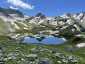
A magnificent loop of the Great Saint Bernard region between Switzerland and Italy, from the Ferret Window to the Col des Chevaux, via the Col du Bastillon and the lakes of Fenêtre, Petit Lé and Grand Lé.
Loop of the window lakes from the Grand Saint Bernard
4.68 mi
+2,116 ft
-2,093 ft
4h 00
Moderate
Departure from Saint-Rhémy-en-Bosses (Aosta Valley)
Hike between Italy and Switzerland, several lakes (Ferret Lakes in the Swiss valley of La Fouly) to discover, as well as the two passes. You will enjoy panoramic views of the Orny, Saleinaz and A Neuve glaciers.
Lacs de Fenêtre
 7.72 mi
+3,264 ft
-3,264 ft
6h 25
Moderate
Departure from Saint-Rhémy-en-Bosses (Aosta Valley)
7.72 mi
+3,264 ft
-3,264 ft
6h 25
Moderate
Departure from Saint-Rhémy-en-Bosses (Aosta Valley)
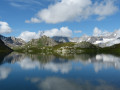
A superb circular walk crossing three cols and the border into Italy and back. There are amazing and changing views throughout. Recently upgraded with signage as a locally important route and marked as 210 on the Swiss side of the border, 103 or 13a on the Italian side.
Described here in a clockwise direction as the Col du Bastillon is better in ascent than descent.
Mont Fourchon
 2.82 mi
+1,696 ft
-1,663 ft
2h 45
Moderate
Departure from Saint-Rhémy-en-Bosses (Aosta Valley)
2.82 mi
+1,696 ft
-1,663 ft
2h 45
Moderate
Departure from Saint-Rhémy-en-Bosses (Aosta Valley)
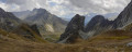
A lovely hike to an easily accessible summit. Close to the Great St Bernard Pass, Mont Fourchon lies on the ridge forming the border between Italy and Switzerland.
Fenêtre Lakes Circular Trail
 4.19 mi
+1,939 ft
-1,936 ft
3h 35
Moderate
Departure from Saint-Rhémy-en-Bosses (Aosta Valley)
4.19 mi
+1,939 ft
-1,936 ft
3h 35
Moderate
Departure from Saint-Rhémy-en-Bosses (Aosta Valley)
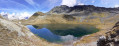
A beautiful circular route along the border between Italy and Switzerland. From the road on the Italian side of the Col du Grand Saint-Bernard, you will discover the Lacs du Ferret in the Swiss valley of La Fouly. You will enjoy panoramic views of the Orny, Saleinaz and A Neuve glaciers.